Updated September 2026 · Jesse McGreevy and Marc Comisar, Domain Realty
What does this page prove about storm risk, flood zones and insurance at Ibis Landing?
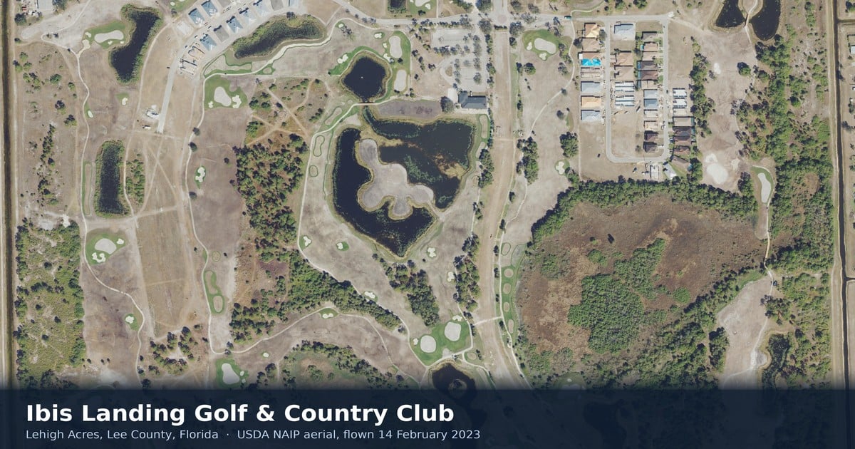
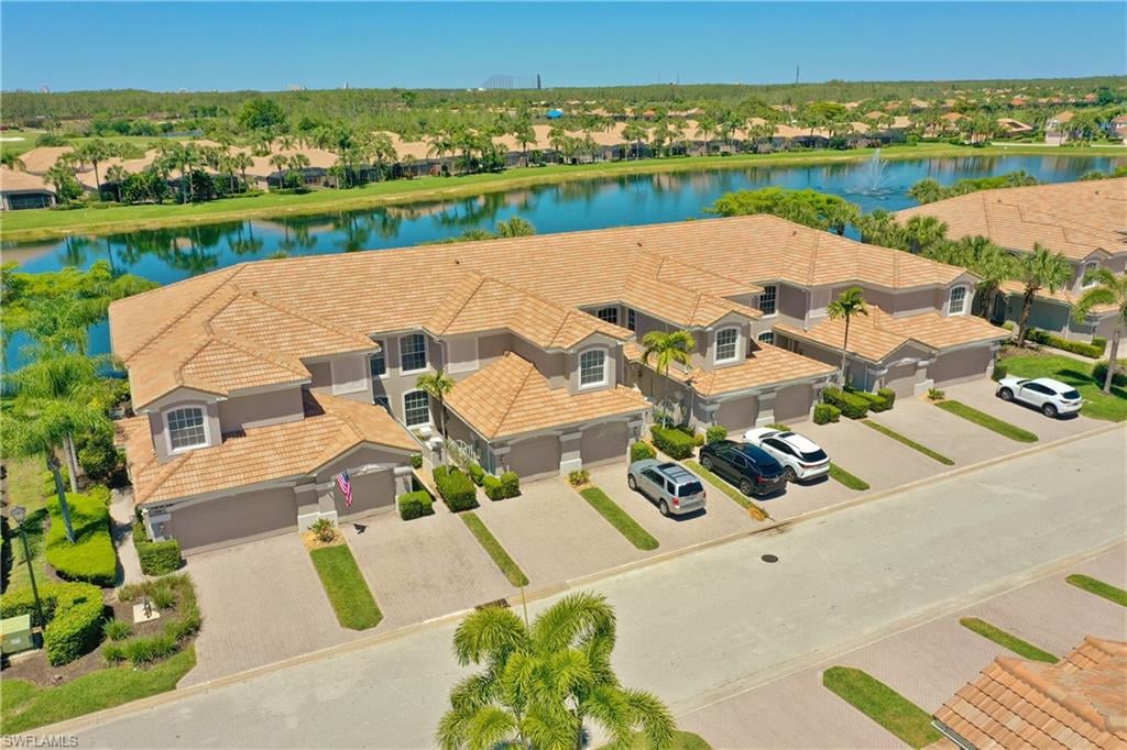
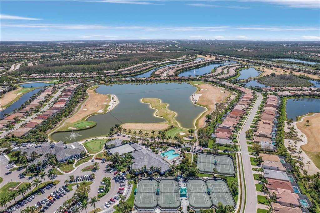
Jesse McGreevy and Marc Comisar of Domain Realty represent sellers and buyers at Ibis Landing Golf & Country Club in Lehigh Acres, Lee County, Florida. This page answers three questions with primary records rather than marketing language: how this community sits against storm surge and wind, what FEMA flood zone governs each street, and what the insurance record actually shows. It is the storm and insurance companion to our complete Ibis Landing community guide.
Sellers first. Free valuation: https://mcgreevyandcomisar.com/home-valuation, or Call Jesse direct at (239) 898-6072. As the leaders of Domain Realty Group our team has closed over $2.5 billion in real estate, and we are Top 1% Real Estate Agents Nationally Since 2008. Buying? Call Marc at (239) 287-5873, and read how we represent buyers in Lehigh Acres. Every figure below carries the authority that issued it and the date it was read. Ibis Landing Golf & Country Club in Lehigh Acres, Lee County, is not The Club at Ibis in West Palm Beach and not Ibis Cove in Naples.
What this page establishes, at a glance
- Evacuation zone. Lee County’s own emergency-management layer returns surge zone NC and county zone NC at three separate points inside the community, which places it outside lettered zones A through E (Lee County GIS EOC layer 7, queried 17 September 2026).
- Storm surge. An envelope query over the whole community footprint returns zero modelled surge polygons of any category through Category 5, sanity-checked against a coastal control point that returned Category 1 at 12.1 feet on the same day and the same layer.
- Flood zone. FEMA Flood Zone X, unshaded, at every point tested, on a single FIRM panel, 12071C0475F, effective 28 August 2008, with no polygon boundary crossing this community and no base flood elevation in existence here.
- Governing hazard. Wind, not water: 160 mph ultimate design wind speed at Risk Category II, with the wind-borne debris region question answered from the Florida Building Commission’s own interim report.
- Insurance. Flood insurance is not federally required in Zone X, Lee County holds a Community Rating System discount that reaches Zone X policies, and the Citizens Property Insurance and Florida Office of Insurance Regulation filings are cited directly rather than paraphrased.
- Construction vintage. Fifty-five of the fifty-seven homes that closed here in the trailing twelve months were built between 2022 and 2026 (Southwest Florida MLS, Matrix, pulled 17 September 2026), which is the measured contrast with the 1960s and 1970s Lehigh Acres grid.
Why McGreevy and Comisar Are the Best Realtor for Ibis Landing
If you are searching for the best realtor for Ibis Landing, whether you are ready to sell your Ibis Landing home or buy your next one, McGreevy and Comisar is the team that delivers. We lead Domain Realty Group, the #1 real estate team in Southwest Florida since 2012, Top 1% Real Estate Agents Nationally Since 2008, with over $2.5 billion sold as a team and $900 million in personal sales between Jesse and Marc. Storm and insurance questions are where a Lehigh Acres transaction is won or lost, and this page exists because we answer them from documents.
The Ibis Landing market over the last 12 months, pulled from the Southwest Florida MLS (Matrix) on 17 September 2026 and filtered to this development: 57 closed sales, spanning $150,000 to $515,000, with a community-wide median time to contract of 39 days. Those 57 sales are four different products and they do not share a median, so the figures are reported by product type in our complete Ibis Landing community guide rather than blended into one number. 55 of the 57 were built between 2022 and 2026, which is the single most important fact on this page for an insurance quote.
Honors and recognition:
- Top 1% Real Estate Agents Nationally Since 2008
- 5 Star Award for Customer Satisfaction for 21 Straight Years. Only 5 out of 21k+ Licensees (Gulfshore Life Magazine)
- #1 Team in Southwest Florida since 2012
- McGreevy and Comisar and their Domain Realty Group team have sold over $2.5 Billion in Real Estate
- McGreevy and Comisar alone have over $900 million in Sales
- Nationally Recognized Top Producing Realtors
- Platinum Sales Production Award Winners
What is your Ibis Landing home worth in today’s insurance market?
Insurance is now part of every Ibis Landing pricing conversation, and a seller who can hand a buyer a wind mitigation inspection, a flood zone determination and the panel number behind it removes the objection before it is raised. In the last 12 months we tracked 57 closed sales in this community, and we represented sellers and buyers across Lehigh Acres and the wider Lee County market. Start with a free home valuation at https://mcgreevyandcomisar.com/home-valuation, or Call Jesse direct at (239) 898-6072. Buying instead? Call Marc at (239) 287-5873, or read how we represent buyers in Lehigh Acres.
How did Ibis Landing fare in Hurricane Ian, and what is the community’s storm posture?
Ibis Landing sits in Lee County hurricane evacuation zone NC, outside lettered zones A through E, with no modelled storm surge polygon of any category reaching the community, Categories 1 through 5, per Lee County GIS EOC layers queried 17 September 2026. Hurricane Ian’s Lee County damage record names coastal communities, not Lehigh Acres.
Everything below is about Ibis Landing Golf & Country Club, Lehigh Acres, Lee County, Florida, not to be confused with The Club at Ibis in West Palm Beach, Palm Beach County, nor with the unrelated Ibis Landing in Parkland, Florida, nor with the Ibis Landing townhome HOA in Leland, North Carolina, all of which surface in the same searches.
Evacuation zone NC: what Lee County’s own layer returns at this address
Lee County’s emergency-management GIS carries the county’s official hurricane evacuation zones. Queried on 17 September 2026 at three separate points inside the community, longitude −81.65711 / latitude 26.59219, −81.6520 / 26.5860, and −81.6600 / 26.5880, the layer returned the same result at every point: surge zone NC, county zone NC, county Lee.
The distinct values that layer carries countywide are surge zones 1 through 5, which map to county zones A through E, plus NC. Ibis Landing is therefore not in evacuation zone A, B, C, D or E. It sits outside Lee County’s lettered storm-surge evacuation zones entirely (Lee County GIS EOC layer 7, queried 17 September 2026).
Two further regulatory overlays were tested at the same three points on the same date. The community returns no feature on the Lee County Coastal High Hazard Area layer and no feature on the Lee County Coastal Building Zone layer; it is outside both (Lee County GIS, queried 17 September 2026). Both overlays carry regulatory and insurance-rating consequences on the coast, and neither applies here.
Storm surge: zero modelled polygons through Category 5, and how that was checked
Lee County’s storm surge layer models maximum surge heights by storm category:
1 | 12.1 ft |
2 | 16.7 ft |
3 | 20.8 ft |
4 | 27.4 ft |
5 | 31.5 ft |
An envelope query of that layer over the whole Ibis Landing footprint, longitude −81.6680 to −81.6440, latitude 26.5840 to 26.6010, returned a count of zero. No modelled storm surge polygon of any category, up to and including Category 5, reaches this community (Lee County GIS EOC layer 22, queried 17 September 2026).
That zero was sanity-checked rather than assumed. A control point on the coast at Fort Myers Beach, longitude −81.9506 / latitude 26.4520, returned Category 1 at 12.1 feet from the same layer on the same day. The query works; the zero result at Ibis Landing is a real absence, not a failed call.
Ground elevation supports the same picture. The US Geological Survey’s 3DEP National Map Elevation Point Query Service, queried on 17 September 2026 in NAVD88 feet, returns 26.8 ft at the clubhouse area (−81.65711, 26.59219), 25.1 ft at −81.6600 / 26.5890, 27.3 ft at −81.6500 / 26.5960, 31.6 ft at −81.6650 / 26.6000 and 28.8 ft at −81.6450 / 26.5850. Natural ground across the footprint sits roughly 25 to 32 feet NAVD88.
Those are natural-ground readings, not finished floor elevations of any home; individual finished floors were not measured and no finished floor elevation should be inferred from them. One documentary datum does exist: Exhibit “D” to the Master Declaration amendment, the Banks Engineering Emergency Preparedness Plan Criteria for Ibis Landing, states that “the minimum first floor elevations must be at 28.5’ N.A.V.D.” and carries a storm-surge table reading Dry for tropical storm and Categories 1 through 5 (recorded instrument, read 17 September 2026).
Hurricane Ian, measured, and what the record does and does not say about Lehigh Acres
The National Oceanic and Atmospheric Administration’s National Hurricane Center Tropical Cyclone Report AL092022 is the primary record of the storm:
Landfall, Cayo Costa | 1905 UTC, 28 September 2022, 130 kt |
Landfall, near Punta Gorda | 2035 UTC, 28 September 2022, 125 kt (Category 4) |
Highest reliably measured sustained wind near landfall | 78 kt, mobile met tower near Punta Gorda airport, 1959 UTC 28 September |
Punta Gorda ASOS | sustained 76 kt, peak gust 117 kt |
Highest wave-filtered surge, USGS sensor | 12.70 ft above MHHW, Fort Myers Beach Pier |
Highest surveyed marks, National Weather Service | approximately 15 ft above MHHW, second storey of beachfront structures |
Highest storm-total rainfall | 26.95 in, Grove City, Florida |
No NHC-reported wind or rainfall observation specific to Lehigh Acres or to inland Lee County was located in that report.
Lee County’s own Hurricane Ian After-Action Report, dated 11 August 2023, records the county-wide toll: 5,076 homes destroyed; 24,585 residential structures damaged; 284 businesses destroyed, 910 with major damage and 1,851 with minor damage; property loss of approximately $3.22 billion; more than 12 million cubic yards of debris, 6.3 million of it in unincorporated areas; 98% of the county without power; and peak surge from Englewood to Bonita Beach of 12 to 18 feet above ground level.
The critical point for this page is where that damage narrative points. The After-Action Report names Sanibel, Captiva, Pine Island, Fort Myers Beach, Matlacha and North Cape Coral. It does not specifically mention Lehigh Acres, inland flooding, canal systems or drainage districts (Lee County Hurricane Ian After-Action Report, 11 August 2023, reviewed in full). The Lehigh Acres Citizen’s one-year retrospective of 29 September 2023 lists the destroyed areas as “Fort Myers Beach… Sanibel, Captiva, Matlacha and parts of Cape Coral, North Fort Myers and Fort Myers”, Lehigh Acres is absent from that damage list, and the article gives no Lehigh-specific destroyed-home, flooding or drainage-district figures.
For scale of the recovery that followed, HUD awarded Lee County $1,107,881,000 in Community Development Block Grant Disaster Recovery funding for Hurricane Ian long-term recovery (Lee County CDBG-DR portal, read 17 September 2026).
Why most Ibis Landing homes have no Ian story at all
No document located in this research records a Hurricane Ian impact specific to Ibis Landing Golf & Country Club. That is an absence of evidence, not evidence of absence, and it is written here as exactly that.
But there is a second fact that matters more, and it is the honest one. At the time of Ian, on 28 September 2022, most of the present housing stock did not exist. The Lee County parcel record shows the overwhelming majority of homes on both the Ibis Landing and Copperhead plats were built in 2023 and 2024, after the storm. A statement about “how this community performed in Ian” would, for most of these homes, be meaningless. Any page that offers one is describing buildings that were not standing.
Wind is the governing hazard here: 160 mph, Risk Category II
Surge is not the exposure at this location. Wind is. Lee County’s regulatory wind layers, queried at three points inside the community on 17 September 2026, return:
Risk Category I | 1609C | 140–150 | 150 mph | Yes |
Risk Category II (ordinary homes) | 1609A | 150–159 | 160 mph | Yes |
Risk Category III and IV | 1609B | 160–169 | 170 mph | Yes |
A single-family home is Risk Category II. The governing ultimate design wind speed at Ibis Landing is therefore 160 mph (Lee County GIS, layers 21, 22 and 23, queried 17 September 2026). The two attributes are reported here exactly as the county publishes them: the wind zone value “150-159” is the contour band the site falls between, and the design wind speed value “160 mph” is the figure carried for permitting. Inland is not low-wind in Lee County.
The wind-borne debris region and what the code actually requires
The community’s wind-borne debris status is confirmed two independent ways.
First, Lee County’s own regulatory layer sets the debris-region attribute to YES at every point tested inside the community, for all three risk categories (queried 17 September 2026).
Second, that is consistent with the code threshold. The Florida Building Commission’s report Investigation of the Wind-borne Debris Regions in ASCE 7-22 states that under ASCE 7-16, adopted in the 7th Edition (2020) Florida Building Code, the wind-borne debris region covers areas where design wind speeds exceed 140 mph, or 130 to 140 mph “within 1 mi. of the coastal mean high water line”; and that under ASCE 7-22, adopted in the 8th Edition (2023) code, it covers areas where design wind speeds exceed 140 mph, or 130 to 140 mph “within 1 mile of the mean high water line where an Exposure D condition exists upwind.” At 160 mph Risk Category II, Ibis Landing is above the 140 mph threshold outright, so its debris-region status does not depend on proximity to water and was unaffected by the ASCE 7-22 change. That last step is an inference from the county’s verified 160 mph design value read against the code’s stated threshold.
What the designation requires is set by Florida Building Code Section 1609.1.2, Protection of Openings:
- “Glazed openings located within 30 feet (9144 mm) of grade shall meet the requirements of the large missile test of ASTM E1996.”
- “Glazed openings located more than 30 feet above grade shall meet the provisions of the small missile test of ASTM E1996.”
- The referenced standards are ASTM E1996, ASTM E1886, TAS 201, TAS 202, TAS 203, ANSI/DASMA 115 for garage and rolling doors, and AAMA 506.
- An exception permits wood structural panels of minimum 7/16 inch thickness for R-3 or R-4 buildings with a mean roof height of 33 feet or less where the wind speed is 180 mph or less. A further exception covers storage sheds of 720 square feet or less not designed for human habitation.
So the sentence a buyer needs is this. Every home at Ibis Landing is legally required to have protected openings. That protection may be delivered as impact-rated glazing, as code-compliant shutters, or within the stated exception as panels. The code mandates the protection; it does not mandate that it be impact glass. What any specific home actually has is a plan-level and permit-level question, taken up in the insurance section below.
No document located in this research specifies the as-built roof strapping detail, tie-down schedule, roof covering class or secondary water barrier for any Ibis Landing product, and none of those is stated here.
Construction vintage, the measured contrast with the 1960s and 1970s Lehigh grid
Lee County’s parcel layer, read on 17 September 2026, carries a minimum-built-year field. On the two plat families:
Ibis Landing | 503 | 167 | 2001: 1 (the golf course and clubhouse parcel); 2024: 166 |
Copperhead plat, Plat Book 77, Pages 1–11 | 119 | 105 | 2002: 1; 2003: 2; 2007: 15; 2008: 8; 2023: 70; 2024: 9 |
That table carries a caveat which must travel with it. The county parcel layer’s built-year field lags completion. A separate envelope query of the same layer on the same day returned Copperhead Drive parcels with years 2023 (30) and 2024 (41) plus one 2007; Copperhead Court North with 2024 (30); Hazelnut Court North with 2024 (28); and Aqua Overlook Court with 2024 (37). Homes completed in 2025 and 2026 are under-counted or absent in this snapshot. These counts are a floor, not a census, and the parcel layer must not be used to state a total home count for this community.
Against that, the Florida Building Commission’s published editions and effective dates:
2001 Florida Building Code, the first statewide code | 1 March 2002 |
2003 Supplement | 30 June 2003 |
2004 Florida Building Code | 1 October 2005 |
2005 Supplement | 16 December 2005 |
2006 Supplement | 8 December 2006 |
2007 Florida Building Code | 1 July 2007 |
First 2009 Supplement | 1 March 2009 |
Second 2009 Supplement | 1 October 2009 |
2010 Florida Building Code | 15 March 2012 |
8th Edition (2023) | 31 December 2023 |
9th Edition (2026) | in development; code-update workplan published August 2025 |
The material point is the first line: Florida had no unified statewide building code before the 2001 code took effect on 1 March 2002.
Now the contrast, measured rather than asserted. A wide-envelope query of the same Lee County parcel layer on 17 September 2026 returns, within roughly one mile of Ibis Landing:
Hamlin Ct | 56 | all 1972 |
Tangerine Ct | 50 | all 1972 |
Tangelo Ct | 38 | all 1972 |
Temple Ct | 36 | all 1972 |
Navajo Ave | 55 | 1961–1982 |
Apache St | 41 | 1961–1963 |
Cherokee Ave | 35 | 1962–1977 |
Alabama Rd S | 100 | mostly 1960–1973, with two in 2024 |
Reading those year-built records against the code effective dates and the county wind design values: Ibis Landing’s housing stock is overwhelmingly 2023–2024 construction, permitted under the 7th Edition (2020) and 8th Edition (2023) Florida Building Code, to a 160 mph Risk Category II ultimate design wind speed, in a designated wind-borne debris region requiring protected openings under Section 1609.1.2. Housing one mile away on the same canals was built between 1961 and 1974, three to four decades before Florida had a statewide building code at all. These are not comparable structures and they must never be averaged together in a statement about “Lehigh Acres housing.”
One qualification belongs with that, and it is published here rather than buried. The roughly two dozen homes on the Copperhead plat built between 2002 and 2008 fall under the 2001, 2004 or 2007 code, not the current one. They are post-statewide-code homes and far newer than the 1960s and 1970s stock around them, but they are a different vintage from the 2023–2024 majority. Check the individual parcel’s year built on the Lee County Property Appraiser’s record before making a code-vintage claim about any specific home.
Drainage: three authorities stacked over this community, and what each controls
Conflating the three is the commonest error in any Lehigh Acres flood discussion. They are separate bodies with separate scopes.
Tier one, the Ibis Landing Community Development District, a unit of special-purpose government under Chapter 190, Florida Statutes. From the District’s executed minutes of 21 November 2024: the District is “just under 300 acres”; about 987 residential units are planned; 959 of those 987, roughly 97%, are subject to the District’s special assessment, with 28 units outside District boundaries; and the infrastructure the District will own or finance is the “master stormwater management system, onsite mitigation, water and wastewater facilities, public roadways, and irrigation.” Water and sewer are to transfer to the Florida Governmental Utility Authority for maintenance. The minutes record “some existing infrastructure from the original Copperhead development, valued at current installation costs”; bond authorisation not to exceed $20,000,000 aggregate principal; anticipated par of approximately $18.9 million; an engineering cost estimate of $16,273,119; and a contemplated 30-year repayment term.
Those same minutes contain no discussion of drainage problems, flooding, lake maintenance issues or involvement by the Lehigh Acres district. District finances as of 31 July 2026, from the balance sheet in the board agenda package for the 17 September 2026 meeting: Series 2025 bonds; general long-term debt $10,340,000; construction account $4,856,388; debt service reserve $367,467; revenue account $335,339; general fund checking $60,983; and special assessment revenue on-roll year to date of $139,391 against a $145,579 budget, or 96%.
Tier two, the Lehigh Acres Municipal Services Improvement District. This was tested, not assumed. Four points inside the community, −81.65711 / 26.59219, −81.6650 / 26.5850, −81.6450 / 26.6000 and −81.6600 / 26.5890, were queried against Lee County’s authoritative district boundary layer on 17 September 2026. All four returned the district polygon, named “Lehigh Acres Municipal Services Improvement District,” 64,580.51 acres.
That district is an independent special district, not a community development district, not a homeowners association and not a county department. It was established on 10 June 2015 by the Florida Legislature under Chapter 2015-202, Laws of Florida, as successor to the East County Water Control District, assuming “all rights, title, and possession of property, and all obligations and liabilities” of its predecessor (Florida House bill analysis h0819z1.LFS, HB 819, 2024 session; district “About” page). Its published asset inventory:
Canal system | 311 miles |
Culvert crossings | 3,260 |
Bridges | 22 |
Water control structures | 66 |
Preserve acreage | 1,298 acres |
Harns Marsh | 578 acres, the primary stormwater facility |
District coverage | approximately 70,000 acres of Lehigh Acres, in Lee County plus a portion in Hendry County |
The district is “authorized to raise funds as provided in general law but is prohibited from imposing or collecting ad valorem taxes,” funding itself through non-ad-valorem assessments (same bill analysis). Its published fiscal 2025-2026 general fund summary shows revenue of $7,662,149 against expenditures of $6,748,409, and its proposed fiscal 2026-2027 budget shows a projected fiscal 2027 ending fund balance of $9,782,181, general fund $873,856, debt service $6,315,889, including a 3% cost-of-living adjustment and a 3% merit increase (district published budget documents).
Tier three, downstream conveyance, which belongs to Lee County and the South Florida Water Management District. The Lehigh district says so itself, in its own published Post-Irma Report on Hurricane Irma, which made landfall on 10 September 2017. That report records “up to 17½ inches of rain in areas of the District,” following a near-100-year rainfall event two weeks earlier that dropped almost 10 inches. Staff pre-emptively drew Harns Marsh down to elevation 13.04 feet NGVD against berms at 20.0 feet NGVD, creating “seven feet of room available for storage.” The referenced engineering report classified Irma as “a 1000-year storm event,” and the district states its stormwater system reduced the impact so that the system performed “down to roughly a 25-year storm event.” It also states plainly that “blockages between our system and the Caloosahatchee River are not under our control,” and that “road flooding should be expected in storms exceeding the 10-year design standard.”
The canals at this footprint are named in Lee County’s hydrography layers, queried on 17 September 2026 over the envelope −81.6640 / 26.5840 to −81.6480 / 26.5940: Copperhead Canal, Yellowtail Canal, Yellowtail Ext, Diamondback Canal, Blackdrum Canal, Racer Canal and Mocasin Canal, plus the numbered district canals 57-6-2, 57-6-3, 57-6-4, 57-7-1, 57-7-2 and 57-7-3. The layer’s own descriptions include “Runs W from Alabama Rd.” for 57-6-2 and “Runs north from Alabama Rd.” for Yellowtail. At the clubhouse coordinate the watershed is Orange River, sub-watershed Or6 (sub-basin identifier 400060), in the South West Caloosahatchee basin (Lee County GIS hydrography layers 10, 11 and 12, queried 17 September 2026).
The drainage path, then, runs from the community development district’s lakes inside Ibis Landing, into the Lehigh district’s canals, Copperhead, Yellowtail, Diamondback and the numbered 57-series, into the Orange River and South West Caloosahatchee basin, and out to the Caloosahatchee River. The final leg is the one the Lehigh district does not control.
The balanced truth, published in full
Three things are all true at once, and this page publishes all three rather than either half.
One. The community’s FEMA flood-zone position is genuinely excellent, unshaded Zone X, no Special Flood Hazard Area anywhere on the panel, no base flood elevation, no letter of map revision, no surge exposure, no evacuation zone, 25 to 32 feet of natural elevation. That is a documented, multiply-sourced fact about mapped flood risk, set out in full in the next section.
Two. The Lehigh canal network’s road-drainage design standard is a 10-year storm, and the district itself states road flooding should be expected above that. Lehigh Acres’ documented drainage story is about street and yard ponding in extreme rainfall, and about downstream conveyance the district does not control, a different mechanism from the riverine and coastal flooding the flood insurance rate maps depict.
Three. Those two statements are not in conflict. A Zone X determination is a statement about the 1%-annual-chance flood as mapped; it is not a warranty that a street will never hold water in a 1000-year rainfall. Anyone who uses the Zone X finding to promise “it never floods here” is overstating it. Anyone who uses the Lehigh drainage reputation to imply this community is in a flood zone is defaming it. Neither is supportable.
What FEMA flood zone is Ibis Landing in, street by street?
Every one of 57 independent point determinations across the Ibis Landing and Copperhead footprint returns FEMA Flood Zone X unshaded, “Area of Minimal Flood Hazard,” SFHA false, on FIRM panel 12071C0475F effective 28 August 2008. No Ibis Landing village, street or sub-area returns any other zone.
The FIRM panel that governs: 12071C0475F, effective 28 August 2008
One flood insurance rate map panel governs this community. Its attributes, from FEMA’s National Flood Hazard Layer and Lee County’s own FIRM layers, all queried 17 September 2026:
FIRM panel number | 12071C0475F |
Map identifier | 12071C, Lee County, Florida, countywide |
Panel and suffix | 0475 / F |
Effective date | 28 August 2008 |
Panel type | “Countywide, Not Printed” |
Reason not printed | “NO SPECIAL FLOOD HAZARD AREAS” |
Scale | 1:24,000 |
Panel corners | Northwest 26°37’30“N / 81°45’00”W to southeast 26°30’00“N / 81°37’30”W |
Panel index document | 12071CIND0B.pdf, the Lee County FIRM panel index |
The flood-hazard polygon that covers the community carries these attributes in the National Flood Hazard Layer, layer 28, queried 17 September 2026: flood zone X; zone subtype AREA OF MINIMAL FLOOD HAZARD; special flood hazard area flag F, meaning false; static base flood elevation −9999, FEMA’s null value; depth −9999; flood area identifier 12071C_11269; and floodway status Outside.
An envelope query over −81.675 / 26.578 to −81.640 / 26.605, an envelope that fully contains the community, returned exactly one flood-hazard polygon. There is no second zone, no shaded X, no AE and no A anywhere within it.
Why “Countywide, Not Printed” is positive evidence, not missing data
This is the paragraph most likely to be misread, so it is stated plainly.
FEMA’s own panel attribute on panel 12071C0475F, the field recording why the panel was not printed, reads “NO SPECIAL FLOOD HAZARD AREAS.” FEMA does not print a flood insurance rate map panel where the entire panel contains no Special Flood Hazard Area. The absence of a printed panel here is therefore positive evidence of the absence of mapped high-risk flood hazard across the whole 7.5-minute quadrangle, not missing data. That attribute is carried in both the FEMA National Flood Hazard Layer and Lee County’s own FIRM layer, both read 17 September 2026.
Note also what Zone X is not. Zone X is a flood zone, an unshaded, minimal-hazard one. This page uses FEMA’s own words rather than the loose phrase “not in a flood zone.”
A FIRM-panel query over an envelope of −81.670 / 26.582 to −81.642 / 26.603, an envelope that fully contains all 503 Ibis Landing parcels and all 119 Copperhead parcels, returns exactly one panel: 12071C0475F. No panel boundary crosses this community (FEMA National Flood Hazard Layer, layer 3, queried 17 September 2026). The neighbouring panels identified in the wider Lehigh Acres search area are 12071C0476F, 12071C0478F and 12071C0490F, all Lee County, all effective 28 August 2008.
Flood zone by street and sub-area, the full multi-point table
How this was measured. Fifty-seven independent point determinations were run against the FEMA National Flood Hazard Layer point-in-polygon query on 17 September 2026, across three separate point sets: a regular grid plus two address points; twenty real Ibis Landing parcel centroids selected for spatial spread, including all four extremes of the parcel bounding box; and ten Copperhead-plat parcel centroids deliberately including the 2002, 2007 and 2008 vintage homes. All 57 returned Zone X, Area of Minimal Flood Hazard, SFHA false, panel 12071C0475F, effective 28 August 2008. Zero exceptions.
Ibis Landing parcel centroids, twenty points:
1 | 20699 Hazelnut Ct N | −81.66196 | 26.59151 | X | Area of Minimal Flood Hazard | F | 12071C0475F | 2008-08-28 |
2 | 20601 Hazelnut Ct N | −81.66192 | 26.58922 | X | Area of Minimal Flood Hazard | F | 12071C0475F | 2008-08-28 |
3 | 20511 Hazelnut Ct S | −81.66188 | 26.58693 | X | Area of Minimal Flood Hazard | F | 12071C0475F | 2008-08-28 |
4 | Carriage Homes common element | −81.66142 | 26.59005 | X | Area of Minimal Flood Hazard | F | 12071C0475F | 2008-08-28 |
5 | 20680 Hazelnut Ct N, unit 1211 | −81.66139 | 26.59128 | X | Area of Minimal Flood Hazard | F | 12071C0475F | 2008-08-28 |
6 | 20665 Copperhead Dr | −81.66029 | 26.59042 | X | Area of Minimal Flood Hazard | F | 12071C0475F | 2008-08-28 |
7 | 20650 Copperhead Dr | −81.65985 | 26.59007 | X | Area of Minimal Flood Hazard | F | 12071C0475F | 2008-08-28 |
8 | 20500 Copperhead Dr | −81.65944 | 26.58675 | X | Area of Minimal Flood Hazard | F | 12071C0475F | 2008-08-28 |
9 | 9290 Aqua Overlook Ct | −81.65864 | 26.58897 | X | Area of Minimal Flood Hazard | F | 12071C0475F | 2008-08-28 |
10 | 9305 Aqua Overlook Ct | −81.65817 | 26.58874 | X | Area of Minimal Flood Hazard | F | 12071C0475F | 2008-08-28 |
11 | 20386 Copperhead Dr | −81.65744 | 26.58550 | X | Area of Minimal Flood Hazard | F | 12071C0475F | 2008-08-28 |
12 | 20314 Copperhead Dr | −81.65576 | 26.58522 | X | Area of Minimal Flood Hazard | F | 12071C0475F | 2008-08-28 |
13 | Right-of-way tract | −81.65447 | 26.58807 | X | Area of Minimal Flood Hazard | F | 12071C0475F | 2008-08-28 |
14 | 20254 Copperhead Dr | −81.65419 | 26.58523 | X | Area of Minimal Flood Hazard | F | 12071C0475F | 2008-08-28 |
15 | Ibis Landing common element, south extreme | −81.65328 | 26.58471 | X | Area of Minimal Flood Hazard | F | 12071C0475F | 2008-08-28 |
16 | 18461 Copperhead Ct N, unit 428 | −81.65289 | 26.59346 | X | Area of Minimal Flood Hazard | F | 12071C0475F | 2008-08-28 |
17 | 18451 Copperhead Ct N, unit 533 | −81.65276 | 26.59244 | X | Area of Minimal Flood Hazard | F | 12071C0475F | 2008-08-28 |
18 | 18782 Copperhead Ct N | −81.65064 | 26.59090 | X | Area of Minimal Flood Hazard | F | 12071C0475F | 2008-08-28 |
19 | 18421 Copperhead Ct N, unit 221 | −81.65418 | 26.59346 | X | Area of Minimal Flood Hazard | F | 12071C0475F | 2008-08-28 |
20 | 18830 Copperhead Ct N, east extreme | −81.64999 | 26.59019 | X | Area of Minimal Flood Hazard | F | 12071C0475F | 2008-08-28 |
The older Copperhead-plat streets, checked separately
The pre-2023 Copperhead housing was tested as its own set, deliberately including the 2002, 2007 and 2008 vintages, because a reader buying one of those homes should not have to infer their position from the new construction’s result:
2491 23rd St SW (2002) | −81.66170 | 26.59244 | X | F | 12071C0475F | 2008-08-28 |
20700 Copperhead Dr (2023) | −81.65964 | 26.59097 | X | F | 12071C0475F | 2008-08-28 |
20780 Copperhead Dr (2023) | −81.65845 | 26.59225 | X | F | 12071C0475F | 2008-08-28 |
20851 Copperhead Dr (2024) | −81.65671 | 26.59229 | X | F | 12071C0475F | 2008-08-28 |
9082 Leatherwood Loop (2023) | −81.65348 | 26.59087 | X | F | 12071C0475F | 2008-08-28 |
Tract, access unrecorded (2007) | −81.65299 | 26.59159 | X | F | 12071C0475F | 2008-08-28 |
9120 Leatherwood Loop (2024) | −81.65290 | 26.58987 | X | F | 12071C0475F | 2008-08-28 |
9129 Leatherwood Loop (2008) | −81.65260 | 26.59023 | X | F | 12071C0475F | 2008-08-28 |
Tract, access undetermined | −81.66117 | 26.58567 | X | F | 12071C0475F | 2008-08-28 |
Copperhead common element tract | −81.65255 | 26.59303 | X | F | 12071C0475F | 2008-08-28 |
The third point set was a 5 × 5 regular grid plus two address points, 27 points in all, spanning longitudes −81.6650 to −81.6450 and latitudes 26.5850 to 26.6000, plus the clubhouse coordinate and 20910 Copperhead Drive. All 27 returned Zone X, Area of Minimal Flood Hazard, SFHA false, panel 12071C0475F, effective 28 August 2008.
Rolled up by sub-area, which is how a buyer reads it:
Hazelnut Court North and South | 3 | X, unshaded | 12071C0475F | 2008-08-28 |
Aqua Overlook Court | 2 | X, unshaded | 12071C0475F | 2008-08-28 |
Copperhead Drive, 20254 to 20851 | 7 | X, unshaded | 12071C0475F | 2008-08-28 |
Copperhead Court North, 18421 to 18830 | 4 | X, unshaded | 12071C0475F | 2008-08-28 |
Leatherwood Loop | 3 | X, unshaded | 12071C0475F | 2008-08-28 |
23rd Street SW, Copperhead plat, 2002 vintage | 1 | X, unshaded | 12071C0475F | 2008-08-28 |
Carriage Homes common element | 1 | X, unshaded | 12071C0475F | 2008-08-28 |
Ibis Landing and Copperhead common-element and right-of-way tracts | 4 | X, unshaded | 12071C0475F | 2008-08-28 |
Grid points, clubhouse coordinate and 20910 Copperhead Drive | 27 | X, unshaded | 12071C0475F | 2008-08-28 |
Total | 57 | X on every point, zero exceptions | 12071C0475F | 2008-08-28 |
Read that table honestly. The roll-up groups the 57 tested points by the street or tract each point sits on. It is not a parcel-by-parcel determination of every address in the community, and no reader should treat it as a flood determination for a specific home. A flood determination for a specific property is a lender or surveyor product. Nor do the 57 points cover every parcel; they are 57 determinations across three deliberately spread point sets, including the four extremes of the parcel bounding box and the 2002, 2007 and 2008 Copperhead vintages.
Triple-sourced: FEMA, Lee County current, Lee County pre-2022 archival
Four independent layers were tested at four points inside the community on 17 September 2026:
FEMA National Flood Hazard Layer, layers 3 and 28 | Flood zone X, subtype Area of Minimal Flood Hazard, SFHA F, panel 12071C0475F |
Lee County FIRM layer 33, current | Flood zone X, subtype AREA OF MINIMAL FLOOD HAZARD, floodway Outside, SFHA F, FIRM community 125124 |
Lee County FIRM layer 7, pre-16 November 2022 archival | Flood zone X, floodway OUTSIDE, SFHA F |
Lee County FIRM floodway layer 34 | No feature at any point; the community is not in a regulatory floodway |
The 2022 Lee County map revision did not change the flood zone at this footprint. It was Zone X before and Zone X after.
A fourth, wholly independent corroboration exists. Lennar, the builder, publishes a list of its Southwest Florida communities “located outside of the Special Flood Hazard Area flood zone,” and Ibis Landing Golf & Country Club, Lehigh Acres, Lee County, Florida is on that list. The other Lehigh Acres communities on it are Maplewood Park and Savanna Lakes (Lennar promotional page, fetched 17 September 2026).
Base flood elevation: none exists, and why that matters
There is no base flood elevation for this community, and that absence is itself the finding.
FEMA’s base flood elevation layer returns zero features within the community envelope, and the static base flood elevation attribute on the governing polygon is −9999, FEMA’s null (National Flood Hazard Layer, layer 16 and layer 28, queried 17 September 2026). Lee County’s own definition of unshaded Zone X reads: “An area of minimal flood hazard that is determined to be outside the Special Flood Hazard Area and higher than the elevation of the 0.2-percent-annual-chance (or 500-year) flood” (Lee County Emergency Management, Flood Zones page, accessed 17 September 2026).
No base flood elevation is quoted for this community anywhere on this page, because none exists and inventing one would be a fabrication. If a lender, surveyor or insurer asks for an elevation at this location, that is a site-specific survey product, not a FEMA map product.
LOMRs and LOMAs: none touches Ibis Landing
Letters of map amendment were queried over −81.700 / 26.560 to −81.610 / 26.625 on 17 September 2026: zero records.
Letters of map revision were queried over a wider envelope, −81.720 / 26.545 to −81.590 / 26.640, on the same day. One case was found: Case No. 18-04-7584P, revision identifier 12071C_3, effective 22 November 2019, status “Effective,” scale 1:6,000. Its two constituent polygons were then fetched and tested geometrically against the community envelope:
A | −81.56611 to −81.56035, 26.61453 to 26.66150 | No | approximately 8.8 km, 5.5 mi |
B | −81.59976 to −81.56519, 26.61443 to 26.66150 | No | approximately 5.4 km, 3.3 mi |
Both lie well to the north-east. No letter of map revision and no letter of map amendment applies to any Ibis Landing parcel.
For an honest distance frame on the nearer higher-risk mapping: the nearest Special Flood Hazard Area, Zone A or AE, is approximately 4.87 km, about 3.0 miles, north, and the nearest 0.2%-annual-chance shaded X area is approximately 5.51 km, about 3.4 miles, north-east (both computed from the community anchor, 17 September 2026).
The countywide remap in progress, and what it does and does not show
The forward-looking layers were checked, and the open item is published here rather than in a footnote.
FEMA’s “Changes Since Last FIRM” layers 1 through 4, coastal high hazard area change, floodway change, special flood hazard area change and non-special flood hazard area change; were queried over the community envelope on 17 September 2026 and returned a count of zero on every layer. No mapped change is proposed at this footprint. FEMA’s preliminary and pending flood hazard layers returned no feature at any of five points inside the community. The preliminary FIRM panel index at those same five points returns panel 12071C0475F, type “Countywide, Not Printed,” reason “NO SPECIAL FLOOD HAZARD AREAS”, the preliminary index carries this panel forward as a no-Special-Flood-Hazard-Area panel.
And here is the open item. Lee County publishes a “REVISED PRELIMINARY 12/04/2025” Flood Insurance Study, Volume 1 of 15, and its flood-mapping page lists map revisions for “2026/2027” alongside the historic 1984, 2008, 2018 and 2022 revisions. A countywide remap is in progress. The FEMA preliminary and change layers show no proposed change at this footprint as queried on 17 September 2026, but the study is live and the final outcome for inland Lehigh Acres has not been confirmed from the study text itself. That is a documentary gap in this research, and it is disclosed here, at the point of use, rather than smoothed over in either direction.
Finally, and this matters because it is the most common misuse of a Zone X finding: Zone X does not mean water cannot reach a street. It is a statement about the 1%-annual-chance flood as mapped. Read this section together with the drainage evidence and the three-part balanced statement in the storm-posture section above.
What does insurance cost at Ibis Landing, and what does the record actually show?
Ibis Landing homes sit in unshaded FEMA Zone X, so the federal mandatory flood-purchase rule that attaches to Special Flood Hazard Areas does not apply, per Lee County Emergency Management’s published flood-zone guidance. Lee County’s average homeowners premium with wind coverage was $3,576 as of 31 March 2026, per the Florida Office of Insurance Regulation.
A standing note before any number in this section. No premium figure below is a quote for any specific home at Ibis Landing Golf & Country Club, Lehigh Acres, Lee County, Florida. Every number is a published market statistic carrying its source and its date, with a county or state denominator. Nothing here is an estimate of what a particular buyer will pay.
Flood insurance: not federally required here, and what that does and does not mean
Lee County’s published flood-zone guidance attaches “Mandatory flood insurance purchase requirements and floodplain management standards apply” only to Zones A, AE, AH, AO, AR, A99, V and VE. Unshaded Zone X it defines as “an area of minimal flood hazard that is determined to be outside the Special Flood Hazard Area and higher than the elevation of the 0.2-percent-annual-chance (or 500-year) flood” (Lee County Emergency Management, Flood Zones page, accessed 17 September 2026).
Applying the county’s own stated rule to the verified Zone X determination set out in the section above: because Ibis Landing is unshaded Zone X, the federal mandatory-purchase requirement that attaches to a federally backed mortgage in a Special Flood Hazard Area does not apply here. That is an inference from the county’s rule read against the verified determination, and it is labelled as one.
The qualification belongs in the same breath, not further down the page. A lender may still require flood insurance as a matter of its own credit policy, and a condominium association may carry it as a master-policy matter. “Not federally required” is not “not required.” A buyer financing a Terrace or Carriage unit should ask the lender and read the association’s master policy, not assume the zone answers the question.
Lee County’s 25 percent discount, and why it applies in Zone X
Unincorporated Lee County participates in the National Flood Insurance Program’s Community Rating System:
NFIP community | Unincorporated Lee County, community identifier 125124 |
Participating since | 1991 |
Published discount | 25% |
Stated annual value of the discount countywide | approximately $15 million |
That is from the county’s own Community Rating System Discounts page, accessed 17 September 2026. Lee County publishes the 25% figure but not the class number. FEMA’s published schedule maps class 10 to 0%, 9 to 5%, 8 to 10%, 7 to 15%, 6 to 20%, 5 to 25%, 4 to 30%, 3 to 35%, 2 to 40% and 1 to 45% (FEMA NFIP Community Rating System Discount Guide, July 2023 guidance). On that basis unincorporated Lee County is class 5, but that class number is an inference from the published discount against FEMA’s table, not a figure located in a primary source, and it is not stated here as verified.
Now the point that is easy to get wrong, and that this page gets right because it saves a buyer money.
Under Risk Rating 2.0, FEMA’s guidance states that the Community Rating System discount “is applied to the full-risk premium for all NFIP policies in the Regular Program in a participating community, including policies outside of the Special Flood Hazard Area” (FEMA NFIP Community Rating System Discount Guide). Therefore the 25% Lee County discount does apply to a voluntary Zone X policy at Ibis Landing.
That corrects the older, pre-Risk-Rating-2.0 FEMA web guidance stating that Preferred Risk Policies received no Community Rating System credit. That legacy statement is still visible on FEMA’s Community Rating System landing page and it would produce the wrong answer if relied on today.
The discount was also recently at risk, and was retained. FEMA signalled in early 2024 that it intended to retrograde Lee County’s discount, citing unpermitted and undocumented repair work after Ian. Lee County submitted a corrective action plan, and on 21 November 2024 it was confirmed that unincorporated Lee County retained its 25% discount, with County Manager Dave Harner quoted: “FEMA found this plan exceeded expectations.” Fort Myers Beach was retrograded, placed on probation and lost its discount (WGCU, 21 November 2024). Ibis Landing, being in unincorporated Lee County, is on the side of that decision that kept the discount.
NFIP claims in ZIP 33936: the raw count, and the denominator nobody publishes
FEMA’s OpenFEMA NFIP Redacted Claims dataset, with data frozen 1 June 2026, was queried directly and filtered to reported ZIP code 33936. The complete result:
- Total NFIP claims ever recorded in ZIP 33936: 21, spanning 1978 to 2022.
- Total paid across all 21 claims: $36,535.53, building and contents combined.
- Only 5 of the 21 claims resulted in any payment at all.
- By year of loss: 2017, 12; 2022, 3; 2005, 2; 2004, 1; 2002, 1; 1999, 1; 1978, 1.
- By rated zone: X, 11; AE, 9; unrecorded, 1.
- Largest payments: $14,069.39 on a loss dated 28 September 2022, structure built 1984; $12,763.07 on a loss dated 10 September 2017, structure built 1969; $6,626.29 on a loss dated 10 September 2017, structure built 1982; and $2,142.19 building plus $870.01 contents on a loss dated 10 September 2017, structure built 1969.
Two observations follow, and both belong on the page.
The claims cluster on Irma in September 2017, not on Ian in September 2022, twelve versus three. For this ZIP code, the 1000-year rainfall event did more insured flood damage than the Category 4 surge event. That is exactly what the evacuation-zone and drainage evidence above would predict for an inland, non-surge, rainfall-governed location. And every paid claim was on a structure built between 1969 and 1984.
The caveat is mandatory and it sits here, not elsewhere. NFIP claims exist only where NFIP policies exist. Take-up outside the Special Flood Hazard Area is low, so a low claim count in a Zone X ZIP partly reflects a low policy count, not only low loss. The NFIP policy count for ZIP 33936 could not be retrieved in this research; that is a documentary gap, disclosed here. So “21 claims ever” is a raw count with an unmeasured denominator. It is not a loss rate and must not be read as one. ZIP 33936 also covers a large part of south Lehigh Acres, far beyond this community: this is area context, not a community-level figure.
What Lee County homeowners actually pay, measured
From the Florida Office of Insurance Regulation’s Property Insurance Stability Report of 1 July 2026, issued by Commissioner Michael Yaworsky, with figures as of 31 March 2026:
Homeowners with wind coverage | $3,576 |
Homeowners without wind coverage | $2,119 |
Condominium unit with wind | $1,494 |
Condominium unit without wind | $1,061 |
The statewide range for homeowners-with-wind across Florida’s counties runs from $2,105 in Sumter County to $7,863 in Monroe County. Lee County’s $3,576 sits in the lower-middle of that range, an arithmetic placement within the stated range, not a ranking published by the regulator.
The same report and the accompanying regulator and Executive Office of the Governor announcements set the market direction as of mid-2026: 21 new companies approved to write residential property policies in Florida since the legislative reforms, with one re-entering after recapitalisation; for policies effective 2024 or later, 44 companies requested a rate decrease and 48 requested no change; Florida’s share of nationwide homeowners lawsuits fell to 41.29% in 2025 from 73.15% in 2024, a 43% year-over-year decline; Florida achieved a pooled combined ratio of 83% in 2025, described as the lowest in more than a decade; and preliminary 2026 reinsurance data showed nearly half of insurers seeing risk-adjusted pricing reductions of 15% to 25%. A January 2026 announcement cited a Citizens statewide average reduction of 8.7%, with over 330,000 policyholders across all 67 counties receiving decreases and more than 150,000 receiving reductions of 10% or greater.
Citizens Property Insurance: Lee County against the statewide picture
Citizens’ exposure, from the same regulator report and from Citizens Property Insurance Corporation:
Policies in force | 293,465, “the lowest level in 25 years” | 5 June 2026 |
Policies in force | approximately 395,144, a 50% reduction year over year | January 2025 |
Policies in force | 1.42 million | October 2023 |
Policies in force | approximately 1.2 million | end of 2022 |
Policies depopulated to private insurers in 2025 | over 546,000 | 2025 |
Peak-to-trough policy decline | approximately 73% | October 2023 to end of 2025 |
And the county-level rate movement, from Citizens’ own “2026 Recommended Rate Changes by County”:
Personal lines combined | −2.6% | −2.6% |
Homeowners HO-3, multiperil residential | −7.5% | −4.8% |
Condominium HO-6, multiperil condo | −3.4% | −8.3% |
Citizens recommended a 2.6% statewide decrease for personal lines, its first rate reduction since 2015, with three of five policyholders seeing an average reduction of 11.5%, roughly $359 a year, effective 1 June 2026 subject to regulator approval following a public hearing. Citizens Chief Executive Tim Cerio attributed it to the reform package (Citizens press release, 10 December 2025).
Reading that county table against the recorded legal descriptions of the housing here: Lee County’s recommended homeowners decrease, −7.5%, is materially better than the statewide average of −4.8%; its condominium decrease, −3.4%, is materially worse than the statewide −8.3%. That is directly relevant at Ibis Landing, because the Terrace and Carriage Home product are condominium forms of ownership per the Lee County legal descriptions, while the Executive, Manor and Villa product are not. Villas at Ibis Landing are fee-simple platted lots, not condominiums.
One structural note belongs with condominium insurance here. The four-storey Terrace buildings are new, so Florida’s milestone inspection regime under section 553.899 and the structural integrity reserve study requirement under section 718.112(2)(g) apply to them and are simply not yet due, Terrace I Building 5 carries an actual year built of 2024 on the Lee County Property Appraiser’s record, which puts its first milestone at 31 December 2054 under the 30-year rule, or 31 December 2049 if Lee County as local enforcement agency invokes the 25-year local determination. That is a materially different position from the 1970s and 1980s coastal condominium stock driving Florida’s assessment pressure, and it is a point about timing, not about escape from the statute. No structural integrity reserve study and no milestone schedule for either Terrace association was located in public records, and that is disclosed here.
Wind mitigation: what the code required when these homes were built
These are drivers of price, stated as drivers. They are not a computed premium and they do not produce one.
Working in the community’s favour:
- Construction year 2023 to 2024 for the large majority, the single strongest rating variable in Florida wind pricing, and the one that drives the mitigation credits below.
- Wind mitigation features mandated by the current code in a wind-borne debris region: protected openings under Section 1609.1.2, plus the current roof-deck attachment, roof-to-wall connection and secondary-water-resistance provisions of the 7th and 8th Edition Florida Building Code. These map directly onto the line items of Florida’s uniform mitigation verification inspection form.
- Unshaded Zone X, no federal mandatory flood purchase, and the 25% Community Rating System discount applies to any voluntary NFIP policy.
- Outside every storm-surge evacuation zone and outside all Category 1 through 5 modelled surge.
- Outside the Coastal High Hazard Area and the Coastal Building Zone.
- Roughly 20 miles inland, which reduces distance-to-coast loading in wind models.
Working against, or simply real:
- A 160 mph Risk Category II ultimate design wind speed is a severe wind load. Inland is not low-wind in Lee County.
- The wind-borne debris region applies here in full.
- Condominium and carriage-home owners are exposed to master-policy and association assessment dynamics distinct from single-family pricing, and Citizens’ Lee County condominium rate movement is worse than statewide.
Those favourable items are inferences drawn from facts verified elsewhere on this page, the zone determination, the surge and evacuation queries, the county wind layers and the parcel year-built record, rather than statements by any insurer.
Impact glass or shutters, the question the builder’s own copy leaves open
This is the hardest and most important paragraph in the section, and it is written to be exactly as strong as the evidence and no stronger.
Lennar’s own Southwest Florida marketing says its homes are “Built to the latest strict building codes and featuring impact-resistant windows or shutters” (Lennar promotional pages, fetched 17 September 2026). Lennar separately states that homes “built pursuant to the current residential building code are designed to give you peace of mind, featuring improved wind-resistant design, impact protection and reduced risk of water intrusion.”
“Impact-resistant windows or shutters” is a disjunction. It was not possible in this research to establish which one is standard on the Ibis Landing Executive, Villa, Carriage, Manor or Terrace product. That is an open documentary gap, and it is disclosed here at the point of use rather than in a footnote.
So this page does not state that impact glass is standard at Ibis Landing. The claim is not supported by any document located. What closes it is a plan-specific included-features sheet, or the recorded window product approval on the individual home’s permit, and a buyer under contract can obtain both.
There is one countervailing single-parcel datum, and it is given here with its exact citation and generalised to nothing. The Lee County Property Appraiser’s cost card for 20453 Copperhead Drive, folio 10625140, an executive home built 2025, carries the attribute “hurricane glass” alongside stories 1.0, improvement type “102 – Ranch”, 2,220 square feet base area, 450 square feet finished garage, quality “4.0000 ABOVE AVERAGE”, land code “140 SFR GOLF”, zoning MPD and a stem wall foundation (cost card read 17 September 2026). That is one parcel’s appraiser-coded attribute. It does not establish a community standard, it does not establish what any other home has, and it is not written here as “homes at Ibis Landing have impact glass.” One appraiser cost card for one 2025-built executive home carries that attribute, and the builder’s own copy still says windows or shutters.
One recorded restriction bears directly on the choice, and it is genuinely useful. Master Declaration section 5.9 makes storm shutters temporary only, to be removed promptly once the threat passes (recorded Master Declaration, Lee County Instrument 2022000397088, recorded 29 December 2022). A buyer who plans to rely on shutters rather than impact-rated glazing, and who is a seasonal owner away from the property for months, needs to know the recorded covenant does not permit shutters to stay up.
What only a wind mitigation inspection and a real quote can tell you
A wind mitigation inspection report and an actual carrier quote are the only ways to obtain a real number for a specific home. Nothing on this page substitutes for either.
That is not a disclaimer, it is the practical instruction. Order the wind mitigation inspection before you shop carriers; ask the builder or the seller for the plan-specific included-features sheet so the opening-protection line on that form is filled in correctly; and, for a condominium unit, read the association’s master policy and its deductible structure before you price the unit-owner policy.
If you want that walked through against a specific Ibis Landing address before you write an offer, here is the direct line. Call Marc at (239) 287-5873, or read how we represent buyers in Lehigh Acres.
Frequently Asked Questions: Storm, Flood Zones and Insurance at Ibis Landing
These are the questions buyers and sellers actually ask us about storm risk, flood mapping and insurance at Ibis Landing, answered from the same records cited above.
Is Ibis Landing in a flood zone?
Ibis Landing sits in FEMA Flood Zone X, unshaded, FEMA’s own designation for an “Area of Minimal Flood Hazard,” outside the Special Flood Hazard Area. Note the wording carefully: Zone X is a flood zone, an unshaded minimal-hazard one, and saying “not in a flood zone” is wrong. Fifty-seven independent point determinations were run against the FEMA National Flood Hazard Layer across the Ibis Landing and Copperhead footprint on 17 September 2026, in three separate point sets, a regular grid plus two address points, twenty real Ibis Landing parcel centroids chosen for spatial spread including all four extremes of the parcel bounding box, and ten Copperhead-plat parcel centroids deliberately including the 2002, 2007 and 2008 vintage homes. All 57 returned Zone X, Area of Minimal Flood Hazard, SFHA = false, on FIRM panel 12071C0475F, effective 28 August 2008. Zero exceptions. A panel query over an envelope containing all 503 Ibis Landing parcels and all 119 Copperhead parcels returns exactly one panel, no panel boundary crosses this community, and a flood-hazard query over the same envelope returns exactly one polygon. The 2022 Lee County map revision did not change the zone here: it was Zone X before and Zone X after. A Zone X determination is a statement about the mapped 1% and 0.2% annual-chance flood. It is not a promise that a street will never hold water in an extreme rainfall, and a flood determination for a specific property is a lender or surveyor product.
Does Lehigh Acres flood?
Both halves of this are true at once, and a page that gives only one is misleading. On the mapped flood risk, Ibis Landing’s position is genuinely strong: unshaded FEMA Zone X at all 57 points tested, no Special Flood Hazard Area anywhere on FIRM panel 12071C0475F, no Base Flood Elevation, no Letter of Map Revision or Amendment touching any parcel here, natural ground of roughly 25 to 32 feet NAVD88 across the footprint (USGS 3DEP, queried 17 September 2026), evacuation zone NC, outside Lee County’s lettered storm-surge zones A through E entirely, and zero modelled storm surge polygons of any category, up to and including Category 5, reaching the community. On street and yard drainage in extreme rainfall, Lehigh Acres has a real and documented story, and it is a different mechanism. The Lehigh Acres Municipal Services Improvement District’s own Post-Irma Report records “up to 17½ inches of rain in areas of the District,” classifies Irma as “a 1000-year storm event,” states that its system reduced the impact “down to roughly a 25-year storm event,” notes that “blockages between our system and the Caloosahatchee River are not under our control,” and says in terms that “road flooding should be expected in storms exceeding the 10-year design standard.” Anyone using the Zone X finding to promise this street cannot flood is overstating it; anyone using Lehigh’s drainage reputation to imply this community sits in a flood zone is wrong on the record.
Where can I see the flood zone map for Ibis Landing?
The governing map for Ibis Landing is FEMA FIRM panel 12071C0475F, effective 28 August 2008, in the Lee County countywide FIRM (DFIRM identifier 12071C, panel 0475, suffix F, scale 1:24,000). The panel is of the type “Countywide, Not Printed,” and its reason attribute, FEMA’s own PNP_REASON field, reads “NO SPECIAL FLOOD HAZARD AREAS.” That is worth understanding rather than skipping: FEMA does not print a FIRM panel where the entire panel contains no Special Flood Hazard Area, so the absence of a printed panel here is positive evidence of the absence of mapped high-risk flood hazard across the whole 7.5-minute quadrangle, not missing data. The determination is triple-sourced: the FEMA National Flood Hazard Layer, Lee County’s current FIRM layer and Lee County’s archival pre-16-November-2022 FIRM layer all return Zone X, SFHA = false at points inside the community, and Lee County’s floodway layer returns no feature; the community is not in a regulatory floodway. One live item, disclosed: Lee County publishes a “REVISED PRELIMINARY 12/04/2025” Flood Insurance Study and lists map revisions for 2026/2027. A countywide remap is in progress. FEMA’s Changes Since Last FIRM and preliminary layers returned zero proposed change at this footprint when queried on 17 September 2026, but the study is live and its final outcome for inland Lehigh Acres has not been confirmed from the study text.
Do people in Lehigh Acres have to evacuate for hurricanes?
Ibis Landing sits in Lee County hurricane evacuation zone NC, outside the lettered zones A through E entirely, per Lee County’s own emergency-operations GIS layer queried at three separate points inside the community on 17 September 2026. Lee County’s lettered zones map to modelled storm-surge categories 1 through 5; NC is the value for areas outside them. An envelope query of Lee County’s storm-surge layer over the Ibis Landing footprint returns count = 0, no modelled storm surge polygon of any category, up to and including Category 5, reaches this community. That query was sanity-checked rather than assumed: a control point on the coast at Fort Myers Beach returns a Category 1 polygon with a 12.1-foot maximum height from the same layer, so the zero result here is a real absence, not a failed call. The community is also outside the Lee County Coastal High Hazard Area and outside the Coastal Building Zone. Evacuation orders are issued by Lee County Emergency Management for a specific storm and can include mobile homes, medically dependent residents and structurally vulnerable housing regardless of zone. An evacuation-zone designation is not an instruction; the county’s order for the storm in front of you is.
How far inland did Hurricane Ian’s damage reach, and how did Ibis Landing fare?
No document located in this research records a Hurricane Ian impact specific to Ibis Landing Golf & Country Club, and that is stated here as an absence of evidence, not as evidence of absence. Two things frame it honestly. First, at the time of Ian, 28 September 2022, most of the present housing stock did not exist. The Lee County parcel record shows the overwhelming majority of homes on both the Ibis Landing and Copperhead plats were built in 2023 and 2024, after the storm, so a statement about “how this community performed in Ian” would be meaningless for most of these homes. Second, Lee County’s own Hurricane Ian After-Action Report of 11 August 2023 tells a coastal story: 5,076 homes destroyed, 24,585 residential structures damaged, about $3.22 billion in property loss, more than 12 million cubic yards of debris and 98% of the county without power, with peak surge of 12 to 18 feet above ground level from Englewood to Bonita Beach, and its damage narrative names Sanibel, Captiva, Pine Island, Fort Myers Beach, Matlacha and North Cape Coral. It does not specifically mention Lehigh Acres, inland flooding, canal systems or drainage districts. The National Hurricane Center’s report on the storm (AL092022) records landfall near Punta Gorda at 125 knots and a highest wave-filtered surge of 12.70 feet above mean higher high water at the Fort Myers Beach Pier, with no wind or rainfall observation specific to Lehigh Acres or inland Lee County located in it.
Is Lehigh Acres safe from hurricanes?
Wind, not water, is the governing hazard at Ibis Landing, and the numbers are specific. Lee County’s own regulatory layers, queried at three points inside the community on 17 September 2026, carry an ultimate design wind speed of 160 mph for Risk Category II, an ordinary home, 150 mph for Risk Category I and 170 mph for Categories III and IV, with the wind-speed contour band recorded as “150-159” and the permitting value as 160 mph. The site is inside the wind-borne debris region at every point tested, for all three risk categories. Inland is not low-wind in Lee County. What that requires, under Florida Building Code Section 1609.1.2, is protected openings: glazed openings within 30 feet of grade must meet the large missile test of ASTM E1996, and those more than 30 feet above grade the small missile test, with a narrow exception for wood structural panels of minimum 7/16 inch on R-3 or R-4 buildings of 33 feet or less where the wind speed is 180 mph or less. The code mandates the protection; it does not mandate that it be impact glass, and the builder’s own copy says “impact-resistant windows or shutters.” On the water side: evacuation zone NC, zero modelled storm surge polygons through Category 5, and natural ground of roughly 25 to 32 feet NAVD88. The recorded Emergency Preparedness Plan Criteria for Ibis Landing, an exhibit to the Master Declaration amendment, state minimum first-floor elevations of 28.5 feet NAVD and a storm-surge table reading Dry for tropical storm and Categories 1 through 5.
Do I need flood insurance in Zone X at Ibis Landing?
The federal mandatory-purchase requirement does not attach to unshaded Zone X. Lee County Emergency Management’s published flood-zone guidance attaches “Mandatory flood insurance purchase requirements and floodplain management standards” only to Zones A, AE, AH, AO, AR, A99, V and VE, and defines unshaded Zone X as “an area of minimal flood hazard that is determined to be outside the Special Flood Hazard Area and higher than the elevation of the 0.2-percent-annual-chance (or 500-year) flood” (accessed 17 September 2026). Because every point tested inside Ibis Landing returns unshaded Zone X on FIRM panel 12071C0475F, the federal rule that applies to a federally backed mortgage inside a Special Flood Hazard Area does not apply here. “Not federally required” is not “not required.” A lender may still require flood insurance as a matter of its own credit policy, and a condominium association may carry it as a master-policy matter, which is a live question for a Terrace or Carriage owner. And one thing worth knowing if you buy a policy voluntarily: unincorporated Lee County has participated in FEMA’s Community Rating System since 1991 and publishes a 25% discount, and under Risk Rating 2.0 FEMA’s own guidance states the CRS discount applies to all NFIP policies in a participating community, “including policies outside of the Special Flood Hazard Area.”
Do lenders require flood insurance in Zone X?
A lender can require flood insurance at Ibis Landing even though the federal rule does not, and the two are separate questions. The federal requirement attaches only inside a Special Flood Hazard Area, and Lee County Emergency Management’s published guidance lists those as Zones A, AE, AH, AO, AR, A99, V and VE; Ibis Landing tests unshaded Zone X at all 57 points checked on 17 September 2026, on FIRM panel 12071C0475F. The lender’s own credit policy is a different instrument entirely, and so is a condominium association’s master policy, which can carry flood coverage the unit owner then pays for through the assessment. Neither is published: the document class that settles it for any given transaction is the lender’s flood determination and its written loan conditions, and for a condominium, the association’s current insurance certificate in the estoppel or resale package. Ask for both in writing. What this page can tell you is that the map position itself is as clean as a Florida map position gets: no Special Flood Hazard Area anywhere on the governing panel, no Base Flood Elevation because none exists in unshaded Zone X, no Letter of Map Revision or Amendment touching any parcel here, and the nearest mapped Special Flood Hazard Area about 3.0 miles north.
How much does flood insurance cost in Florida?
No flood premium figure for Ibis Landing, for Lehigh Acres or for Florida is published on this page, because no premium statistic at that granularity was sourced for this build and nothing here is a quote for any specific home. What is sourced and is genuinely useful: unincorporated Lee County has participated in FEMA’s Community Rating System since 1991 and publishes a 25% discount, worth roughly $15 million a year countywide by the county’s own statement. FEMA’s CRS class and discount schedule maps a 25% discount to Class 5; Lee County publishes the percentage but not the class number, so Class 5 here is an inference from the published discount against FEMA’s table, not a verified figure. The part that saves money and is easy to get wrong: under Risk Rating 2.0, FEMA’s guidance states the CRS discount is applied “to the full-risk premium for all NFIP policies in the Regular Program in a participating community, including policies outside of the Special Flood Hazard Area”, so it does apply to a Zone X policy at Ibis Landing. FEMA’s older, pre-Risk-Rating-2.0 statement that Preferred Risk Policies received no CRS credit is still visible on FEMA’s CRS landing page and would give you the wrong answer today. The county’s discount was at risk after Ian and was retained: on 21 November 2024 it was confirmed that unincorporated Lee County kept its 25%, while Fort Myers Beach was retrograded and lost its discount.
How much is homeowners insurance in Lee County?
Every figure here is a published market statistic with a county or state denominator, not a quote for any home at Ibis Landing. The Florida Office of Insurance Regulation’s Property Insurance Stability Report of 1 July 2026, with figures as of 31 March 2026, puts Lee County’s average premiums at $3,576 for homeowners with wind coverage, $2,119 without wind, $1,494 for a condominium unit with wind and $1,061 without wind. The statewide range for homeowners-with-wind runs from $2,105 in Sumter County to $7,863 in Monroe, which places Lee County in the lower-middle. On direction: Citizens Property Insurance’s 2026 recommended rate changes by county show Lee County at −7.5% on homeowners HO-3 against −4.8% statewide, and −3.4% on condominium HO-6 against −8.3% statewide, so Lee County’s single-family movement is materially better than the state and its condominium movement materially worse, which matters directly to a Terrace or Carriage buyer here. Citizens’ statewide personal-lines decrease of 2.6% is its first rate reduction since 2015, effective 1 June 2026 subject to regulatory approval, and its policies in force stood at 293,465 on 5 June 2026, the lowest level in 25 years. A wind mitigation inspection report and an actual carrier quote are the only ways to get a real number for a specific home. Nothing on this page substitutes for either.
Sources and Authoritative References for This Ibis Landing Page
Rows routed from the Ibis Landing research catalogue to the storm, FEMA and insurance sibling page. Grouped by the authority that issued them and carried verbatim.
- Lee County, Revised Preliminary Flood Insurance Study, 4 December 2025, Volume 1 of 15. 4 Dec 2025. https://www.leegov.com/dcd/Documents/Flood/FIS/12071CV001D.pdf Proves: The countywide flood insurance study behind the FIRM panels. Identified as the study of record and not parsed for a specific figure.
- Lee County Community Development, FIRM / flood mapping. Accessed 17 Sep 2026. https://www.leegov.com/dcd/flood/firm Proves: The county’s own flood-map portal, the correct buyer-facing route to a panel lookup.
- Lee County, Community Rating System Discounts. Accessed 17 Sep 2026. https://www.leegov.com/dcd/flood/firm/insurance/discounts Proves: The CRS discount the county holds and what it is worth to a policyholder.
- Lee County Emergency Management, Flood Zones. Accessed 17 Sep 2026. https://www.leegov.com/publicsafety/emergencymanagement/plan/floodinfo/floodzones Proves: County flood-zone explainer for residents.
- Lee County, Hurricane Ian After-Action Report, 11 August 2023. 11 Aug 2023. https://www.leegov.com/hurricane/Documents/AAR/Lee%20County%20Hurricane%20Ian%20AAR.pdf Proves: The county’s own account of Ian, the documented basis for any statement about Lehigh drainage performance.
- Lee County CDBG-DR, Action Plan Amendment 4 (PAP 5), 15 October 2024. 15 Oct 2024. https://www.leegov.com/recovery/cdbg-dr/Amendments/Lee%20County%20%20CDBG-DR%20Action%20Plan%20Amendment%204%20PAP%205%20-%2010-15-2024%20FINAL.pdf Proves: Federal disaster-recovery allocations and programme design for Lee County after Hurricane Ian. Cited as the plan of record.
- Lee County CDBG-DR, Action Plan portal. Accessed 17 Sep 2026. https://ian-cdbgdr.leegov.com/pages/action-plan Proves: The live index of every CDBG-DR amendment, the durable landing page.
Florida state agencies and the Florida Building Commission
- Florida Building Commission, Investigation of the Wind-borne Debris Regions in ASCE 7-22, Interim Report. Jan 2025. https://www.floridabuilding.org/fbc/commission/FBC_0125/hrac/Interim_Report_WBDR.pdf Proves: Whether the parcels fall in a wind-borne debris region, a direct insurance and opening-protection consequence.
Federal agencies, FEMA, the Census Bureau, NOAA, USGS and Congress
- FEMA, National Flood Hazard Layer, MapServer (layers 1 LOMRs, 3 FIRM Panels, 16 Base Flood Elevations, 22 Political Jurisdictions, 28 Flood Hazard Zones, 34 LOMAs). Queried 17 Sep 2026. https://hazards.fema.gov/arcgis/rest/services/public/NFHL/MapServer Proves: Panel-level flood evidence for the Ibis Landing footprint specifically, rather than a Lehigh-wide generalisation.
- FEMA, Preliminary / Pending NFHL MapServer. Queried 17 Sep 2026. https://hazards.fema.gov/arcgis/rest/services/PrelimPending/Prelim_NFHL/MapServer Proves: What the flood map is about to become, the forward-looking half a buyer needs before closing.
- FEMA, Changes Since Last FIRM (Preliminary) MapServer. Queried 17 Sep 2026. https://hazards.fema.gov/arcgis/rest/services/CSLF/Prelim_CSLF/MapServer Proves: Which parcels change zone under the preliminary map.
- FEMA, OpenFEMA NFIP Redacted Claims API (filtered
reportedZipCode eq '33936'); dataset frozen 1 June 2026. Frozen 1 Jun 2026. https://www.fema.gov/api/open/v2/FimaNfipClaims Proves: Actual paid NFIP claims in the ZIP, measured flood history rather than a marketing claim of “Flood Zone X”. - FEMA, NFIP Redacted Claims v3 dataset page (successor to E4). https://www.fema.gov/openfema-data-page/nfip-redacted-claims-v3 Proves: The current dataset of record; where a reader goes for fresher claims data.
- FEMA, Community Rating System. https://www.fema.gov/floodplain-management/community-rating-system Proves: What CRS is and how a community’s class converts into a policyholder discount.
- FEMA, Community Rating System Discount Guide, 2023 guidance (July 2025 posting). 2023 guide, posted Jul 2025. https://agents.floodsmart.gov/sites/default/files/media/document/2025-07/fema-nfip-crs-guide-2023.pdf Proves: The discount table itself, the dollar consequence of Lee County’s CRS class.
- U.S. House of Representatives, Rep. Byron Donalds, letter to FEMA re Lee County CRS, 3 April 2024. 3 Apr 2024. https://donalds.house.gov/uploadedfiles/240403_fema_re_lee_county.pdf Proves: Primary congressional correspondence on the CRS-class change that moved flood premiums in Lee County.
- NOAA National Hurricane Center, Tropical Cyclone Report: Hurricane Ian (AL092022). 2023. https://www.nhc.noaa.gov/data/tcr/AL092022_Ian.pdf Proves: The federal report of record on Ian, measured wind and surge, not recollection.
The districts’ and associations’ own publications
- LA-MSID, Post Irma Report. Post-Irma. https://www.la-msid.com/files/b81b99c22/Post+Irma+Report.pdf Proves: The district’s own account of how the Lehigh canal and drainage system performed in a major storm, the honest counterpart to the Ian after-action report.
Operators of record, the developer, the club and the course operator
- Lennar Southwest Florida, “Homes Designed to Give You Peace of Mind!” (Flood Zone X communities list). https://www.lennar.com/new-homes/florida/naples-ft-myers/promo/lehlen_ftm_floodzonex_communities Proves: The builder’s own Flood Zone X claim, as the builder states it.
- Lennar Southwest Florida, “Homes Designed to Give You Peace of Mind!” (scattered-lot version). https://www.lennar.com/new-homes/florida/naples-ft-myers/promo/lehlen_ftm_floodzonex_scattered Proves: The same Flood Zone X claim by the builder, for scattered-lot inventory.
- Lennar Southwest Florida, “Together, we weathered the storm.”. https://www.lennar.com/new-homes/florida/naples-ft-myers/promo/leh_v2_ftm_staystormsafe Proves: The builder’s own post-Ian storm-performance messaging, as the builder states it.
- Lehigh Acres Citizen, “One year later”, 29 September 2023. 29 Sep 2023. https://www.lehighacrescitizen.com/2023/09/29/one-year-later/ Proves: Ian’s one-year mark in Lehigh Acres.
- Lehigh Acres Citizen, “Hurricane Ian, One Year Later: islands up and running as storm damages add up”, 2 October 2023. 2 Oct 2023. https://www.lehighacrescitizen.com/2023/10/02/hurricane-ian-one-year-later-islands-up-and-running-as-storm-damages-add-up/ Proves: Regional recovery context.
- WGCU (PBS/NPR for Southwest Florida), “Unincorporated Lee County keeps flood program discount; Fort Myers Beach does not”, 21 November 2024. 21 Nov 2024. https://www.wgcu.org/government-politics/2024-11-21/unincorporated-lee-county-keeps-flood-program-discount-fort-myers-beach-does-not Proves: Unincorporated Lee, which is where this community sits, kept the CRS discount. A direct, dated insurance fact for a buyer.
- WGCU, “Lee officials say FEMA change on flood insurance discounts hurts residents, seems punitive”, 29 March 2024. 29 Mar 2024. https://www.wgcu.org/top-story/2024-03-29/lee-officials-say-fema-change-on-flood-insurance-discounts-hurts-residents-seems-punitive Proves: The Community Rating System dispute that produced the congressional letter.
Insurance, the insurer’s and the regulator’s own record
- Citizens Property Insurance Corporation, “Citizens Recommends Rate Cuts for Most Policyholders”, 10 December 2025. 10 Dec 2025. https://www.citizensfla.com/-/20251210-citizens-recommends-rate-cuts-for-most-policyholders Proves: The state-created insurer of last resort’s own rate action, the direction of travel for a Lee County premium.
- Citizens Property Insurance Corporation, 2026 Recommended Rate Changes by County. 2026. https://www.citizensfla.com/documents/20702/35182283/2026+Recommended+Rate+Changes+by+County.pdf Proves: The Lee County line item. County-specific, in the insurer’s own filing, the single most useful insurance document for a Lehigh buyer or seller.
- Citizens Property Insurance Corporation, Policies in Force. https://www.citizensfla.com/policies-in-force Proves: How much of the market is in Citizens, the depopulation trend, measured.
- Florida Office of Insurance Regulation, Property Insurance Stability Report, July 1, 2026. 1 Jul 2026. https://floir.gov/docs-sf/default-source/property-and-casualty/stability-unit-reports/july-2026-isu-report.pdf Proves: The regulator’s own statewide market assessment, carrier count, rate filings, market health. The document that replaces anecdote with a regulator’s number.
- Florida Office of Insurance Regulation, newsroom, rate-relief announcement, 13 January 2026. 13 Jan 2026. https://floir.gov/newsroom/archives/item-details/2026/01/13/icymi–governor-ron-desantis-announces-major-insurance-rate-relief-as-florida-s-reforms-deliver-results Proves: The regulator’s dated statement on statewide rate movement.
Your Local Real Estate Experts for Ibis Landing
Jesse McGreevy and Marc Comisar of Domain Realty are the Southwest Florida agents behind this Ibis Landing storm, flood and insurance research, working Lehigh Acres and the wider Lee County market since 2012. Reach Jesse McGreevy and Marc Comisar by text, call, email, the contact form, or the sixty-second Ibis Landing home valuation tool, whichever you prefer. Send us an address and we will put the flood zone determination, the FIRM panel number and its effective date in writing.
Jesse McGreevy
Jesse McGreevy is a licensed Florida sales associate with Domain Realty, licensed as Jesse Eli McGreevy P.A. under Florida licence SL3101296, and a co-founder of both McGreevy and Comisar and the Domain Realty brokerage. He serves Lehigh Acres and Lee County alongside the team’s wider Southwest Florida market, and he is Top 1% Real Estate Agents Nationally Since 2008. Jesse is the contact for the seller side, including the question this page exists to answer for an owner: which FEMA flood zone a specific Ibis Landing address sits in, which panel says so, and what a buyer’s lender will and will not require because of it. Jesse McGreevy is a top-reviewed Ibis Landing realtor, and you can read the team’s Google reviews first.
Marc Comisar
Marc Comisar is a licensed Florida broker associate with Domain Realty, licensed as Marc J Comisar P.A. under Florida licence BK3060671, and a co-founder of McGreevy and Comisar. He serves Lehigh Acres and Lee County alongside the team’s wider Southwest Florida market, and he is the contact for buyers at Ibis Landing. The buyer-side work on this subject turns on the documents rather than the brochure: what the wind-borne debris region determination means for opening protection, whether a given home has impact glass or shutters, and what a wind mitigation inspection can actually move on a premium. Reach Marc at (239) 287-5873 for a personalized buyer consultation, or read how we represent buyers in Lehigh Acres. Marc Comisar is a top-reviewed Ibis Landing realtor, and you can read the team’s Google reviews there as well.
What McGreevy and Comisar Bring to an Ibis Landing Transaction
- Top 1% Real Estate Agents Nationally Since 2008
- 5 Star Award for Customer Satisfaction for 21 Straight Years. Only 5 out of 21k+ Licensees (Gulfshore Life Magazine)
- #1 Team in Southwest Florida since 2012
- McGreevy and Comisar and their Domain Realty Group team have sold over $2.5 Billion in Real Estate
- McGreevy and Comisar alone have over $900 million in Sales
- Nationally Recognized Top Producing Realtors
- Platinum Sales Production Award Winners
How to Reach the Team
- Jesse McGreevy: (239) 898-6072 · [email protected]
- Marc Comisar: (239) 287-5873
- Office: 24031 S Tamiami Trl #101, Bonita Springs, FL 34134
Jesse McGreevy (Sales Associate) and Marc Comisar (Broker Associate) are licensed Florida REALTORS® with Domain Realty; Florida real estate licensure is regulated by the Florida Real Estate Commission (FREC).
Five more ways in, all of them yours to start:
Send us the Ibis Landing address you are looking at, by text or by email, and we will put in writing the FEMA flood zone it returns, the FIRM panel and effective date that govern it, what Lee County’s Community Rating System discount is worth on a Zone X policy, and what the wind mitigation questions are that a quote will actually turn on. Top 1% Real Estate Agents Nationally Since 2008, and we have been answering this question in Lehigh Acres since 2012.
What Clients Say
★★★★★ “Marc’s attention to detail and deep understanding of the Southwest Florida market gave us so much confidence.” Verified Google review
★★★★★ “Marc and Jesse were amazing to work with AGAIN! We just sold our 3rd home with them and couldn’t have been happier! If we ever move again we’ll always call Jesse and Marc!” Verified Google review
★★★★★ “I highly recommend Jesse and his brokerage for any of your real estate needs. They offer ‘white glove’ service from beginning to end.” Verified Google review
McGreevy and Comisar lead Domain Realty Group, a full-service Southwest Florida real estate team. Learn more about our team at DomainRealtyGroup.com.
Companion pages on Ibis Landing
This page is one of a cluster. The community guide is the parent, and the other companions each carry a subject deep enough to stand on its own.
- Ibis Landing, Lehigh Acres: the complete community guide. Governance, the fee stack, the market by product type, the club, the golf course and the recorded documents behind all of it.
- Schools, healthcare and drive times from Ibis Landing. In production; we will link it here as it goes live.
- What is being built near Ibis Landing. In production; we will link it here as it goes live.
- Ibis Landing home types: the condominiums, villas and single-family homes. In production; we will link it here as it goes live.
Market data from Southwest Florida MLS, pulled 17 September 2026. Storm, flood and insurance facts on this page are cited to the agency that issued them and to the date each record was read; flood zone determinations are point-in-time readings of the FIRM panel named above and are not a substitute for an elevation certificate or a lender’s own determination. Brokered by Domain Realty. Jesse McGreevy, FL Lic. SL3101296 · Marc Comisar, FL Lic. BK3060671.