Updated September 2026 · Jesse McGreevy and Marc Comisar, Domain Realty
Estuary at Grey Oaks is one of the neighborhoods inside Grey Oaks in Naples, and other neighborhoods in Grey Oaks on our site include Terra Verde at Grey Oaks and Torino at Grey Oaks. If you are buying or selling here, our comparison of the best real estate agents in Naples shows how local agents stack up on the public record.
Why McGreevy and Comisar Are the Best Realtor for the Estuary at Grey Oaks
The Estuary is the western campus of Grey Oaks, and it is the part of that community almost nobody describes accurately. It is inside the City of Naples rather than unincorporated Collier County. It is governed by its own master association rather than by the Grey Oaks master association. It pays its own assessment, sits in its own evacuation zone, is served by its own utilities, and enters through its own gate on its own arterial. Most published material treats it as a neighborhood inside Grey Oaks. Legally and municipally it is closer to a separate development that shares a club and a brand.
We built this page from the primary record instead of from other people's summaries: the Collier County certified tax roll, the Estuary association's own resident portal, the Florida Division of Corporations, the recorded plats and agreements at the Clerk of the Circuit Court, the club's own scorecard and membership documents, the City of Naples ordinance and site plan record, the FEMA National Flood Hazard Layer, and the school district's own attendance zone geometry. Every figure below traces to one of those. Where a source is silent, we say so rather than filling the gap with something that reads well.
That is also how we price a house. Jesse McGreevy and Marc Comisar have been selling Southwest Florida real estate since 2004, and our team has closed over $2.5 billion in real estate as Domain Realty Group. When we value an Estuary home we are not starting from a portal estimate. We start from the 374 qualified recorded sales inside this gate going back to April 2001, street by street, because the Estuary is not one market either.
★★★★★ "Marc's attention to detail and deep understanding of the Southwest Florida market gave us so much confidence." Verified Google review
Key Takeaways
The Estuary holds 176 assessable homes across 213 platted parcels on roughly 350 acres, of which 181 parcels carry a structure of some kind. The gap between 213 and 176 is vacant lots plus golf, lake, roadway and utility tracts, and almost no published source explains it.
The Estuary is separately governed. It has its own master association, registered with the State of Florida as document N01000000911, plus a second tier entity registered as N01000000912. It is not one of the 19 constituent neighborhood associations under the Grey Oaks master association.
Its assessment is $3,345 per quarter, or $13,380 a year, applying to 170 of the 176 parcels. Six double lots differ. That is 2.2 times the Grey Oaks east campus master fee of $1,509 per quarter.
The Estuary is inside the City of Naples, not unincorporated Collier County. Its 213 parcels plus the four Moorings Park parcels make up the 217 City parcels inside the wider community.
It carries the lowest total millage in Grey Oaks despite paying a municipal levy. The combined rate on an Estuary parcel is 9.0076 mills, against 9.4020 and 10.4020 mills on the two unincorporated millage areas across Airport-Pulling Road.
The Estuary golf course is the shortest of the club's three at 6,680 yards and simultaneously the hardest, carrying the highest men's slope rating in the community at 145. It has been named a Florida Golf Course of the Year.
It is not a separate club. One membership, two campuses. No separate Estuary club entity exists in the Florida corporate record.
The median qualified sale from 2016 to 2026 is $3,597,500 across 110 sales, with a mean of $4,296,304 and a high of $13,000,000.
The street spread inside this one gate is 2.8 times, from Noble Heron Way at a ten year median of $2,375,000 to Osprey Trail at $6,550,000.
The Estuary sits in storm surge evacuation Zone B, one tier safer than the coastal Naples neighborhoods in Zone A and one tier more exposed than the Grey Oaks east campus in Zone C.
It is the only part of Grey Oaks reached by reclaimed irrigation water, and the only residential part on City of Naples sewer as well as City of Naples water.
Freedom Park and the Gordon River Greenway are 0.9 miles and about two minutes from the Estuary gate. Fifth Avenue South is 3.6 miles.
Table of Contents
The Estuary at a Glance
Market Snapshot and Price History
The Streets of the Estuary
How the Estuary Was Built
Separately Governed, and Why That Matters
What It Costs to Own Here
Property Taxes and the Save Our Homes Reset
The Estuary Golf Course
The Clubhouse and Club Access
The Gordon River Setting and the Bird Streets
Flood, Elevation and Storm History
Insurance Reality in 2026
Utilities and Daily Life
Schools
Getting Around
What Is Coming Nearby
Primary Source Documents
Selling an Estuary Home
Buying in the Estuary
Frequently Asked Questions
Frequently Asked Questions for Sellers
The Estuary at a Glance
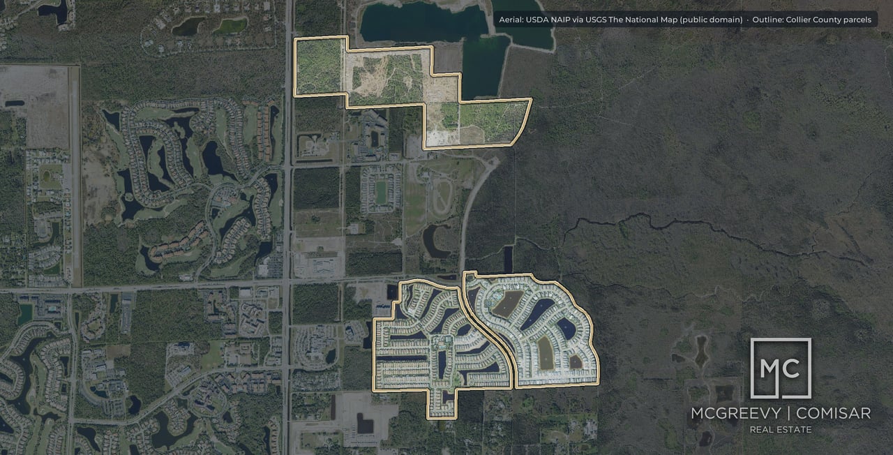
The Estuary at Grey Oaks occupies roughly 350 acres west of Airport-Pulling Road and north of Golden Gate Parkway, running out toward the Gordon River corridor. It is entered from Estuary Boulevard off Golden Gate Parkway, which makes it the only part of the Grey Oaks community that does not use Airport-Pulling Road or Livingston Road to get home. Its westernmost residential street is the furthest west any Grey Oaks address goes.
The 350 acre figure is corroborated by the South Florida Water Management District record, where the Estuary's own surface water management system is permitted over 338.06 acres and was formally transferred to the Estuary at Grey Oaks Property Owners Association in September 2010.
The figures below come from the Collier County Property Appraiser's certified tax roll, file date 29 August 2026.
Measure | Figure |
|---|
Platted parcels carrying the Estuary legal description | 213 |
Parcels carrying a structure | 181 |
Assessable parcels per the association | 176 |
Single family residential parcels | 175 |
Vacant residential parcels | 15 |
Median just value, all 213 parcels | $3,433,054 |
Median just value, the 175 single family homes | $4,993,854 |
Median land value, all parcels | $2,010,899 |
Median lot size, all parcels | 0.470 acres |
Median base area | 8,236 square feet |
First homes completed | 2002 |
Median year built | 2007 |
Most recent completion | 2023 |
Homesteaded, as a share of all parcels | 56% |
Owners with an out of state mailing address | 14% of parcels |
Parcels held in a trust, LLC or corporation | 52.1% |
Median total annual tax bill, all parcels | $27,584 |
Non ad valorem assessments | $0 on all 213 parcels |
ZIP code | 34105 |
213 parcels, 181 structures, 176 homes: the count nobody explains
Three different numbers describe the Estuary and all three are correct. The confusion is entirely definitional, and it is worth ten minutes of a buyer's attention because it is the same confusion that causes published home counts across Naples to disagree with each other.
213 is the parcel count on the tax roll. It counts every parcel carrying the Estuary legal description, which includes far more than houses. Broken out by the appraiser's own use codes, the 213 comprises 175 single family residential parcels, 15 vacant residential lots, 9 tracts classed as right of way, streets, roads and irrigation, 5 golf course parcels, 3 utility parcels, 3 parcels classed for sewage disposal and solid waste, 2 parcels of rivers, lakes and submerged land, and 1 parcel classed miscellaneous residential.
181 is the number of those parcels that carry a structure. That count includes the clubhouse and the golf and utility buildings alongside the homes, which is why it exceeds the residential count. It is also why the roll's median base area of 8,236 square feet is computed across a set that includes buildings that are not houses. Across the 175 single family parcels alone the median base area is 8,242 square feet, with the largest at 25,449.
176 is the association's count of assessable parcels, and the association states it in exactly those terms on its own resident site. It is also the figure that comes out of the roll when the eight residential street groupings are summed: 29 plus 2 on Gordon River Trail, 18 on Osprey Trail, 15 on Great Egret Trail, 20 on Nighthawk Point, 17 on Anhinga Point, 39 on Marsh Wren Lane and 36 on Noble Heron Way. That is 176 exactly. Three independent methods landing on the same number is unusual and it is the reason we publish 176 with confidence.
One further figure circulates and should be handled rather than repeated blindly. Developer marketing from 2009 describes 179 home sites. Treat that as a dated marketing figure from a period when lots were still being sold, not as a competing count of what exists today.
The roll's median just value for the Estuary is $3,433,054 when computed across all 213 parcels and $4,993,854 when computed across the 175 single family homes. That is a 45% difference produced by nothing except which parcels you include, and it is exactly the mechanism by which two honest sources publish two very different numbers about the same place.
The same applies to the tax bill. The median across all 213 parcels is $27,584. Across the 175 single family homes it is $35,004. If you are budgeting for a house, the second number is the one that describes your situation.
We publish both, with their denominators attached, every time.
Market Snapshot and Price History
Collier County records every deed transfer and the property appraiser flags which of them were arm's length and usable for valuation. That makes it possible to rebuild the Estuary's entire price history from primary record rather than from a market report.
There are 662 recorded deed transfers on Estuary parcels and 374 qualified arm's length sales above $100,000, the earliest dated 9 April 2001.
Year | Qualified sales | Median price | Highest sale |
|---|
2001 | 14 | $915,000 | $5,021,000 |
2002 | 13 | $995,000 | $4,700,000 |
2004 | 15 | $1,125,000 | $6,800,000 |
2005 | 31 | $1,537,000 | $2,415,000 |
2006 | 26 | $1,645,000 | $6,950,000 |
2007 | 21 | $1,875,000 | $5,050,000 |
2008 | 19 | $988,600 | $5,450,000 |
2009 | 11 | $1,225,000 | $4,300,000 |
2011 | 18 | $1,416,250 | $6,000,000 |
2013 | 21 | $1,400,000 | $6,000,000 |
2015 | 24 | $1,983,800 | $7,000,000 |
2017 | 17 | $2,350,000 | $6,860,000 |
2019 | 12 | $2,613,750 | $6,750,000 |
2020 | 17 | $2,400,000 | $6,750,000 |
2021 | 16 | $4,525,000 | $10,600,000 |
2022 | 6 | $3,525,000 | $6,250,000 |
2023 | 5 | $5,150,000 | $7,300,000 |
2024 | 10 | $5,047,500 | $11,250,000 |
2025 | 3 | $9,300,000 | $9,795,000 |
2026 to date | 4 | $9,850,000 | $13,000,000 |
Across the last ten years, 110 qualified sales recorded between 2016 and 2026 carry a median of $3,597,500, a mean of $4,296,304, a low of $1,195,000 and a high of $13,000,000.
An honest warning about the last two rows
The 2025 median of $9,300,000 rests on three qualified sales and the 2026 median on four. Those are not market-wide medians and should not be read as one. In a community of 176 homes where recent annual volume runs between three and seventeen qualified sales, a single year's median moves violently depending on which streets happened to trade. Three sales on Great Egret Trail and Gordon River Trail will produce a median above nine million; three sales on Marsh Wren Lane will produce one near two and a half.
This is the single most common way an Estuary valuation goes wrong, and it goes wrong in both directions. The correct comparable set here is a street level set over a multi year window, not a community median from last year.
What the curve actually shows
The correction was real and the recovery took a decade. The median fell from $1,875,000 in 2007 to $988,600 in 2008 and did not durably clear the 2007 level until 2017. Unlike a coastal Naples market, though, volume never stopped entirely. The Estuary recorded eleven qualified sales in its worst year.
The re-rating since 2020 is steep and it is real. The median moved from $2,400,000 in 2020 to $4,525,000 in 2021 and has stayed above $3.5 million since. The ceiling moved harder still: the highest sale of the year has gone from $6,750,000 in 2020 to $13,000,000 in 2026.
Volume has compressed sharply. The Estuary recorded 31 qualified sales in 2005 and 24 in 2015. It has recorded ten or fewer in each of the last four years. This is now a very thin market, which is favorable to a well prepared seller and punishing to a buyer who waits for a wide selection that is not coming.
The largest recorded sales
Date | Price | Address |
|---|
17 June 2026 | $13,000,000 | 1275 Osprey Trail |
10 May 2024 | $11,250,000 | 1213 Gordon River Trail |
4 May 2026 | $10,700,000 | 1249 Gordon River Trail |
25 January 2021 | $10,600,000 | 1264 Osprey Trail |
29 April 2021 | $9,850,000 | 1201 Gordon River Trail |
27 February 2025 | $9,795,000 | 1395 Great Egret Trail |
25 October 2024 | $9,650,000 | 1389 Great Egret Trail |
11 February 2025 | $9,300,000 | 1388 Great Egret Trail |
23 April 2024 | $9,250,000 | 1399 Great Egret Trail |
9 January 2026 | $9,000,000 | 1437 Nighthawk Point |
Every one of the ten largest recorded sales in the Estuary sits on one of four streets. That is not a coincidence and it is the subject of the next section.
Turnover and tenure
Across the 181 improved parcels, measured by the date of the last qualified sale on record:
Time since last qualified sale | Parcels | Share |
|---|
0 to 2 years | 17 | 9% |
3 to 5 years | 22 | 12% |
6 to 10 years | 44 | 24% |
11 to 20 years | 68 | 38% |
Over 20 years | 18 | 10% |
No qualified sale on record | 12 | 7% |
Roughly half the Estuary has not changed hands in over eleven years. For a community whose first homes were completed in 2002, that is a strikingly settled ownership profile, and it drives the tax discussion below.
The Streets of the Estuary
This is the section that does not exist anywhere else, because the county roll files the Estuary under plat groupings rather than under marketed street identities, and reconstructing it takes a parcel by parcel pass.
The Estuary is two distinct products behind one gate. An estate tier on Gordon River Trail, Osprey Trail, Great Egret Trail, Nighthawk Point and Anhinga Point, on lots between roughly 0.43 and 1.02 acres. And a villa tier on Noble Heron Way and Marsh Wren Lane, on lots of roughly a quarter acre. They are different houses, different lots, different price bands and different buyers, and treating them as one market is the fastest way to misprice a home here.
Street | Homes | Median lot | Median base area | Qualified sales 2016 to 2026 | Median sale | Highest sale |
|---|
Osprey Trail | 18 | 0.66 acres | 9,529 sq ft | 9 | $6,550,000 | $13,000,000 |
Gordon River Trail | 31 | 0.67 to 1.02 acres | 9,545 sq ft | 17 | $6,150,000 | $11,250,000 |
Great Egret Trail | 15 | 0.69 acres | 9,841 sq ft | 11 | $4,950,000 | $9,795,000 |
Nighthawk Point | 20 | 0.66 acres | 9,822 sq ft | 8 | $4,575,000 | $9,000,000 |
Anhinga Point | 17 | 0.43 acres | 6,028 sq ft | 13 | $4,565,000 | $7,250,000 |
Marsh Wren Lane | 39 | 0.25 acres | 5,365 sq ft | 30 | $2,450,000 | $4,250,000 |
Noble Heron Way | 36 | 0.24 acres | 5,420 sq ft | 22 | $2,375,000 | $4,395,000 |
Gordon River Trail is carried on two separate plat groupings, 29 homes on one and 2 on the other, and the two lot homes sit on the largest lots in the community at roughly an acre each.
Reading the table
The spread inside one gate is 2.8 times, from $2,375,000 on Noble Heron Way to $6,550,000 on Osprey Trail on ten year medians. That is narrower than the 5.7 times spread across the whole of Grey Oaks, but it is far wider than most Naples subdivisions of 176 homes, and it means a community median tells a seller almost nothing useful.
The villa streets carry the volume. Marsh Wren Lane and Noble Heron Way account for 52 of the 110 qualified sales in the last decade, from 75 of the 176 homes. The estate streets turn over less than half as often per home. If you own on Gordon River Trail or Osprey Trail, your comparable set is genuinely small and it needs to be built by hand.
Osprey Trail edges Gordon River Trail on median while Gordon River Trail carries the deeper trading history. Nine sales against seventeen. Both streets have recorded sales above ten million. Any claim that one street is definitively the community's best address is a marketing statement rather than a measurement, and we would rather show you the numbers.
Anhinga Point is the interesting one. Its lots are roughly a third smaller than the other estate streets and its median base area is materially smaller, yet its ten year median sale of $4,565,000 sits within a whisker of Nighthawk Point's $4,575,000 on far larger lots. That is a position and exposure premium doing the work, and it is exactly the kind of thing that a square foot analysis alone will get wrong.
Live Market Snapshot, September 2026
Pulled from the Southwest Florida MLS on 13 September 2026, scoped to Development Name GREY OAKS and filtered to the Estuary.
Measure | Estuary at Grey Oaks | Grey Oaks community |
|---|
Closed sales, trailing 12 months | 5 | 52 |
Median sold price | $7,250,000 | $3,975,000 |
Median price per square foot | $1,143 | $1,024 |
Median days on market | 92 | 52 |
Median sale to list ratio | 93.9% | 94.9% |
Homes currently listed | 1 | 10 |
The five closings, in full
Sold | Address | Living area | DOM | Sold price | $/sq ft |
|---|
12 May 2026 | 1249 Gordon River Trl | 7,356 | 77 | $10,700,000 | $1,454 |
12 Jan 2026 | 1437 Nighthawk Pt | 8,160 | 524 | $9,000,000 | $1,103 |
5 Aug 2026 | 1397 Great Egret Trl | 6,890 | 186 | $7,250,000 | $1,052 |
18 May 2026 | 1561 Marsh Wren Ln | 3,460 | 53 | $4,250,000 | $1,228 |
3 Oct 2025 | 1580 Marsh Wren Ln | 3,695 | 92 | $4,225,000 | $1,143 |
Reading it honestly
The Estuary is the highest priced neighborhood in Grey Oaks by a wide margin, with a median closing of $7,250,000 against a community median of $3,975,000, and it commands the second highest price per square foot at $1,143.
But five sales is a small sample and the page should say so. The more durable signals are the ratio and the time. At 93.9% of list and 92 days to contract, the Estuary trades slightly slower and slightly further below asking than the community as a whole. The 1437 Nighthawk Point sale took 524 days and closed at $9,000,000 against a $10,199,000 list, which is a 12% concession. At this price point the buyer pool is measured in dozens, not hundreds, and pricing discipline in the first month matters more than it does anywhere else in the community.
One home is currently listed in the Estuary, at $10,250,000 on Great Egret Trail, 8,793 square feet, 75 days on market. With five closings a year and one active listing, the Estuary is carrying roughly 2.4 months of inventory.
How the Estuary Was Built
The Estuary is the newest large piece of Grey Oaks. Where the east campus began in 1993, the roll records the Estuary's first completions in 2002, its median year built as 2007, and its most recent completion in 2023.
The clubhouse came first. Club records date the Estuary Clubhouse to 2002 and the Estuary golf course to 2003, so the earliest owners bought into a finished clubhouse and a course under construction.
The corporate and municipal record dates the project precisely. Estuary at Grey Oaks, Ltd., the developer limited partnership, is registered with the Florida Division of Corporations as document A00000000104. The Estuary at Grey Oaks Property Owners Association, Inc. (N01000000911) and the Estuary at Grey Oaks Estate Neighborhood Association, Inc. (N01000000912) were both organized in 2001, at the front of the build.
The plats are recorded at Plat Book 36, pages 9 to 16, and Plat Book 37, pages 13 to 18. The City of Naples record then tracks the buildout through a decade of individual actions: a preliminary subdivision plat for Tract C in April 2001, voluntary annexation of a portion of Estuary Drive together with the clubhouse and golf tract in August 2002, Ordinance 02-9775 in September 2002 covering the Estuary roadway, clubhouse and maintenance facility tract, an action on Tract A in February 2005, and Resolution 09-12334 in February 2009 replatting Lots 7, 8 and 9 at the petition of The Estuary at Grey Oaks, Ltd.
The two tier build
The roll shows why the community reads as two places. Completions ran from 2002 through 2023, but they did not run evenly across the streets. The estate streets carry median base areas between 6,028 and 9,841 square feet on lots from 0.43 to 1.02 acres. The villa streets carry median base areas of roughly 5,400 square feet on quarter acre lots. The largest single home on the roll measures 25,449 square feet of base area.
Homes here were custom built by multiple builders rather than by a single production builder, which is the normal pattern for a golf estate community of this era and which is why the housing stock varies more than a Torino or a Traditions does. Several builder names circulate in secondary material for the Estuary specifically. We have not been able to confirm any of them against a primary source such as a building permit record, so we are not going to publish a builder list. If the builder of a specific house matters to you, the permit record will answer it and we will pull it.
New construction, and what "2023" means
The roll's latest completion year for the Estuary is 2023. There are still 15 vacant residential lots on the roll here, which is a meaningful figure in a community of 176 homes and considerably more headroom than the east campus carries. Some of those are genuine unbuilt lots and some represent homes taken down for replacement building. Either way, the Estuary is not fully built out in the way that the phrase is usually used about a 2002 community, and new construction is a live category here rather than a historical one.
Separately Governed, and Why That Matters
This is the section that most changes how a buyer should think about the Estuary, and it is almost entirely absent from published material.
The Estuary is not one of the 19 constituent neighborhood associations under the Grey Oaks master association. It has its own master association, and the Grey Oaks master association's own roster of its 19 members does not include it.
Entity | Florida document number | Role |
|---|
Estuary at Grey Oaks Property Owners Association, Inc. | N01000000911 | The Estuary's master association |
Estuary at Grey Oaks Estate Neighborhood Association, Inc. | N01000000912 | Second tier association |
Estuary at Grey Oaks, Ltd. | A00000000104 | The original developer limited partnership |
The practical consequences run all the way through ownership.
A different assessment. An Estuary owner pays $3,345 per quarter to the Estuary association and does not pay the $1,509 per quarter Grey Oaks master assessment. The two are alternatives, not a stack.
A different zoning instrument. The east campus is governed by the Collier County Grey Oaks and Halstatt planned unit development under County Ordinance 07-40 as amended. The Estuary is a City of Naples Planned Development, carried in the City's own planned development log under Ordinance 02-9773, which itself traces back to Ordinance 90-6210 as amended by 00-8971. Two campuses, two zoning authorities, two sets of development standards.
A different building department. A permit in the Estuary is issued by the City of Naples. A permit across Airport-Pulling Road is issued by Collier County Growth Management.
A different relationship with the club, and it is documented. On 9 February 2026 the Estuary at Grey Oaks Property Owners Association and Grey Oaks Country Club, Inc. recorded a 27 page agreement with the Collier County Clerk, Instrument 6783201, Official Records Book 6552, Page 183. The existence of that instrument is itself informative: the Estuary contracts with the club through its own association rather than through the Grey Oaks master association. We have verified the recording, the parties, the date and the length from the Clerk's certified index. We have not read the document text, and we say that plainly rather than characterizing terms we have not seen.
A different stormwater system. The Estuary's surface water management system is permitted separately by the South Florida Water Management District over 338.06 acres and was transferred to the Estuary association in September 2010. Responsibility for the wider community's stormwater is split three ways among the Grey Oaks master association, the Estuary association and the country club, which mirrors the governance structure exactly.
What the Estuary association actually publishes
The association publishes its own operating detail, and it differs from the east campus on nearly every line.
Item | What the Estuary association publishes |
|---|
Assessment | $3,345 per quarter for 170 of 176 parcels; six double lots vary |
Gate access | Residents collect a clicker from the association office; permanent guest lists are managed through the Proptia app or website |
Gate staffing | Two staffed gate houses plus a roving patrol |
Trash and recycling | Trash Tuesdays and Fridays, recycling Fridays, out after 6 PM the night before |
Pest control | The association provides pest control for palm rats, cane toads and iguanas. In home pest control is not included |
Cable and internet | Comcast, on a service tier the association describes as White Glove |
Association insurance broker | Arthur J. Gallagher and Company |
Day to day management is by Castle Group, the same firm that manages the Grey Oaks master association, with an onsite accounting function covering both.
Two of those rows are worth pausing on. The Proptia gate access system is used in the Estuary and does not appear in the east campus association's material, which means guest management genuinely works differently on the two sides of the road. And the pest control scope is unusually specific: it names the three nuisance species that a Gordon River corridor community actually contends with, which tells you something real about the setting that no marketing page will.
Leasing, pets and guest rules
We have these now, from the recorded master declaration. An earlier version of this page reported them as unsourced, and reasoned that the conflicting figures circulating for Grey Oaks were evidence that no community wide answer existed. That reasoning was wrong, and the instrument settles it.
Rule | The recorded master declaration |
|---|
Minimum lease term | Six months |
Maximum lease term | Twelve months |
What may be leased | The entire home or unit only. No sub leasing, no single rooms |
Notice | A copy of the lease to the association at least 20 days before the term begins |
Amenity trade | An owner whose home is leased may not use the recreation or parking facilities during the lease term |
And the qualification cuts only one way. The declaration expressly allows each neighborhood association to set more stringent standards, including tenant screening and advance approval. It does not permit them to be more permissive. So six months is a floor for the whole community, an individual neighborhood may sit above it, and any shorter figure you encounter for Grey Oaks is not a neighborhood variation, it is an error. The Estuary is separately governed under its own master association, so confirm its specific provision in writing, but it cannot be looser than the community floor.
Pets. Dogs, cats and other household pets are permitted, none for a commercial purpose. The declaration limits numbers by a Board judgment of what is reasonable rather than by a fixed cap, so there is no published pet number here and we will not invent one. Pets must be caged, carried or leashed outside the home, may not be tied outside or left on a balcony or patio, and may not be left outside unattended.
Guests. A guest is anyone present on a temporary basis, and the owner is responsible for their conduct. The rules bind a guest or tenant to the same extent as the owner, and the Board may suspend a guest's or contractor's right to enter. The master declaration sets no numeric guest limit, though a neighborhood association may.
We will not publish a number we cannot attribute. If rental flexibility matters to your purchase, the restriction for a specific address can be obtained in writing before you go under contract, and we do that as a matter of routine.
One structural note that is worth knowing. Florida Statute 720.30851 requires an association to designate on its website a person or entity for receipt of estoppel certificate requests. Neither the Estuary association nor the Grey Oaks master association currently designates one on its public site. Both publish a general phone number and a management company line instead. That does not prevent an estoppel from being ordered, but it does mean the request has to go through a person rather than a published address, and it is one more reason to start that process early rather than late.
What It Costs to Own Here
The association assessment
Association | Quarterly | Annually | Applies to |
|---|
Estuary at Grey Oaks Property Owners Association | $3,345 | $13,380 | 170 of the 176 assessable parcels |
Six double lot parcels | varies | varies | The remaining 6 parcels |
The association publishes those figures itself, in exactly those words, on its own resident portal.
For context, the Grey Oaks master association on the east campus charges $1,509 per quarter, or $6,036 a year. The Estuary assessment is 2.2 times that. It is the single most expensive master assessment anywhere in the Grey Oaks community.
That is not a like for like comparison, and the difference is not waste. The Estuary assessment funds a smaller community. 176 doors carry the cost of their own gate house staffing and roving patrol, their own gate access system, their own roads, their own 338 acre stormwater system, their own irrigation, their own landscaping, their own pest control program and their own bulk Comcast contract. The east campus spreads a comparable set of obligations across 732 assessable doors, a figure the recorded declaration puts at 737. A per door figure that is 2.2 times higher across a community that is roughly a quarter the size is, on its face, the arithmetic of scale rather than the arithmetic of extravagance.
Two things it is not. It is not stacked on top of the Grey Oaks master fee; an Estuary owner does not pay both. And it is not club dues, which are separate again and are not an association assessment at all. Conflating association fees with club dues is the single most common error in published material about the cost of living in this community, and it is where the widely repeated claim of fifteen to twenty thousand dollars a year in HOA fees comes from.
Club dues, and what we will not tell you
The club does not publish its current fees. We checked its membership materials directly and they carry no dollar figures.
What we can source is a club issued document from approximately 2021 recording a Golf Member joining fee of $200,000, structured as $150,000 of membership plus a $50,000 capital contribution, none of it refundable. The same period records April capital project dues of $3,000 for golf members and $1,350 for sports members, an assessment tied to the 2015 capital plan and to the 2017 Estuary golf course work, which the club stated would expire in fiscal 2024 and was not expected to be extended.
That $200,000 figure is roughly four years old and is historical rather than current. Several higher figures circulate in secondary material and they contradict one another on both joining fee and annual dues, so we will not repeat any of them. The club's membership office is the only reliable source for a current number, and we are glad to make that introduction.
The rest of the annual carry
An honest total cost of ownership for an Estuary home has these lines, and only the first is published:
The association assessment, at $13,380 a year for a standard parcel.
Property tax, with a median across the single family homes of $35,004 and a median across all parcels of $27,584.
Club dues, which the club does not publish.
Insurance, which we will not estimate and explain why below.
City of Naples water, sewer and reclaimed irrigation water, at the published city rates set out in the utilities section.
City of Naples solid waste, at a published 2026 residential charge of $77.08 bimonthly.
There is no Community Development District assessment, and no non ad valorem assessment of any kind. All 213 Estuary parcels carry $0.00 in that column on the certified roll. In a Naples community at this price point that is worth checking against any alternative you are comparing, because a CDD bond can add several thousand dollars a year to a tax bill for two or three decades.
Property Taxes and the Save Our Homes Reset
The millage finding nobody has published
Here is a fact that runs directly against intuition. The Estuary carries the lowest total millage rate anywhere in Grey Oaks, and it does so while paying a municipal levy that the rest of the community does not.
The certified roll carries the component rates. Reading them straight:
Millage area | Where | County | School | Municipal | Other districts | Total |
|---|
208 | The Estuary and Moorings Park, City of Naples | 3.2449 | 4.1470 | 1.2900 | 0.3257 | 9.0076 |
70 | Part of the unincorporated east campus | 3.9293 | 4.1470 | 0.0000 | 1.3257 | 9.4020 |
116 | The rest of the unincorporated east campus | 3.9293 | 4.1470 | 0.0000 | 2.3257 | 10.4020 |
The City of Naples municipal levy of 1.2900 mills is real, and an Estuary owner pays it. But it is more than offset by two things. The county rate inside the city is 0.6844 mills lower, because the unincorporated general municipal services taxing unit levy does not apply inside city limits. And the Estuary carries no separate fire district levy, where the two unincorporated areas carry 1.0000 mills for North Collier Fire and 2.0000 mills for Greater Naples Fire respectively, the latter following an August 2025 voter referendum.
Net result: an Estuary parcel is taxed at 9.0076 mills, 0.39 mills below the cheaper unincorporated area and 1.39 mills below the more expensive one. On a $5,000,000 assessed value, that 1.39 mill difference is roughly $6,950 a year.
Every published treatment of Grey Oaks that mentions the city line frames it as a cost. On the millage rate, measured from the roll's own component fields, it is the opposite.
What an Estuary tax bill looks like
Measure | Across all 213 parcels | Across the 175 single family homes |
|---|
Median total annual tax bill | $27,584 | $35,004 |
Median just value | $3,433,054 | $4,993,854 |
Effective rate on just value | 0.80% | 0.70% |
The effective rate sits below the nominal 9.0076 mills because homesteaded owners of long standing pay tax on a capped assessed value rather than on market value. Which brings us to the number that matters most here.
The Save Our Homes reset
Florida's Save Our Homes provision caps the annual increase in the assessed value of a homesteaded property at 3% or the change in the Consumer Price Index, whichever is lower. Over a long ownership the gap between market value and capped assessed value compounds. The roll records that gap explicitly, as a Save Our Homes benefit.
In the Estuary, 104 parcels carry a Save Our Homes benefit. The median benefit is $1,471,106. The largest is $4,339,693.
Read that alongside the tenure table above, where 68 parcels have not traded in eleven to twenty years and a further 18 have not traded in over twenty, and the picture is clear: a very large share of this community is sitting on a substantial embedded tax advantage that does not survive a sale.
For a buyer. When a long held Estuary home sells, the cap resets. The new assessed value is market value, and your first full year tax bill can be dramatically higher than the seller's, on the same house. On a median benefit of $1,471,106 at the Estuary's 9.0076 mill rate, that reset represents roughly thirteen thousand dollars a year of additional tax that the seller was not paying. Do not budget from the seller's current tax bill. Budget from the assessed value your purchase will create.
For a seller. The same arithmetic explains why long tenured Florida owners hesitate to move, and why Florida's portability provision matters so much. A homesteaded seller can transfer up to $500,000 of accumulated Save Our Homes benefit to a new Florida homestead. If you have held an Estuary home since the 2000s, portability is very likely the single largest financial variable in your next move, and it should be modeled before you list rather than discovered at closing.
Nobody in Naples luxury real estate publishes this analysis. It is the first thing we model when we sit down with an Estuary owner, and in the last 12 months we have run it before every listing conversation we have had in this community.
The Estuary Golf Course
The Estuary course is the most interesting golf course in Grey Oaks and the least accurately described.
Designed by Bob Cupp, it opened per the club's own timeline in 2003, the year after the Estuary clubhouse. Some published accounts date it to 2002, which is the clubhouse year; the club's own record separates the two and we follow it. It was later re-imagined by Tim Liddy, who also redesigned the club's Palm course.
The club describes it as carved among original stands of towering pine, cypress and oak, with natural preserves and water features throughout, and credits Liddy's work with variation in fairway width, green size, bunker design and landscaping inside the preserve.
The number that defines it
The Estuary plays 6,680 yards from the tips, the shortest of the club's three courses, and carries a men's slope rating of 145, the highest in the community. The Pine course, renovated by Andrew Green and reopened in November 2023, plays 7,120 yards at 74.8 and 143. The Palm plays 6,882 yards.
Short and hard is an unusual combination and it is the signature of a target golf layout: the yardage is modest, the penalty for a miss is not. That single pairing explains why members describe the Estuary as the trickiest of the three despite it being the one you would expect to be easiest.
The full card
Par 72, out 36 and in 36, across five tee sets.
Tee | Out | In | Total |
|---|
I | 3,314 | 3,366 | 6,680 |
II | 3,173 | 3,181 | 6,354 |
III | 2,973 | 2,981 | 5,954 |
IV | 2,747 | 2,723 | 5,470 |
V | 2,427 | 2,443 | 4,870 |
Course rating and slope:
Tee | Men | Women |
|---|
I | 73.3 / 145 | |
II | 71.7 / 137 | |
III | 70.1 / 130 | 75.3 / 142 |
III and IV combined | 68.9 / 127 | |
IV | 67.6 / 122 | 72.6 / 136 |
V | 64.7 / 117 | 69.2 / 128 |
Hole pars run 4-4-5-5-4-4-3-4-3 out and 4-5-3-5-3-4-4-3-5 in. From the back tee the front nine measures 368, 451, 513, 501, 417, 382, 201, 338 and 143 yards, and the back nine 424, 555, 175, 537, 198, 393, 362, 227 and 495.
The 9th is 143 yards, the shortest hole on any of the three Grey Oaks courses. The 11th is 555 yards, the Estuary's longest.
The local rule that tells you everything
The Estuary scorecard carries a local rule that neither the Pine nor the Palm card carries:
Whenever taking two club-lengths from a Penalty Area that extends into a Bunker, the ball can be placed rather than dropped.
A course does not need that rule unless water intrudes into its bunkering often enough to make the drop unworkable. It is a small piece of print and it is a more honest description of the golf here than any adjective.
Recognition
The Estuary course has been named a Florida Golf Course of the Year. The club's own materials credit the award to the National Golf Course Association and do not state the year, and we have not been able to independently confirm either the exact awarding body's name or the year, so we report the award as the club states it and go no further.
The Clubhouse and Club Access
One membership, two campuses
The Estuary is not a separate club, and this is the correction that matters most. There is one membership at Grey Oaks and two campuses.
The club's own membership materials state that resident and non-resident Equity Golf Members enjoy full access to the amenities of Grey Oaks Country Club and the Estuary at Grey Oaks Country Club, including unlimited golf privileges, and that Equity Sports Members enjoy the same access excluding golf course access and golf privileges.
The corporate record confirms it from the other direction. No separate Estuary club corporation exists on the Florida Division of Corporations register. The only Estuary at Grey Oaks entities are the developer limited partnership and the two property owner associations, which are real estate bodies rather than a club.
What genuinely is separate is physical and operational. The Estuary has its own clubhouse, its own golf shop with its own telephone line, its own dining room, its own kitchen and its own street address. The impression of a club within a club is a campus fact, not a membership fact.
The West Clubhouse
The Estuary clubhouse, also known as the West Clubhouse, is 19,000 square feet at 1600 Estuary Drive, and it opened in 2002. The club describes it as a facility with expansive views of the lake and golf course, known for an elevated dining experience and a sunset outlook. The architectural plan reproduced in the club's own capital documents records the main floor at 6,873 square feet, so the 19,000 square foot figure describes the whole building across floors rather than a single level.
For scale, the East Clubhouse at 2400 Grey Oaks Drive North is 62,000 square feet.
The Estuary dining room is one of the club's three full service restaurants, alongside the Pool Café and the Point Grille on the east campus, and the club describes it as a refined venue pairing an intimate indoor room with al fresco dining over the golf course.
Recent investment in the Estuary specifically
The club's current capital program, budgeted at $17.4 million in total, includes two line items that land directly on this campus:
Project | Budget |
|---|
Estuary Kitchen Redesign | $450,000 |
New Parking Lot at the Estuary entrance | $750,000 |
The kitchen redesign, delivered in 2024, was a total redesign of the kitchen space with new equipment including a Hestan cooking suite, with preliminary plans developed by the culinary design firm Cini-Little. The parking lot was built on club owned land at the entrance of the Estuary, on part of what had been a retention pond, and it serves both employee parking and overflow capacity for large functions at the Estuary. The Estuary dining room had already been renovated under the club's earlier 2015 capital plan.
The club also borrowed specifically for what its own documents call the 2017 Estuary golf course projects, which is the other half of the capital story on this campus.
Sports membership and golf
One feature of the membership structure is materially favorable to buyers and is almost universally mis-stated. Equity Sports Members hold unlimited golf privileges from May through October, with on course golf excluded only from November through April. The same seasonal structure appears in club materials going back to 2012, so this is long standing policy rather than a recent change.
If you are buying in the Estuary primarily for the setting and the club social life and you play golf occasionally in the off season, that distinction is worth understanding before you choose a membership category.
The Gordon River Setting and the Bird Streets
The naming is deliberate and it is specific
The Estuary's street names are a birding register, and not a generic one: Anhinga Point, Osprey Trail, Great Egret Trail, Noble Heron Way, Marsh Wren Lane and Nighthawk Point, with Gordon River Trail naming the river itself and Estuary Drive and Estuary Boulevard naming the system.
Every one of those six birds is a wading, diving or aerial feeding species of the Gordon River and Naples Bay estuarine system. Anhinga, osprey, great egret, great blue heron, marsh wren and common nighthawk are precisely what an observer records along that corridor. This is not a decorative list of pretty birds. It is a coherent identity applied to a community that was laid out along an estuary and named for one.
The contrast with the east campus is complete. Across Airport-Pulling Road the streets carry a Florida native plant vocabulary: Bulrush, Buckthorn, Cocoplum, Indigobush, Plumbago, Sedge, Silverleaf, Spicebush, Tarflower, Thistle, Canna, Chicory, Dahlia, Day Lily, Bellflower, Indian Pipe, Caladium, Chinaberry, Alexander Palm, King Palm and Silver Palm. Two naming systems, executed consistently across two campuses of one community.
A small cartographic note, because it causes real confusion in searches and in navigation apps. Some mapping services render two of these streets as Anhinga Place and Nighthawk Pointe. The Collier County certified roll uses Anhinga Point and Nighthawk Point, and the roll is the authority for the legal and postal name.
The river itself
The Gordon River channel runs roughly 400 feet west of the Estuary's western boundary, measured from published waterway geometry, and it runs alongside the community for its entire north to south extent. North of the community it becomes the Gordon River Canal.
That single fact explains three things at once, and a buyer deserves all three rather than one.
It is why the Estuary has water and preserve exposure that the rest of Grey Oaks does not. It is why parts of the Estuary carry a 100 year flood designation that most of the east campus does not. And it is why the Estuary sits in evacuation Zone B while the east campus sits in Zone C. The setting and the risk are the same feature. Anyone who sells you the first without mentioning the second is not doing the job.
The green space next door
Fred W. Coyle Freedom Park is 0.9 miles and about two minutes from the Estuary gate. Gordon River Greenway Park is 1.1 miles and about four minutes. Together they make up roughly 190 acres of public wetland boardwalk, trail, lake and hammock along the same river corridor the community is named for, with a kayak and canoe launch, fishing and lookout piers, and pedestrian access that is realistically a bicycle ride rather than a drive.
From the main Grey Oaks gate on Airport-Pulling Road those same parks are 2.3 and 2.5 miles. The Estuary is the closest gated golf address in Naples to the Gordon River Greenway system, and that is a genuine, checkable amenity rather than a marketing line.
Preserve and open land inside the gate
Of the Estuary's 213 parcels, 22 are non residential tracts: 9 classed as right of way, streets, roads and irrigation, 5 golf course parcels, 3 utility, 3 for sewage disposal and solid waste, and 2 of rivers, lakes and submerged land. The single largest parcel in the Estuary measures 67.63 acres.
We looked specifically for a recorded conservation easement naming the Estuary, because permanently protected open space is materially different from open space that could be re-entitled later. We could not locate one, and we are not going to assert protection we cannot document. The recorded plats are the place that designation would appear, and they can be pulled for a specific question.
We also looked for Audubon certification of the golf courses, which is commonly claimed of Naples clubs. We found no mention of it anywhere in the club's own materials and we do not assert it.
Flood, Elevation and Storm History
This section is deliberately honest, including where honesty is less flattering. At this price point a buyer is making an insurance decision as well as a housing decision, and a page that oversells here is worse than useless.
The Estuary is in the City of Naples for flood mapping purposes, NFIP community 125130. The Grey Oaks east campus is in unincorporated Collier County, community 120067. Both sit on the same countywide map panel, 12021C0392J, effective 8 February 2024. There is no separate City of Naples flood map.
That distinction determines who administers the floodplain, who reviews an elevation certificate, and who processes a substantial improvement determination on a renovation. For an Estuary property those functions sit with the City of Naples.
The zones, measured
Measured by sampling points against the National Flood Hazard Layer:
Area sampled | Points | Zone mix | Median ground elevation |
|---|
Estuary interior | 5 | All 5 in Zone AE | 7.1 feet NAVD88 |
Estuary Drive | 37 | 21 in Zone X at the 0.2% annual chance level, 16 in Zone AE | 9.1 feet NAVD88 |
Estuary Boulevard | 11 | 7 Zone X at 0.2%, 3 Zone AE, 1 minimal Zone X | 9.7 feet NAVD88 |
The Estuary's Special Flood Hazard Areas carry a static base flood elevation of 9 feet NAVD88 in the map's own attribute data.
Two points follow from those numbers and neither is obvious.
The AE areas here are riverine, not coastal. The map's own subtype field describes the floodplain as a combined riverine and coastal floodplain, and the AE areas track the Gordon River corridor along the Estuary's western flank rather than pushing in from the Gulf. This is a river floodplain that happens to sit near a coast.
The measured ground is at or near the base flood elevation. Along Estuary Drive and Estuary Boulevard the sampled ground runs 9.1 to 9.7 feet NAVD88 against a base flood elevation of 9 feet, and finished floors sit higher than natural ground. That is a materially different situation from a property sitting three feet below the base flood elevation, and it is why the specific elevation certificate on a specific house matters far more here than the zone label on a map.
It is not accurate to say the Estuary is not in a flood zone. Parts of it plainly are, the answer varies lot by lot, and the only correct answer is the determination on the specific parcel.
The Letters of Map Amendment finding, and it cuts against the Estuary
There are 21 Letters of Map Amendment and Map Revision on file across the Grey Oaks community, the most recent dated 18 June 2026. A Letter of Map Amendment is a FEMA determination that a specific structure sits above the base flood elevation and should not be treated as being in the high risk zone even though the surrounding mapped area is.
Every one of those 21 is filed under unincorporated Collier County, community 120067. None of them is in the Estuary.
We could have quietly used the community wide figure of 21 and left the impression that some of them were here. They are not, and the honest reading is more useful anyway. Twenty one determinations on the other side of the road establish that in this part of Naples the mapped floodplain and the actual ground repeatedly disagree in the owner's favor. A Letter of Map Amendment is free to apply for, the Estuary's ground elevations along its main streets sit at or above the base flood elevation, and no owner here appears to have filed one. For a buyer facing a lender mandated flood policy at high risk rates, that is a question worth asking on day one rather than after the first renewal.
Evacuation zones, which are a different thing entirely
Storm surge evacuation zones are routinely confused with FEMA flood zones. They are not the same. A FEMA zone drives insurance rating. An evacuation zone determines when the county orders you to leave.
Location | Evacuation zone |
|---|
Coastal Naples: Port Royal, Aqualane Shores, Old Naples, Coquina Sands, The Moorings, Park Shore | A |
The Estuary at Grey Oaks and Moorings Park at Grey Oaks | B |
Grey Oaks east campus | C |
The Estuary sits one tier safer than every coastal Naples neighborhood a buyer at this price point cross shops, and one tier more exposed than the Grey Oaks east campus. Zone A leaves first and leaves most often. Zone B leaves next. Zone C leaves only for the largest surge events.
That middle position is the honest description of the Estuary. It is not a coastal risk profile and it is not the interior profile of the east campus. It is the Gordon River, 400 feet away, doing exactly what you would expect it to do.
For scale, the Florida Division of Emergency Management records Collier County's Zone B population at 23,612, against 79,527 in Zone A and 61,498 in Zone C.
How far inland it actually is
Location | Straight line distance to the Gulf shoreline |
|---|
Estuary at Grey Oaks, western edge | 1.53 miles |
Estuary at Grey Oaks, core | 2.03 miles |
Grey Oaks eastern edge | 3.53 miles |
The Estuary is the closest part of the wider Grey Oaks community to the coast, and it is still over a mile and a half inland at its nearest point.
What the storms actually did
Hurricane Ian, 2022. The National Weather Service's own description of Ian's surge envelope places the inundation south and west of US 41 and of the Naples airport. The surge did not reach Grey Oaks. Inland Collier County experienced near surface gusts of 80 to 90 miles per hour, with damage described as mainly confined to trees, fences and screens.
Hurricane Irma, 2017, was the more serious wind event for this location, producing a 142 mile per hour gust two miles away. Irma's Naples inundation extended less than half a mile inland. The Estuary's nearest point to the coast is 1.53 miles.
2025 and 2026. NOAA tide gauges at Naples record no surge event in either year, with a 2025 maximum of 1.42 feet above mean higher high water and a 2026 maximum of 1.29 feet.
The wind finding that does not favor the Estuary
Measured against Florida's adopted ASCE 7-22 wind speed contours, the Estuary sits in the same 160 to 170 mile per hour design band as Old Naples.
The Estuary holds a meaningful surge and evacuation advantage over the coastal neighborhoods. It holds essentially no wind design advantage. A home here is built to the same wind standard, and a 2002 Estuary home carries the same wind questions as a comparably aged home anywhere in coastal Collier County.
Collier County is confirmed outside the High Velocity Hurricane Zone, which applies only to Miami-Dade and Broward counties. It is, however, entirely inside the wind borne debris region, so opening protection is required.
The maps are about to change
FEMA's proposed new Collier County flood maps entered a 90 day appeal period on 19 August 2026. The preliminary map was released on 20 March 2025 and a community open house was held on 17 June 2025. New maps are targeted to take effect around summer 2027, subject to completion of the appeal review.
If you are buying in the Estuary between now and then, the zone determination that applies at closing may not be the one that applies at your first renewal after adoption. The preliminary mapping is publicly viewable and can be checked against a specific parcel. Almost nobody is doing this, and it is a ten minute question with a multi year consequence.
Insurance Reality in 2026
An Estuary home is almost certainly ineligible for Citizens Property Insurance. Florida's state backed insurer of last resort carries a statutory replacement cost cap of $700,000, and essentially no home in this community falls below it. The Estuary is a private market community, which is generally an advantage rather than a disadvantage, because it means these homes are written by carriers competing for them.
We are not going to publish a premium range. Premiums at this price point vary so widely by roof age, opening protection, construction type, claims history and carrier appetite that a single figure would mislead more than it would help. Any page that gives you a number for a community rather than for a house is guessing.
What actually drives the number here:
Roof age and material. The most significant single underwriting variable in Florida today, and in a community whose homes span 2002 to 2023 this varies enormously across the gate.
Opening protection. Impact glass or code approved shutters throughout, versus partial or none.
Wind mitigation credits. A current wind mitigation inspection is worth commissioning before you shop coverage, not after.
Flood, separately. Whether the specific parcel sits in Zone AE or in Zone X, what the elevation certificate says, and whether the base flood elevation of 9 feet NAVD88 sits above or below the finished floor.
The 2027 map revision. A property that is in an AE zone today and out of it after adoption, or the reverse, will reprice.
The Estuary association carries its own insurance program brokered through Arthur J. Gallagher and Company. That covers association property and liability, not your house, and it is a separate conversation from your own policy.
Utilities and Daily Life
The Estuary's utility profile is different from the rest of Grey Oaks on almost every line, and the differences are all consequences of the city limit.
Service | The Estuary | Grey Oaks east campus |
|---|
Water | City of Naples | City of Naples |
Out of city 25% surcharge | Not applicable | Applies |
Sewer | City of Naples | Collier County Water-Sewer District, billed on the City's bill |
Reclaimed irrigation water | Available | Not available |
Solid waste | City of Naples | Collier County |
Electric | Florida Power and Light | Florida Power and Light |
The Estuary is the only part of Grey Oaks inside the City of Naples reclaimed water service area. Measured against the City's own service area mapping, every tested Estuary point falls inside it and every tested point elsewhere in the community, including Moorings Park, falls outside. City reclaimed water is billed at a $27.16 bimonthly base, a $20.02 availability charge whether the meter is connected or not, and $0.90 per thousand gallons.
That availability charge is worth reading twice. It is levied whether or not you connect, so it is a fixed line on an Estuary bill rather than an optional one.
On sewer, City rates are materially lower than the county rates the east campus pays. The City's own 2026 rate sheet publishes a City schedule at $53.76 bimonthly base plus $5.21 per thousand gallons with a 20,000 gallon bimonthly cap, against a county schedule for out of city customers at $106.12 bimonthly base plus $7.46 per thousand gallons with a 30,000 gallon cap. And the 25% out of city surcharge that Grey Oaks east campus customers pay does not apply to the Estuary, because the Estuary is inside the city.
Two homes two thousand feet apart, on either side of Airport-Pulling Road, are on different water rates, different sewer rates, different trash systems and different millage. Nobody publishes this.
Solid waste, in practical detail
City of Naples collection applies in the Estuary, and it differs from the county service across the road in ways that matter day to day.
Household trash twice a week, out by 7:00 AM, container back in by 7:00 PM.
Side door collection is available on request, with refuse collected next to the house, garage or carport rather than at the curb. The county does not offer this.
Containers must be plastic with a tight fitting solid lid, 30 gallon maximum.
Recycling once a week in a city issued blue roll out cart, 65 or 95 gallon.
Yard and horticultural waste once a week, within six feet of the curb, in paper bags or lidless cans. The City does not collect debris cut by landscape contractors, which is a real and frequently missed rule in a community where every home is professionally landscaped.
Bulk waste by appointment only, booked at least 48 hours ahead, with items out no more than 24 hours in advance.
Collection runs on all holidays except New Year's Day, Independence Day, Thanksgiving and Christmas.
Electronics are not collected curbside. The drop off point is the Naples Recycling Drop-Off Center at 2640 Corporate Flight Drive, Tuesday through Saturday, 8:30 to 4:30.
The 2026 residential solid waste charge is $77.08 bimonthly, comprising garbage collection $39.14, horticultural collection and disposal $12.68, recycling collection and disposal $8.96 and Collier County disposal $16.30.
The Estuary association publishes its own collection days on top of that: trash Tuesdays and Fridays, recycling Fridays, containers out after 6 PM the night before.
Natural gas
We could not establish whether natural gas mains reach Estuary streets, and we are not going to assert it either way. Individual buried propane is at least as likely as a distribution main at this price point in Naples. If a gas range or a gas generator is part of your plan for a specific house, availability at that address can be confirmed directly with the utility before you contract, and we do that as a matter of course.
Schools
Estuary addresses zone to three schools, and we verified this rather than assuming it. We extracted the school district's own 2026 to 2027 attendance zone geometry and ran a point in polygon test on ten addresses spread across the wider community, three of which are Estuary addresses on Nighthawk Point, Osprey Trail and Great Egret Trail.
All ten returned the same three schools.
Level | School | 2025 to 2026 grade |
|---|
Elementary | Poinciana Elementary | A |
Middle | Gulfview Middle | A |
High | Naples High | A |
Two findings are worth stating because they are counterintuitive. The city limit line is not a school zone boundary, and neither is Airport-Pulling Road. Despite the Estuary sitting in the City of Naples while most of Grey Oaks sits in unincorporated Collier County, the two campuses zone identically. Collier County Public Schools is a countywide district and its attendance zones cross the municipal boundary freely.
Poinciana Elementary is at 2825 Airport-Pulling Road, a short distance from the community.
On performance: Gulfview Middle has held an A grade for 25 consecutive years since 2001. Naples High moved from a B to an A in 2024 to 2025 and held it. Collier County Public Schools is an A rated district for the ninth consecutive year and ranks sixth among Florida's 67 districts.
Private schools
Naples has an unusually deep private school market for a city its size and most Estuary families consider it. The principal options within a reasonable drive include Community School of Naples, Seacrest Country Day School, First Baptist Academy, Royal Palm Academy, St. Ann Catholic School and The Village School of Naples. Royal Palm Academy opened an $8 million middle school expansion in August 2026, clearing a waiting list.
Two corrections worth carrying into your own research: Naples Classical Academy is a public charter school rather than a private school, and is frequently miscategorized. Hodges University has closed, its Naples campus in 2021 and the institution in August 2024.
Getting Around
Distances below were computed by road routing from the Estuary gate at Estuary Boulevard and Golden Gate Parkway rather than estimated from straight line distance. Times are free flow, which makes them an off season, off peak floor rather than a February reality.
Destination | Distance | Drive time |
|---|
Fred W. Coyle Freedom Park | 0.9 miles | 2 minutes |
Gordon River Greenway Park | 1.1 miles | 4 minutes |
Naples Municipal Airport | 2.3 miles | 6 minutes |
Interstate 75 at Golden Gate Parkway | 2.8 miles | 5 minutes |
Lowdermilk Park | 2.9 miles | 7 minutes |
Baker Park | 3.0 miles | 7 minutes |
NCH Baker Hospital, downtown | 3.25 miles | 8.4 minutes |
Fifth Avenue South | 3.6 miles | 8 minutes |
Venetian Village | 4.1 miles | 9 minutes |
Third Street South | 4.8 miles | 11 minutes |
Naples Pier | 4.8 miles | 11 minutes |
Waterside Shops | 4.9 miles | 9 minutes |
Clam Pass Park | 5.3 miles | 12 minutes |
Naples Botanical Garden | 5.7 miles | 13 minutes |
Mercato | 7.5 miles | 14 minutes |
NCH North Naples Hospital | 8.38 miles | 16.2 minutes |
Vanderbilt Beach | 8.5 miles | 16 minutes |
Southwest Florida International Airport, RSW | about 33 miles | 43 minutes |
The Estuary gate is the downtown gate
Compared against the main Grey Oaks gate on Airport-Pulling Road, the Estuary gate is 1.4 miles closer to Fifth Avenue South and 1.4 miles closer to Lowdermilk Park, while the main gate is closer to Mercato and Vanderbilt Beach. The two halves of Grey Oaks genuinely have different orientations: the Estuary faces downtown and the beach at Lowdermilk, the east campus faces North Naples.
On healthcare the same pattern holds. The Estuary gate reaches NCH Baker Hospital downtown in 3.25 miles and about 8.4 minutes, roughly two minutes faster than the main gate. The main gate reaches NCH North Naples about 2.4 minutes faster. Both routes to both hospitals converge on Goodlette-Frank Road, so a closure there degrades access to both hospitals from both gates.
Everything on that list except the Fort Myers airport is inside seventeen minutes of free flow driving. That combination of a gated golf address, a private airfield six minutes away, downtown at eight minutes and the interstate at five is genuinely uncommon in Naples.
Season, quantified
Naples traffic is seasonal and it is measurable. County traffic counts on Golden Gate Parkway west of Airport-Pulling ran 36.9% higher in the first quarter than the third quarter in 2023, and 26.5% higher in 2025. Golden Gate Parkway is the Estuary's only exit, so unlike the east campus there is no alternative gate to switch to in February. Add time between January and April and plan around it.
What Is Coming Nearby
The site plan under review, and what we will not do with it
City of Naples site plan item 26-SP5, "Estuary at Grey Oaks," is under review. It covers 1600 Estuary Drive and 2785 Airport Road, the Estuary clubhouse address and the Grey Oaks Country Club address, and lists RDA Consulting Engineers as agent, with submissions dated 19 May 2026 and 10 June 2026.
Its scope is not published, and the City's own site plan summary report carries only the item number, the name, the addresses, the agent, the dates and the status. We are not going to speculate about what it proposes. Given the two addresses, a club facility or golf course project is plausible, but plausible is not sourced, and a page that invents a scope for a live application does its readers a disservice. The file can be obtained from City of Naples Planning by referencing the petition number.
For historical context, a comparable prior item, 22-SP3, converted an irrigation pond at 2785 Airport Road North into overflow parking and went before the City's Planning Advisory Board in June 2022. That is the parking lot referenced in the club's capital plan.
We ran a keyword sweep of the complete City of Naples City Council voting record from 21 January to 19 August 2026. No 2026 City ordinance or resolution touches Grey Oaks or the Estuary. Searches for Grey Oaks, Estuary, continuing care, group housing, assisted living, floor area ratio, rezone and retirement all returned zero hits in that record.
This matters because a widely discussed 2026 zoning change is frequently associated with Grey Oaks. Collier County Ordinance 2026-12, adopted 28 April 2026, raised the permitted floor area ratio for assisted living within the Grey Oaks planned unit development from 0.45 to 0.60. The parcel affected is Moorings Park Grande Lake, which is in unincorporated Collier County, south of Golden Gate Parkway, and is not the Estuary. The county's own staff analysis caps the real world effect at a net increase of about 40,000 square feet, roughly twelve additional independent living units, with no change in height.
Roads
No county or state road construction project touches the Estuary's frontage. The Airport Road widening frequently associated with this area is the segment from Vanderbilt Beach Road to Immokalee Road, four to five miles north, and it does not affect the Estuary gate on Golden Gate Parkway.
Looking further out, the region's adopted 2050 long range transportation needs plan carries a Golden Gate Parkway overpass over Livingston Road and an intersection improvement at Airport-Pulling and Golden Gate Parkway. These are identified needs rather than funded projects and their funding status is unverified. The Interstate 75 project in the corridor remains in a design and public involvement phase with no construction date set as of a public meeting at the end of August 2026.
The airport, addressed honestly
The Estuary is the part of Grey Oaks closest to Naples Municipal Airport, and a page that skipped this would be doing you a disservice.
The airfield sits immediately west of Airport-Pulling Road. Its primary runway, 5/23, is 6,600 feet long and its secondary, 14/32, is 5,000 feet, and the 5/23 approach and departure corridors run southwest to northeast across the Airport-Pulling and Golden Gate Parkway area. That geometry puts the Estuary among the closer parts of the community to the field, at 2.3 miles from the gate.
Grey Oaks sits outside the airport's DNL 60 noise contour. For scale, the countywide population inside DNL 60 or above is 97 persons across 46 housing units.
But it is not silent, and the airport's own records show it. In the airport's noise complaint table for May 2025 to April 2026, Grey Oaks appears with 2 households filing 48 comments, out of 6,821 countywide.
Traffic is rising. The airport recorded 54,216 jet operations, up 8% year over year, and 127,172 total operations, up 1.5%. Curfew compliance runs at 98.2%, and non exempt curfew flights have fallen 26% in two years.
And the airport is staying. The Naples Airport Authority board voted 3 to 1 on 19 June 2025 to end the relocation study, finding it not financially feasible and unsupported by the county.
Our honest read: aircraft noise in the Estuary is real but modest, it varies with where in the community you stand and with runway configuration on the day, and it is a question to answer with your own ears on a weekday morning in February rather than from any page, including this one.
County context
Collier County's fiscal 2026 general fund millage is 3.0107 with an aggregate of 3.7675, against a rolled back rate of 3.5870, a 5.03% increase. Countywide taxable value stands at $164.9 billion. State population projections put Collier at 413,314 in 2025 rising to a medium series estimate of 506,800 by 2050.
Primary Source Documents
These are the governing and public records behind the facts on this page.
Document | Issuing body | Reference |
|---|
Estuary at Grey Oaks Property Owners Association corporate record | Florida Division of Corporations | Document N01000000911 |
Estuary at Grey Oaks Estate Neighborhood Association corporate record | Florida Division of Corporations | Document N01000000912 |
Estuary at Grey Oaks, Ltd. corporate record | Florida Division of Corporations | Document A00000000104 |
Agreement, Estuary at Grey Oaks Property Owners Association and Grey Oaks Country Club, Inc. | Collier County Clerk of the Circuit Court | Instrument 6783201, OR Book 6552, Page 183, recorded 9 February 2026, 27 pages |
Estuary at Grey Oaks recorded plats | Collier County Clerk | Plat Book 36, pages 9 to 16; Plat Book 37, pages 13 to 18 |
Estuary at Grey Oaks Planned Development | City of Naples | Ordinance 02-9773, tracing to Ordinance 90-6210 as amended by 00-8971 |
Annexation, Estuary roadway, clubhouse and maintenance tract | Naples City Council | Ordinance 02-9775, adopted 4 September 2002 |
Replat of Lots 7, 8 and 9, Estuary at Grey Oaks | Naples City Council | Resolution 09-12334, adopted 4 February 2009 |
Site plan under review | City of Naples Planning | Item 26-SP5, 1600 Estuary Drive and 2785 Airport Road |
Estuary surface water management system permit | South Florida Water Management District | Permit 11-00806-S, 338.06 acres, transferred to the Estuary association 17 September 2010 |
Flood Insurance Rate Map panel | FEMA Map Service Center | Panel 12021C0392J, effective 8 February 2024 |
NFIP community identifier | FEMA | City of Naples, CID 125130 |
Certified real property tax roll | Collier County Property Appraiser | File date 29 August 2026 |
School attendance zones | Collier County Public Schools | 2026 to 2027 zoning geometry |
Estuary Course scorecard, ratings and slopes | Grey Oaks Country Club | 1600 Estuary Drive |
Grey Oaks Country Club corporate records | Florida Division of Corporations | Documents V30984 and A32901 |
Selling an Estuary Home
If you own in the Estuary, the market you are selling into is not the market described in most published material, and the difference is worth real money.
What we know about your home before we arrive
We hold the complete recorded transfer history of all 213 Estuary parcels: 662 recorded deeds and 374 qualified arm's length sales going back to April 2001, with dates, prices, addresses and the property appraiser's own qualification flag. We hold the assessed value, land value, improvement value, base area, adjusted area, lot size, year built and exemption status for every parcel. And we hold the Save Our Homes benefit on every homesteaded property inside the gate.
When we sit down with you, we are not asking what you think your neighbors sold for. We already know.
The three things that decide an Estuary sale
One: which street you are on. The ten year median ranges from $2,375,000 on Noble Heron Way to $6,550,000 on Osprey Trail, a 2.8 times spread inside one gate. An analysis that treats the Estuary as a single market will misprice your home in one direction or the other, and the community wide median from a thin recent year is the worst possible starting point. We build a street level comparable set, over a multi year window, by hand.
Two: your tax basis, and your buyer's. With 104 Estuary parcels carrying a Save Our Homes benefit at a median of $1,471,106, a long held home here carries a tax reset for its buyer that a well prepared listing addresses openly rather than letting it surface as an objection late in a negotiation. We model the buyer's likely first year bill at the Estuary's 9.0076 mill rate before we go to market, so the conversation happens on our terms.
Three: your own portability. If you are moving within Florida, up to $500,000 of accumulated Save Our Homes benefit transfers to your next homestead. For an owner who bought here in the 2000s that is frequently the single largest financial variable in the move, and it needs modeling before the listing decision rather than after.
The Estuary turns over slowly and is turning over more slowly than it used to. Forty eight percent of improved parcels have not traded in more than eleven years, and recent annual qualified volume has run between three and ten sales across 176 homes.
In a market that thin, each listing is measured against a small and heavily scrutinized comparable set, and a mispriced first three weeks is expensive to recover from. At the same time the top of this market has re-rated hard: the highest sale of the year has moved from $6,750,000 in 2020 to $13,000,000 in 2026. If your home sits in the upper tier, a comparable set from even three years ago understates it materially.
What we do differently
For more than two decades we represented sellers across Southwest Florida, and our approach here starts from the county record rather than from a market report. In the last 12 months we tracked Estuary closings from the recorded deed rather than waiting for them to surface in a quarterly summary. Pricing starts from recorded sales, is adjusted to your specific street rather than the community average, is checked against the assessed value trend on the roll, and is stress tested against the active set.
If you would like to know what your Estuary home is worth, we will prepare a full analysis with the recorded comparable set for your street, the tenure and turnover picture, and the tax modeling for both sides of the transaction. There is no obligation attached to it.
Jesse McGreevy: (239) 898-6072 · [email protected]
Buying in the Estuary
If you are buying here, this is the short list of questions that actually matter and that most buyers do not think to ask.
Which street is it on, and what has that street actually traded at? The spread is 2.8 times inside this gate. A community median is not a valuation.
Estate tier or villa tier? Lots of 0.43 to 1.02 acres with base areas near 9,500 to 9,800 square feet, versus quarter acre lots with base areas near 5,400. They are different products with different buyers and different resale dynamics.
What is the seller's Save Our Homes benefit? Because your tax bill will not be theirs. Budget from the assessed value your purchase creates, at 9.0076 mills.
Is the parcel in Zone AE or Zone X, and what does the elevation certificate say? The base flood elevation here is 9 feet NAVD88 and the ground along the main streets runs 9.1 to 9.7 feet. The difference between a bad flood answer and a good one on the same street is a single document.
Has anyone checked whether this structure would qualify for a Letter of Map Amendment? There are 21 on file across the wider community and none in the Estuary. It is free to apply for.
What will the 2027 flood map revision do to this parcel? The preliminary mapping is already public.
What is the roof age and the opening protection? Estuary homes span 2002 to 2023 construction and these two variables will drive your insurance more than anything else.
What is the minimum lease term? The recorded master declaration sets a floor of six months and a ceiling of twelve. A neighborhood association may be stricter but never more permissive, so confirm the Estuary's own provision in writing if rental flexibility matters to you.
What is the club's current membership structure and cost for this specific property? The club does not publish it. We confirm the position with the membership office rather than repeating a figure from the internet.
We work through this list on every Estuary purchase we handle. Marc Comisar: (239) 287-5873.
Frequently Asked Questions
How many homes are in the Estuary at Grey Oaks?
176 assessable homes across 213 platted parcels. The Collier County tax roll records 213 parcels carrying the Estuary legal description, of which 181 carry a structure of some kind and 175 are classed single family residential. The association itself publishes 176 as its count of assessable parcels, and summing the eight residential street groupings on the roll gives exactly 176. A developer figure of 179 home sites appears in 2009 marketing and should be read as a dated marketing number from a period when lots were still selling.
Why do the Estuary's parcel count and home count differ?
Because a tax roll counts parcels and an association counts assessable doors. The 213 parcels include 15 vacant residential lots, 9 tracts classed as right of way, streets, roads and irrigation, 5 golf course parcels, 3 utility parcels, 3 classed for sewage disposal and solid waste, 2 of rivers, lakes and submerged land, and 1 classed miscellaneous residential. Strip out everything that is not a home and you are left with the association's 176.
Is the Estuary part of Grey Oaks?
Yes and no, and the distinction is the most important thing on this page. It shares the Grey Oaks name, the country club and the master brand. It does not share the Grey Oaks master association, the county jurisdiction, the zoning instrument, the assessment, the gate, the sewer utility or the evacuation zone. It is the community's City of Naples campus, governed separately.
Is the Estuary one of the 19 Grey Oaks neighborhoods?
No. The Grey Oaks master association governs 19 constituent neighborhood associations and the Estuary is not one of them. The Estuary has its own master association, registered in Florida as document N01000000911, plus a second tier entity registered as N01000000912.
How much are the Estuary at Grey Oaks HOA fees?
$3,345 per quarter, or $13,380 per year, applying to 170 of the 176 assessable parcels. Six double lot parcels are assessed differently. The association publishes those figures on its own resident portal. Estuary owners do not additionally pay the Grey Oaks master association fee of $1,509 per quarter.
Why is the Estuary fee more than double the Grey Oaks fee?
Because 176 doors carry the full cost of a self contained community. The Estuary funds its own gate staffing and roving patrol, its own gate access system, its own roads, its own 338 acre stormwater system, its own irrigation and landscaping, its own pest control program and its own bulk Comcast contract. The Grey Oaks master association spreads a comparable set of obligations across 732 assessable doors. The ratio is roughly the ratio of the two door counts.
What does the Estuary assessment cover?
Comcast cable and internet on a tier the association calls White Glove, association provided pest control for palm rats, cane toads and iguanas, gated security through two staffed gate houses and a roving patrol, the Proptia gate access system for guest management, and trash and recycling collection on Tuesdays and Fridays. In home pest control is not included.
Does the Estuary have CDD fees?
No. All 213 Estuary parcels carry a non ad valorem assessment of $0.00 on the Collier County certified tax roll. There is no Community Development District covering this community and no CDD bond debt. Florida's special district registry returns no district for it.
Is the Estuary in the City of Naples?
Yes. All 213 Estuary parcels sit inside the City of Naples, in millage area 208, carrying a municipal millage of 1.2900. Together with the four Moorings Park at Grey Oaks parcels they make up the 217 City of Naples parcels within the wider Grey Oaks community. The remaining 836 Grey Oaks parcels are in unincorporated Collier County.
Are Estuary property taxes higher because it is in the city?
No, they are lower. The total millage on an Estuary parcel is 9.0076 mills, against 9.4020 and 10.4020 mills in the two unincorporated millage areas of Grey Oaks. The municipal levy of 1.2900 mills is more than offset by a county rate that is 0.6844 mills lower inside the city and by the absence of any separate fire district levy.
What are Estuary property taxes?
The median total annual tax bill is $27,584 across all 213 parcels and $35,004 across the 175 single family homes, at an effective rate of 0.80% and 0.70% of just value respectively. The lower effective rate on the homes reflects long tenured homesteaded owners paying tax on a capped assessed value.
Why would my tax bill be higher than the seller's?
Because of Florida's Save Our Homes cap. A homesteaded owner's assessed value rises by no more than 3% or the change in the Consumer Price Index each year, whichever is lower. When the home sells, that cap resets to market value. In the Estuary, 104 parcels carry a Save Our Homes benefit with a median of $1,471,106 and a maximum of $4,339,693. At 9.0076 mills, a median benefit represents roughly thirteen thousand dollars a year of tax the seller is not currently paying and you would be.
Across the last decade, 110 qualified arm's length sales between 2016 and 2026 carry a median of $3,597,500, a mean of $4,296,304 and a high of $13,000,000. Single year medians in this community are unreliable because annual volume has recently run between three and ten sales.
What is the highest price ever paid in the Estuary?
$13,000,000, on Osprey Trail, recorded 17 June 2026. The next highest are $11,250,000 on Gordon River Trail in May 2024 and $10,700,000 on Gordon River Trail in May 2026.
Which is the most expensive street in the Estuary?
By ten year median qualified sale, Osprey Trail at $6,550,000 across 9 sales, narrowly ahead of Gordon River Trail at $6,150,000 across 17 sales. Gordon River Trail carries the deeper trading record and both streets have recorded sales above ten million dollars.
Which is the least expensive street in the Estuary?
Noble Heron Way, at a ten year median of $2,375,000, with Marsh Wren Lane immediately above it at $2,450,000. These are the villa streets, on quarter acre lots with median base areas near 5,400 square feet.
How many different types of home are in the Estuary?
Two clearly distinct tiers. An estate tier on Gordon River Trail, Osprey Trail, Great Egret Trail, Nighthawk Point and Anhinga Point, on lots of roughly 0.43 to 1.02 acres with median base areas from 6,028 to 9,841 square feet. And a villa tier on Noble Heron Way and Marsh Wren Lane, on lots of roughly a quarter acre with median base areas near 5,400 square feet.
When was the Estuary built?
The first homes were completed in 2002, the median year built is 2007, and the most recent completion on the roll is 2023. The Estuary clubhouse opened in 2002 and the Estuary golf course in 2003.
Is there still new construction in the Estuary?
Yes. The roll records 15 vacant residential lots in the Estuary, which is meaningful headroom in a community of 176 homes, and completions are recorded as recently as 2023. Some of that activity is genuine new construction on unbuilt lots and some is replacement building.
How big are Estuary lots?
The median across all 213 parcels is 0.470 acres, and across the 175 single family parcels it is 0.45 acres, with the largest single family lot at 1.34 acres. Lots on the estate streets run roughly 0.43 to 1.02 acres. Lots on the villa streets run roughly a quarter acre.
How large are Estuary homes?
The roll's median base area across the improved parcels is 8,236 square feet, and across the 175 single family homes it is 8,242 square feet, with the largest at 25,449 square feet. Median base areas by street run from roughly 5,365 square feet on Marsh Wren Lane to 9,841 on Great Egret Trail.
Is the Estuary a separate country club?
No. There is one Grey Oaks membership and two campuses. The club's own materials give Equity Golf Members full access to the amenities of both Grey Oaks Country Club and the Estuary at Grey Oaks Country Club, and no separate Estuary club corporation exists in the Florida corporate record. The only Estuary entities on the register are the developer limited partnership and the two property owner associations.
Does the Estuary have its own clubhouse?
Yes. The Estuary clubhouse, also called the West Clubhouse, is 19,000 square feet at 1600 Estuary Drive and opened in 2002. It holds the Estuary dining room, one of the club's three full service restaurants, and its own golf shop with its own telephone line. The East Clubhouse at 2400 Grey Oaks Drive North is 62,000 square feet.
Who designed the Estuary golf course?
Bob Cupp. It opened in 2003 per the club's own timeline, and was later re-imagined by Tim Liddy, who also redesigned the club's Palm course. Some published accounts date the course to 2002, which is the year the Estuary clubhouse opened.
How long is the Estuary golf course?
6,680 yards from the back tee, at par 72, across five tee sets measuring 6,680, 6,354, 5,954, 5,470 and 4,870 yards. It is the shortest of the club's three courses.
Is the Estuary the hardest course at Grey Oaks?
Yes, by slope rating. It carries a men's slope of 145 from the back tee, the highest in the community, against 143 on the renovated Pine course. It is simultaneously the shortest of the three at 6,680 yards, which is the signature of a target golf layout: modest yardage, severe penalty for a miss.
What is the signature hole on the Estuary course?
The card offers two candidates. The 9th plays 143 yards, the shortest hole on any of the three Grey Oaks courses. The 11th plays 555 yards, the Estuary's longest. The scorecard also carries a local rule found on neither of the other two courses, allowing a ball to be placed rather than dropped when taking relief from a penalty area that extends into a bunker, which tells you how much water intrudes into the bunkering.
Has the Estuary course won any awards?
It has been named a Florida Golf Course of the Year. The club's own materials credit the award to the National Golf Course Association and do not state the year. We report the award as the club states it and have not independently confirmed the year or the exact awarding body's name.
Do Estuary residents get access to the Pine and Palm courses?
Yes, through the club membership. Equity Golf Members hold full access to the amenities of both campuses including unlimited golf privileges, and Equity Sports Members hold full access to both campuses excluding golf course access, except that Sports members hold unlimited golf privileges from May through October.
How much is membership at Grey Oaks Country Club?
The club does not publish its current fees. The most recent figure sourceable to a club issued document is a Golf Member joining fee of $200,000, structured as $150,000 of membership plus a $50,000 capital contribution and none of it refundable, dating to approximately 2021 and therefore historical. Conflicting higher figures circulate in secondary material and we do not repeat them. The club's membership office is the only reliable source for a current number.
What flood zone is the Estuary in?
It varies by parcel and both zones are present. Sampled points along Estuary Drive returned 21 in Zone X at the 0.2% annual chance level and 16 in Zone AE. Along Estuary Boulevard, 7 in Zone X at 0.2%, 3 in Zone AE and 1 in minimal Zone X. Interior sample points returned Zone AE. The governing map panel is 12021C0392J, effective 8 February 2024.
What is the base flood elevation in the Estuary?
A static 9 feet NAVD88 across the Estuary's Special Flood Hazard Areas, per the map's own attribute data. Measured ground along Estuary Drive and Estuary Boulevard runs 9.1 to 9.7 feet NAVD88, so the natural ground in those areas sits at or slightly above the base flood elevation and finished floors sit higher still.
Why is the Estuary in a flood zone when most of Grey Oaks is not?
The Gordon River. The channel runs roughly 400 feet west of the Estuary's western boundary. The Special Flood Hazard Areas here follow that corridor rather than pushing in from the Gulf, and the map's own classification describes the floodplain as a combined riverine and coastal floodplain. The same adjacency that gives the Estuary its water and preserve setting gives it its flood designation.
What evacuation zone is the Estuary in?
Zone B. The Grey Oaks east campus is Zone C. Port Royal, Aqualane Shores, Old Naples, Coquina Sands, The Moorings and Park Shore are all Zone A, which evacuates first and most often. The Estuary sits one tier safer than the coastal neighborhoods and one tier more exposed than the east campus.
Did the Estuary flood during Hurricane Ian?
The National Weather Service's description of Ian's storm surge envelope places the inundation south and west of US 41 and of the Naples airport. The surge did not reach Grey Oaks. Inland Collier County experienced near surface gusts of 80 to 90 miles per hour, with damage described as mainly confined to trees, fences and screens.
How far is the Estuary from the Gulf?
1.53 miles at its western edge and 2.03 miles at its core, measured straight line to the Gulf shoreline. It is the closest part of the wider Grey Oaks community to the coast.
Is the Estuary in a hurricane wind zone?
Yes, like all of coastal Collier County. Measured against Florida's adopted ASCE 7-22 contours it sits in the 160 to 170 mile per hour design band, the same band as Old Naples. The Estuary has a real surge and evacuation advantage over the coastal neighborhoods and essentially no wind design advantage. Collier County is outside the High Velocity Hurricane Zone but entirely inside the wind borne debris region, so opening protection is required.
Are there Letters of Map Amendment in the Estuary?
No. All 21 Letters of Map Amendment and Map Revision on file across the Grey Oaks community are filed under unincorporated Collier County, and none is in the Estuary. Given that measured ground along the Estuary's main streets sits at or above the base flood elevation, that is a question worth raising with a floodplain professional rather than an absence to accept.
Can I get Citizens insurance on an Estuary home?
Almost certainly not. Citizens carries a statutory replacement cost cap of $700,000 and essentially no home in the Estuary falls below it. This is a private market community.
What schools does the Estuary zone to?
Poinciana Elementary, Gulfview Middle and Naples High, all currently A rated. We verified this by extracting the district's own 2026 to 2027 attendance zone geometry and running a point in polygon test on ten community addresses including three in the Estuary. All ten returned the same three schools. The city limit line is not a school zone boundary.
Who provides water and sewer in the Estuary?
City of Naples for both. The Estuary is the only residential part of Grey Oaks inside the City of Naples sanitary sewer service area; the east campus is on the Collier County Water-Sewer District. Because the Estuary is inside the city, it also does not pay the 25% out of city utility surcharge that Grey Oaks east campus customers pay.
Does the Estuary have reclaimed irrigation water?
Yes, and it is the only part of Grey Oaks that does. Every tested Estuary point falls inside the City of Naples reclaimed water service area and every tested point elsewhere in the community falls outside it. City reclaimed water is billed at a $27.16 bimonthly base, a $20.02 availability charge whether the meter is connected or not, and $0.90 per thousand gallons.
How many gates does the Estuary have?
The Estuary is entered from Estuary Boulevard off Golden Gate Parkway, on a different arterial from the rest of Grey Oaks. The association's own published contact list names two staffed gate houses plus a roving patrol, and guest access is managed through the Proptia app rather than the system used on the east campus. The Grey Oaks master association names three entrances of its own and does not include the Estuary gate, because the Estuary is separately governed.
How far is the Estuary from Fifth Avenue South?
3.6 miles, about 8 minutes by road from the Estuary gate. That is 1.4 miles closer than the main Grey Oaks gate on Airport-Pulling Road. Third Street South is 4.8 miles and the Naples Pier is 4.8 miles.
How far is the Estuary from the airport?
Naples Municipal Airport is 2.3 miles and about 6 minutes from the Estuary gate. Southwest Florida International at Fort Myers is about 33 miles and roughly 43 minutes free flow.
Is there aircraft noise in the Estuary?
The Estuary is the part of Grey Oaks closest to Naples Municipal Airport and sits near the approach and departure corridor of the airfield's primary runway. Grey Oaks sits outside the airport's DNL 60 noise contour, but it is not silent: the airport's own complaint record for May 2025 to April 2026 shows 2 Grey Oaks households filing 48 comments out of 6,821 countywide. Jet operations rose 8% year over year. The Airport Authority voted in June 2025 to end the study of relocating the airport. This is a question to answer with your own ears on a February weekday morning.
What are the Estuary's street names about?
They are a deliberate birding register drawn from the Gordon River and Naples Bay estuarine system: Anhinga, Osprey, Great Egret, Noble Heron, Marsh Wren and Nighthawk, with Gordon River Trail naming the river itself. Every one is a wading, diving or aerial feeding bird of that corridor. The Grey Oaks east campus uses an entirely separate Florida native plant vocabulary.
Can you rent a home in the Estuary?
The recorded master declaration sets a minimum lease term of six months and a maximum of twelve, community wide. Only the entire home may be leased, never a single room, and no sub leasing is permitted. A copy of the lease must reach the association at least 20 days before the term begins, and an owner whose home is leased gives up use of the recreation and parking facilities for the duration.
Neighborhood associations may impose stricter rules, including screening and advance approval, but not looser ones. So a shorter minimum lease term at Grey Oaks is an error rather than a local variation. The Estuary is separately governed, so we obtain its specific provision in writing before you contract.
How close is the Estuary to parks and the Gordon River Greenway?
Fred W. Coyle Freedom Park is 0.9 miles and about two minutes from the gate; Gordon River Greenway Park is 1.1 miles and about four minutes. Together they make up roughly 190 acres of public wetland boardwalk and trail along the same river corridor the community is named for. From the main Grey Oaks gate those same parks are 2.3 and 2.5 miles.
What is being built at 1600 Estuary Drive?
City of Naples site plan item 26-SP5, listed as "Estuary at Grey Oaks" and covering 1600 Estuary Drive and 2785 Airport Road, is under review. Its scope is not published, and the City's own summary report carries only the item number, addresses, agent, submission dates and status. We are not going to speculate about it. The file can be obtained from City of Naples Planning by referencing the petition number.
Did the 2026 zoning change affect the Estuary?
No. Collier County Ordinance 2026-12, adopted 28 April 2026, raised the assisted living floor area ratio within the Grey Oaks planned unit development, and the parcel affected is Moorings Park Grande Lake in unincorporated Collier County. A keyword sweep of the complete City of Naples City Council voting record from January to August 2026 returns zero references to Grey Oaks or the Estuary.
How often do Estuary homes sell?
Slowly, and less often than they used to. Across the 181 improved parcels, 38% have not traded in 11 to 20 years and a further 10% not in over 20 years. Recent annual qualified volume has run between three and ten sales across 176 homes, against 31 in 2005 and 24 in 2015.
Is the Estuary a good investment?
We are not going to give you an investment opinion, but we will give you the measurements. The ten year median qualified sale is $3,597,500 against a 2016 median of $2,285,350. The annual high has moved from $6,750,000 in 2020 to $13,000,000 in 2026. Volume has compressed to single digits in most recent years. Roughly half the community has not traded in over a decade. Those are the facts; what they mean depends entirely on your holding period and your street.
Frequently Asked Questions for Sellers
What is my Estuary home worth?
That depends heavily on which street it sits on, because the ten year spread inside this gate is 2.8 times. We prepare a full analysis from the recorded comparable set for your specific street over a multi year window rather than from a community median, which in a market this thin is actively misleading. Call Jesse McGreevy on (239) 898-6072.
Is now a good time to sell in the Estuary?
The ten year median is $3,597,500 and the top of the market has re-rated sharply, with the annual high moving from $6,750,000 in 2020 to $13,000,000 in 2026. Volume is thin, which favors a well prepared seller. Whether it is right for you depends on your tax basis and your next move, which is why we model portability before recommending a listing decision.
How long does it take to sell a home in the Estuary?
The Estuary is a low turnover market where each listing is measured against a small comparable set, which makes the first three weeks of pricing disproportionately important. We will give you a realistic timeline for your specific street and price tier rather than a community average.
Why does my street matter so much?
Because the Estuary is not one market. Ten year median qualified sales run from $2,375,000 on Noble Heron Way to $6,550,000 on Osprey Trail. A valuation that averages across the community will be wrong in one direction or the other, often by seven figures.
What will my tax bill do if I sell and buy again in Florida?
Florida's portability provision lets you transfer up to $500,000 of accumulated Save Our Homes benefit to a new Florida homestead. With 104 Estuary parcels carrying a benefit at a median of $1,471,106, this is frequently the largest financial variable in a long tenured owner's move.
Will the buyer's higher tax bill affect my sale?
It can, if it is not addressed. At the Estuary's 9.0076 mill rate, a median Save Our Homes benefit represents roughly thirteen thousand dollars a year of additional tax for your buyer. A buyer who discovers that late in a negotiation may reprice. We put the modeling in front of buyers early, which turns a late objection into an early disclosure.
Does the Save Our Homes reset make my home harder to sell?
Not if it is handled openly. It is a fact about every long held homesteaded property in Florida, not a defect in yours, and every competing Estuary listing carries the same dynamic. What damages a sale is a buyer discovering it late. We put the modeling in the listing materials.
How do you price an Estuary home?
From the 374 qualified recorded sales inside this gate going back to April 2001, adjusted to your specific street, checked against the assessed value trend on the county roll, and stress tested against the current active set. We do not price from portal estimates and we do not price from last year's community median, which in a three sale year is not a median of anything useful.
Should I renovate before selling?
It depends on your tier. On the estate streets a portion of demand is for the lot and the exposure, and renovation spend can be recovered poorly. On Marsh Wren Lane and Noble Heron Way, where the product is more consistent, condition drives price more directly. We will tell you honestly which situation you are in, and the roll separates your land value from your improvement value so we can show you the split before you decide.
What is my home's land value versus improvement value?
The county roll separates them on every parcel. Across the Estuary the median land value is $2,010,899 against a median total just value of $3,433,054, and on the single family parcels the median land value is $2,230,114. On the estate streets land is a very substantial share of total value. We will show you your specific split.
Florida now requires flood disclosure on residential sales, and in the Estuary the answer is genuinely parcel specific because both Zone AE and Zone X are present within a few hundred feet of each other. Get the determination and the elevation certificate before you list rather than during a negotiation.
Should I sell before or after the new flood maps take effect?
FEMA's proposed Collier County maps entered a 90 day appeal period on 19 August 2026 and are expected to take effect around summer 2027. Whether a revision helps or hurts is parcel specific. We check the preliminary mapping against your parcel before advising on timing.
My home is in a Special Flood Hazard Area. Does that hurt the price?
It affects the buyer's insurance cost, so it affects what they can pay. The more useful question is whether your specific structure sits above the 9 foot base flood elevation and could qualify for a Letter of Map Amendment. There are 21 on file across the wider Grey Oaks community and none in the Estuary, so this is an open question here rather than a settled one, and it is free to ask.
What documents will I need from my association?
An estoppel certificate from the Estuary at Grey Oaks Property Owners Association, the recorded Declaration and any amendments, and the current budget. Note that the association does not currently designate an estoppel contact on its public site as Florida Statute 720.30851 contemplates, so the request has to go through the management company. We order these early rather than at the last minute.
Should I get an estoppel certificate before listing?
Yes. Ordering it early removes the most common source of delay in the final two weeks of a closing here, and it lets us answer fee questions accurately in the first buyer conversation rather than the last. Florida caps the fee for a standard estoppel on a non delinquent parcel, and the certificate must disclose any capital contribution, resale or transfer fee, which is information a buyer will otherwise ask for anyway.
What happens to my club membership when I sell?
That depends on your category and on the club's transfer terms, which are not published. The Estuary's relationship with the club is additionally governed by a separate 27 page agreement recorded between the Estuary association and the club in February 2026. We confirm the position in writing with the membership office as part of listing preparation rather than repeating an assumption.
How do you market an Estuary home?
Through the gates as much as through the portals. In a community of 176 homes where roughly half have been held over a decade, a meaningful share of the likely buyer pool is already inside Grey Oaks, already in the club, or already looking specifically at this community. Broad syndication matters, and so does reaching the membership and the neighboring streets directly.
Can you sell my home privately?
Yes, and in a community this small and this settled a targeted approach reaches a real share of the likely buyers. We will discuss the trade off against open market exposure honestly, because quiet marketing usually costs price, and in a market with three to ten qualified sales a year the exposure premium is not small.
How many Estuary homes are on the market at once?
Historically few. With recent annual qualified volume in the single digits across 176 homes, active inventory is thin by design. That is generally favorable to sellers, but it also means the comparable set is small and each new listing repositions the others.
Do you recommend pre-listing inspections?
For homes built in the early 2000s, usually yes, particularly roof and opening protection, because those two variables drive the buyer's insurance quote and are the most common source of a renegotiation. Given the Estuary's build span of 2002 to 2023, condition varies far more across this community than the single gate suggests.
Do I have to bring my home to current code?
No. Existing homes are not required to be retrofitted to current wind or elevation standards in order to sell. What matters commercially is that a buyer can insure it at a price they will accept, which is a different question from code compliance.
How do you handle a trust or estate sale?
More than half of Estuary parcels are held in a trust, LLC or corporation, at 52.1% of the 213, so this is the normal case here rather than the exception. We coordinate with your attorney on title, homestead status and the tax consequences of the transfer before listing.
What if I am not ready to sell yet?
That is the most useful time to have the conversation. Understanding your Save Our Homes position, your portability, your land to improvement split and where your street sits in the cycle is worth doing well before a decision rather than during one.
Do you charge for a valuation?
No. There is no cost and no obligation.
Who will actually handle my listing?
Jesse McGreevy and Marc Comisar personally. Jesse McGreevy: (239) 898-6072 · [email protected]. Marc Comisar: (239) 287-5873.
Your Local Real Estate Experts
★★★★★ "We had been on the market for several months with no offers. When we signed with Marc our house was sold in 2 weeks. He has a unique system for selling homes." Verified Google review
Top 1% Real Estate Agents Nationally Since 2008
5 Star Award for Customer Satisfaction for 21 Straight Years. Only 5 out of 21k+ Licensees (Gulfshore Life Magazine)
#1 Team in Southwest Florida since 2012
McGreevy and Comisar and their Domain Realty Group team have sold over $2.5 Billion in Real Estate
McGreevy and Comisar alone have over $900 million in Sales
Nationally Recognized Top Producing Realtors
Platinum Sales Production Award Winners
Jesse McGreevy: (239) 898-6072 · [email protected] Marc Comisar: (239) 287-5873 Office: 24031 S Tamiami Trl #101, Bonita Springs, FL 34134
Jesse McGreevy (Sales Associate) and Marc Comisar (Broker Associate) are licensed Florida REALTORS® with Domain Realty; Florida real estate licensure is regulated by the Florida Real Estate Commission (FREC).
McGreevy and Comisar lead Domain Realty Group, a full-service Southwest Florida real estate team. Learn more about our team at DomainRealtyGroup.com.
This page is one of a series. The parent guide to Grey Oaks covers the community as a whole, including the 19 east campus neighborhoods, the club, the master association and the wider market. We also publish a full guide to Naples and a dedicated guide to Traditions at Grey Oaks, with guides to Torino, Miramonte, Terra Verde, The Estates and Isle Royale to follow.
Sources
Collier County Property Appraiser certified real property tax roll, file date 29 August 2026 · Collier County Property Appraiser parcel use code schedule · Collier County Property Appraiser recorded sales ledger, 1992 to 2026 · Collier County Property Appraiser Save Our Homes benefit data · Collier County Property Appraiser millage area and component rate fields · Collier County Clerk of the Circuit Court certified official records index · Collier County Clerk of the Circuit Court, Instrument 6783201, Official Records Book 6552, Page 183, recorded 9 February 2026 · Collier County Clerk recorded plats, Plat Book 36 pages 9 to 16 · Collier County Clerk recorded plats, Plat Book 37 pages 13 to 18 · Collier County Ordinance 07-40 · Collier County Ordinance 2026-12, adopted 28 April 2026 · Collier County Land Development Code Appendix F · Collier County Code Chapter 118 · Collier County adopted fiscal 2026 budget and millage resolution · Collier County Growth Management Department planned unit development master list · Collier County Growth Management Department zoning and land development records · Collier County Community Planning and Resiliency floodplain management records · Collier County Emergency Management evacuation zone maps · Collier County Public Utilities service district records · Collier County Solid Waste residential collection service schedules · Collier County traffic count station data · Collier County Transportation Management quarterly average daily traffic reports · City of Naples planned development log and ordinance record · City of Naples Ordinance 02-9773 · City of Naples Ordinance 02-9775, adopted 4 September 2002 · City of Naples Resolution 09-12334, adopted 4 February 2009 · City of Naples site plan summary report, item 26-SP5 · City of Naples Planning Advisory Board agendas and legal notices · City of Naples City Council voting record, January to August 2026 · City of Naples Building Department records · City of Naples utility rate schedule 2026 · City of Naples solid waste service schedule and 2026 rate table · City of Naples ArcGIS potable water, sanitary sewer and reclaimed water service area layers · Estuary at Grey Oaks Property Owners Association resident portal, frequently asked questions · Estuary at Grey Oaks Property Owners Association management contacts · Grey Oaks Property Owners' Association resident portal · Florida Division of Corporations record N01000000911 · Florida Division of Corporations record N01000000912 · Florida Division of Corporations record A00000000104 · Florida Division of Corporations records N48016, V30984 and A32901 · Grey Oaks Country Club Estuary Course scorecard, ratings and slope table · Grey Oaks Country Club membership materials and 2026 Membership Guide · Grey Oaks Country Club GO Forward 2026 strategic financial and capital plan · Grey Oaks Country Club Amended and Restated Articles of Incorporation 2019 · Grey Oaks Country Club guest arrival and gate directions · Grey Oaks Country Club Platinum Clubs of America submission 2025 to 2026 · South Florida Water Management District environmental resource permit 11-00806-S · South Florida Water Management District environmental resource permit 11-90024-S · South Florida Water Management District permit transfer and modification records · FEMA Map Service Center and National Flood Hazard Layer, panel 12021C0392J effective 8 February 2024 · FEMA National Flood Hazard Layer base flood elevation and static BFE attributes · FEMA NFIP community identifiers 125130 and 120067 · FEMA Letters of Map Amendment case records for Collier County · FEMA Collier County flood map revision Project 16-04-1501S · Florida Division of Emergency Management storm surge evacuation zones · National Weather Service Miami post storm reports for Hurricane Ian and Hurricane Irma · NOAA Tides and Currents, Naples gauge · United States Geological Survey 3DEP elevation data · Florida Building Commission ASCE 7-22 ultimate design wind speed contours · Florida Statutes 553.899, 627.714 and 720.30851 · Florida Statutes Chapter 718 and Chapter 720 · Florida Department of Business and Professional Regulation condominium milestone and reserve study filings · Florida Department of Commerce Special District Accountability Program registry · Florida Department of Revenue taxing authority file · Collier County Public Schools 2026 to 2027 attendance zone geometry · Collier County Public Schools interactive zoning tool · Florida Department of Education school grades · United States Census Bureau American Community Survey and 2020 Decennial Census block data · Collier Metropolitan Planning Organization 2050 Long Range Transportation Plan · Florida Department of Transportation District One project records · Naples Airport Authority monthly noise reports and Part 150 noise exposure maps · Naples Airport Authority board minutes, 19 June 2025 · Naples Airport Authority runway and operations data · Bureau of Economic and Business Research Bulletin 174 · Greater Naples Fire Rescue District approved budget · North Collier Fire Control and Rescue District records · Golf Course Architecture · Gulfshore Life, July 2023 · NCH Healthcare System facility records · Moorings Park corporate and regulatory filings · OpenStreetMap road and waterway geometry · Open Source Routing Machine road network routing · Florida Real Estate Commission licensure records