Updated October 2026 · Jesse McGreevy and Marc Comisar, Domain Realty
McGreevy and Comisar are the team El Dorado Acres owners call first when it is time to sell, and the team buyers use to read the 1961 restrictions, the flood map lot by lot and the sewer record before they buy. Top 1% Real Estate Agents Nationally Since 2008, #1 Team in Southwest Florida since 2012, and our headquarters is right here in Bonita Springs, on Tamiami Trail.
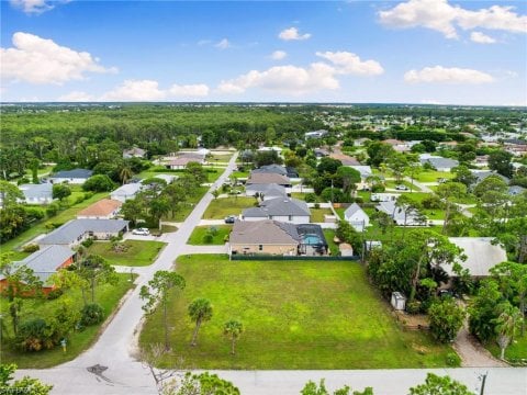
El Dorado Acres is an older grid of single-family homes on 75 by 130 foot lots off Coconut Road in Bonita Springs, Florida, between the Saltleaf golf course of Pelican Landing and US 41. It has a Bonita Springs mailing address but sits in unincorporated Lee County, not the City of Bonita Springs and not the Village of Estero, so Lee County's taxes, code and flood rules apply.
This guide to El Dorado Acres in Bonita Springs is built from the public record: the Lee County Property Appraiser's roll dated October 11, 2026, every Lee County recorded sale through September 25, 2026, the 1961 restrictions and sketch-map deed at the Lee County Clerk, three 2025 tax bills, FEMA's flood map at the centre of every parcel, the Lee County road file and the state's sewer and well inventory. Every figure carries its source and date, and where a record does not exist we say so.
Why McGreevy and Comisar Are the Best Realtor for El Dorado Acres
McGreevy and Comisar are the best realtor for El Dorado Acres in Bonita Springs because we price and advise from the record: every recorded El Dorado Acres sale for 12 months, the 1961 restrictions and sketch map read at the Clerk, three 2025 tax bills, FEMA's map at every parcel and the state's sewer and well inventory. Our team is Top 1% Real Estate Agents Nationally Since 2008.
Data updated: October 2026 (Lee County recorded sales through September 25, 2026; county roll dated October 11, 2026).
If you're searching for the best realtor for El Dorado Acres, whether you're ready to sell your El Dorado Acres home or buy your next one, McGreevy and Comisar is the team that delivers. We lead Domain Realty Group, the #1 real estate team in Southwest Florida since 2012, Top 1% Nationally since 2008, and as the leaders of Domain Realty Group our team has closed over $2.5 billion in real estate. Between Jesse and Marc personally, the number is over $900 million in Sales.
The El Dorado Acres market record, 12 months to September 25, 2026
We pulled every recorded El Dorado Acres sale in the Lee County record for the 12 months to September 25, 2026: 12 sales at a $657,500 median, from $425,000 to $800,000, and 66 sales at a $600,000 median over 60 months. In the last 12 months we tracked 12 El Dorado Acres sales in the Lee County record, and 11 of them were resales of existing homes; the twelfth was the first sale of a new home. The full breakdown by window, year, price band and street is in the market section below.
Days on market and sale-to-list ratio: Information not available at time of publishing (checked 2026-10-10).
Honors and recognition
- Top 1% Real Estate Agents Nationally Since 2008
- 5 Star Award for Customer Satisfaction for 21 Straight Years. Only 5 out of 21k+ Licensees (Gulfshore Life Magazine)
- #1 Team in Southwest Florida since 2012
- McGreevy and Comisar and their Domain Realty Group team have sold over $2.5 Billion in Real Estate
- McGreevy and Comisar alone have over $900 million in Sales
- Nationally Recognized Top Producing Realtors
- Platinum Sales Production Award Winners
- #5 real estate team in Florida (RealTrends 2026)
- #1 real estate team in Bonita Springs (RealTrends 2026)
For El Dorado Acres sellers
An El Dorado Acres home is priced by its age, its block and its lot: a 2020s home on the west edge and a 1980s home on an interior lane recorded very different prices over the last five years, and buyers ask about the flood zone, the sewer connection and the street surface before they make an offer. For El Dorado Acres sellers we add premium marketing: cinematic video, drone, professional photography, a qualified-buyer database, and discretion with off-market capability when a sale needs to stay private. Get a free home valuation, or Call Jesse direct at (239) 898-6072. Our El Dorado Acres seller guide walks through pricing by age, block and lot, the 1961 restrictions and the sewer and flood records a buyer asks for.
For El Dorado Acres buyers
Buyers in El Dorado Acres are reading three layers a listing does not show: the jurisdiction and tax bill of unincorporated Lee County, the recorded 1961 restrictions, and the lot itself, with its flood zone, its sewer or septic record and the street in front of it. Call Marc at (239) 287-5873 for a personalized buyer consultation, or read how we represent buyers in Southwest Florida. Our guide to buying a home in El Dorado Acres sets out the checks lot by lot.
McGreevy and Comisar is a top-reviewed El Dorado Acres realtor, and our clients review us on Google in their own words. We publish no aggregate score, and every review we quote is a five-star review.
★★★★★ "Marc knows the market, works for his buyer and is attentive to his goals." Verified Google review
Key Takeaways: What Should El Dorado Acres Buyers and Sellers Know?
El Dorado Acres is an older single-family neighborhood with a Bonita Springs address in unincorporated Lee County, and these eight points from the county roll, the recorded sales, the Clerk's records, the tax bills and the flood, road and utility layers carry the rest of this guide.
Data updated: October 2026 (Lee County recorded sales through September 25, 2026; county roll dated October 11, 2026; FEMA National Flood Hazard Layer read October 12, 2026).
- El Dorado Acres is an older single-family grid of 75 by 130 foot lots off Coconut Road with a Bonita Springs address, in unincorporated Lee County rather than the City of Bonita Springs or the Village of Estero.
- Lee County recorded 12 sales in the 12 months to September 25, 2026 at a $657,500 median, from $425,000 to $800,000, or $336.61 per square foot of county heated area.
- The newest homes, most of them on the west edge, have recorded the highest prices: homes built from 2020 to 2024 sold at a $684,950 median over 60 months against $450,000 for homes built before 2000.
- No plat was ever recorded; the developer sold lots by deed and recorded restrictions in 1961 covering Blocks 1 to 15, and whether those restrictions can still be enforced is a question for a title commitment.
- The owners' group is voluntary on its own articles and asks a voluntary $120 a year; the 2025 tax bills carry 13.2005 mills and one $366.39 solid waste line, with no CDD or road assessment.
- Lee County does not maintain the interior streets, and about 1,204 feet on two edge segments are gravel.
- Bonita Springs Utilities holds the water and sewer franchise; most homes are recorded on its sewer, while a handful carry septic permits and many have private well permits.
- FEMA's map shows Zone AE at the centre of 35 of 279 parcels, mostly on the west edge, and shaded or minimal Zone X on the rest; the whole neighborhood is in Lee County evacuation zone A.
Table of Contents
This El Dorado Acres guide is organized so a Bonita Springs seller or buyer can jump straight to the record that answers the question, from the county's recorded sales and the 1961 restrictions to the streets, sewer, flood map, schools, drive times and the buyer and seller FAQs.
The neighborhood: What Is El Dorado Acres in Bonita Springs, and Where Is It? · Is El Dorado Acres in Bonita Springs, Estero or Unincorporated Lee County? · What Is It Like Living in El Dorado Acres as a Homebuyer? · What Does the El Dorado Acres Market Look Like Right Now? · What Kinds of Homes and Lots Are in El Dorado Acres?
History, restrictions, rules and costs: How Did El Dorado Acres Begin, and Why Is It an Unrecorded Subdivision? · Does El Dorado Acres Have Deed Restrictions? · Does El Dorado Acres Have an HOA, and Who Sets the Rules? · What Does It Cost Each Year to Own a Home in El Dorado Acres? · What Can You Build or Keep on an El Dorado Acres Lot?
Streets, utilities, blocks and water: Who Maintains the Streets in El Dorado Acres? · Is El Dorado Acres on Public Water and Sewer, Septic or Wells? · How Do the Blocks and Streets of El Dorado Acres Differ? · Is El Dorado Acres a Boating or Golf Community?
Flood, storms and insurance: What Flood Zone Is El Dorado Acres In? · How Do Hurricanes Affect El Dorado Acres? · How Does Insurance Work for El Dorado Acres Homes?
Location: What Schools Serve El Dorado Acres? · How Far Is El Dorado Acres From Hospitals and Emergency Care? · How Long Is the Drive From El Dorado Acres to Everywhere? · What Is Near El Dorado Acres for Shopping, Beaches and Parks? · What Is Being Built Around El Dorado Acres?
Comparisons: How Does El Dorado Acres Compare With Nearby Neighborhoods? · El Dorado Acres vs Bonita Farms: Which Neighborhood Fits Your Priorities? · What Are the Pros and Cons of El Dorado Acres?
Selling and contact: Thinking of Selling Your El Dorado Acres Home? List With the #1 Team in Southwest Florida Since 2012 · Your Local Real Estate Experts
FAQs and sources: El Dorado Acres FAQ: Buyer Edition · El Dorado Acres FAQ: Seller Edition · Sources · Downloadable Documents
What Is El Dorado Acres in Bonita Springs, and Where Is It?
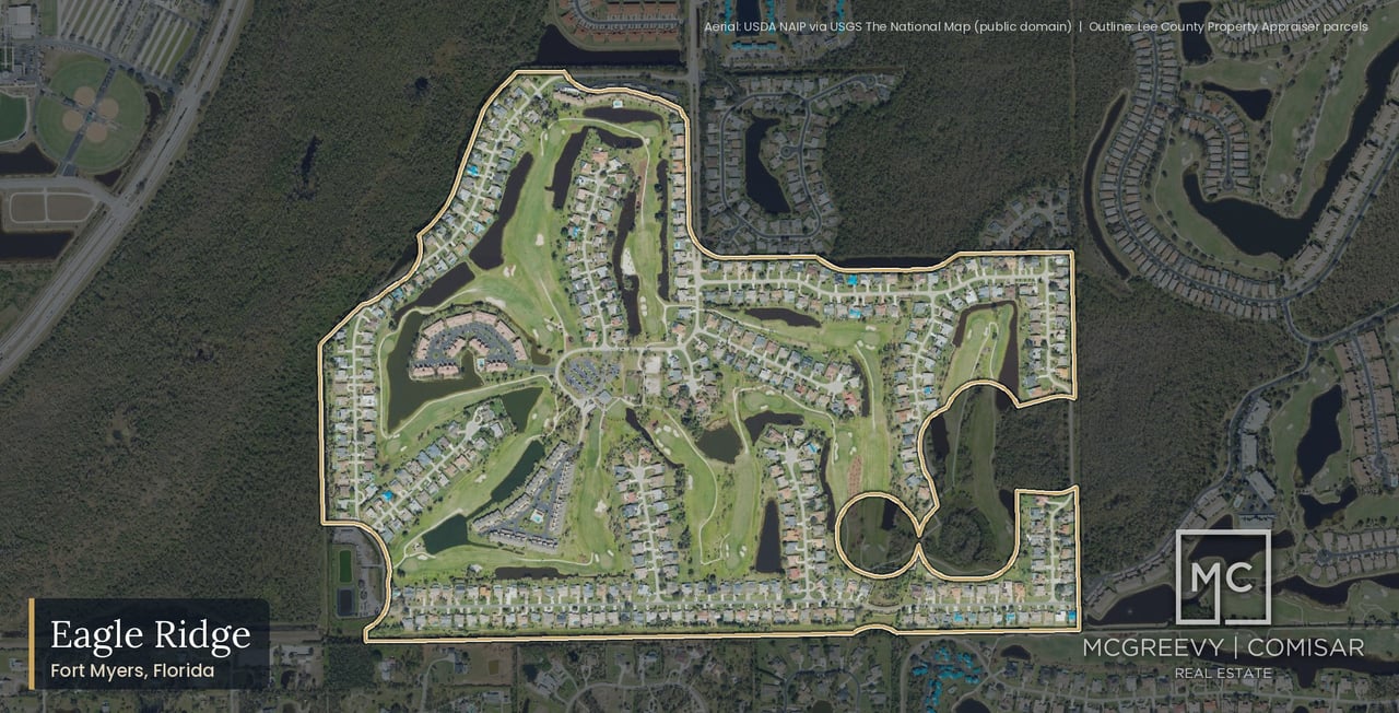
El Dorado Acres is an older single-family neighborhood of about 288 parcels on an unrecorded street grid on the north side of Coconut Road, about 1.1 road miles west of US 41, with a Bonita Springs address (ZIP 34134) in unincorporated Lee County. Its lots are 75 by 130 feet, and its homes were built from 1959 to 2025.
Data updated: October 2026 (county roll dated October 11, 2026; Lee County parcel, road and jurisdiction layers read October 12, 2026).
The neighborhood sits in Section 8, Township 47 South, Range 25 East. It was laid out by deed rather than by a recorded plat, which is why its legal descriptions read "UNREC" and why its blocks are numbered in the deeds rather than on a plat sheet. The rest of this guide follows that record: who governs it, what the 1961 restrictions say, what each lot carries on the flood, sewer and road layers, and what the county has recorded for sales.
Where exactly is El Dorado Acres?
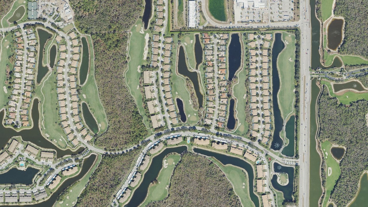
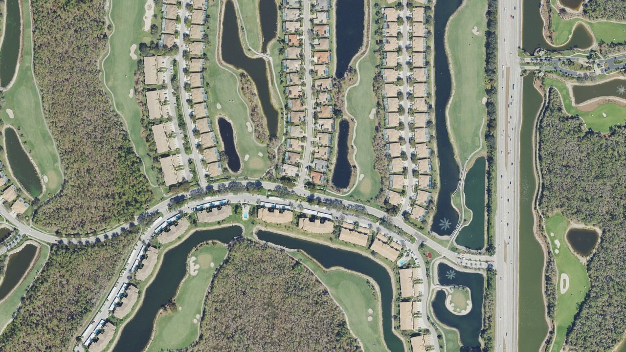
El Dorado Acres fills a rectangle north of Coconut Road. The golf course that Lee County's golf layer names Saltleaf Golf Preserve and other Saltleaf land lie along its west and north edges; Meadowbrook of Bonita Springs lies to the east; Coconut Landing, a 25-lot subdivision, sits at the southeast corner; and Coconut Road runs along the south. Beyond the golf course to the west is Pelican Landing, the master-planned community whose Saltleaf planned development and golf course wrap the west and north sides. The Village of Estero borders about 916 meters of the perimeter, on the Meadowbrook and Coconut Landing sides and along the Coconut Road right-of-way, and the nearest land inside the City of Bonita Springs is about a tenth of a mile (161 meters) southwest, at Coconut Road. The rest of the perimeter is unincorporated Lee County.
How big is El Dorado Acres?
Lee County's hosted parcel layer shows about 288 parcels in El Dorado Acres, and 284 of them are in the county roll file used for every sales figure on this page. In that roll file, 232 parcels are coded single-family homes, 51 are vacant residential lots and 1 is a small multifamily parcel; the layer adds 4 single-family homes, so it counts 236 homes in all (232 + 4 = 236, and 284 + 4 = 288). The parcels cover about 74 acres. The roll lists 12 street names: Catalina, Del Rio, Key Largo, San Antonio, Santiago, Sierra and Villa Capri Lanes, E El Dorado Avenue, W El Dorado Avenue, El Dorado Boulevard, Coconut Rum Court and Coconut Road, where four Block 17 parcels front. The legal descriptions number 16 blocks: 1 to 15 and 17. Blocks 1 to 6 run south to north on the east side of El Dorado Boulevard and Blocks 7 to 12 on the west side; Block 13 is the west-edge strip on W El Dorado Avenue, Block 14 the north strip on Key Largo Lane, Block 15 the east-edge strip on E El Dorado Avenue, and Block 17 the south block on Coconut Road and Coconut Rum Court.
How do you get in and out of El Dorado Acres?
El Dorado Acres reaches Coconut Road by El Dorado Boulevard, and every routed trip from inside the neighborhood leaves that way. The paved link at the southeast corner (Seagrove Landing Way and Coconut Landing Drive) is Coconut Landing's private road: its recorded plat dedicates that tract as a private road right-of-way to the Coconut Landing homeowners' association, with the public dedication limited to a utility easement with emergency-services access. A Village of Estero landscape plan dated January 2, 2020 draws a vehicle gate at the El Dorado Boulevard end, and the builder's marketing (read October 12, 2026) describes a secondary resident access gate on El Dorado. No recorded right for El Dorado Acres traffic over that road was found, and the public record does not show whether the gate is installed and closed today. Coconut Road beside the neighborhood is maintained by the Village of Estero, which took over local road maintenance on January 9, 2017; US 41 is a state road.
El Dorado Acres is not Eldorado Estates, Coconut Landing or Estero
Three names travel with El Dorado Acres in the records. "Eldorado Estates" appears in one county legal description for a Block 14 lot, and "El Dorado Estates" appears in Lee County's 2025 to 2026 Saltleaf case documents; both mean this same neighborhood, not a separate place. Coconut Landing is a separate recorded subdivision: its plat is titled "A REPLAT OF BLOCK 16, OF THE UNRECORDED PLAT OF EL DORADO ACRES" plus a 50-foot strip, 10.407 acres in the Village of Estero, accepted by the Estero Village Council on May 19, 2021, which is why no Block 16 appears in today's El Dorado Acres records. And two Block 10 parcels on Santiago Lane carry the roll situs city ESTERO; they are part of the same grid, billed in the same tax district with the same school zones, and the word there is a postal coding, not Village of Estero jurisdiction.
El Dorado Acres at a glance
Parcels | About 288 on the county layer (284 in the roll file) | Lee County parcel layer; county roll, October 11, 2026 |
Single-family homes | 236 on the layer (232 in the roll file) | Lee County parcel layer; county roll |
Vacant lots | 51 | County roll, October 11, 2026 |
Lot grid | 75 by 130 feet (9,750 square feet) | County roll |
Years built | 1959 to 2025 (median 1998) | County roll |
Plat | None recorded (deed-sold grid, Deed Book 310 page 183) | Lee County legal descriptions |
Developer | Bonita Springs Development Company, Inc. | Florida Division of Corporations |
Recorded restrictions | Official Records Book 87 page 641 (1961, Blocks 1 to 15) | Lee County Clerk |
Owners' group | Voluntary (2019) | Florida Division of Corporations; articles of incorporation |
Jurisdiction | Unincorporated Lee County | Lee County City_County layer |
ZIP | 34134 | County roll |
Tax district | 079 (13.2005 mills, 2025) | 2025 Lee County tax bills |
Fire | Estero Fire Rescue | Lee County tax district record |
Zoning | Lee County RS-1 | Lee County zoning |
Streets | Non-County Maintained | Lee County DOT road file |
Water and sewer franchise | Bonita Springs Utilities | Utility franchise layers |
FEMA panel and zones | 12071C0589G (2022); AE, shaded X and X by parcel | FEMA National Flood Hazard Layer, October 12, 2026 |
Evacuation zone | A | Lee County evacuation layer |
School zones | Elementary Zone Q, Middle Zone GG, High South Zone 3 | School District of Lee County locator, 2026-27 |
If you are choosing an agent for a move in or out of El Dorado Acres, our guide to the best real estate agents in Bonita Springs sets out how we compare teams on the public record.
Is El Dorado Acres in Bonita Springs, Estero or Unincorporated Lee County?
El Dorado Acres is unincorporated Lee County with a Bonita Springs mailing address. It pays Lee County's tax district 079, is served by Estero Fire Rescue and follows Lee County zoning and code, and it lies inside neither the City of Bonita Springs nor the Village of Estero. The neighborhood asked to be left out of Estero when the Village formed in 2014.
Data updated: October 2026 (Lee County City_County layer and tax district records read October 12, 2026; 2025 Lee County tax bills).
What the county record shows
Every El Dorado Acres parcel carries the Lee County Property Appraiser's MuniCode L, the code for unincorporated land. Lee County's City_County layer returns "Unincorporated Lee County" at every point tested, and the City limits layer returns no polygon at any of them. The parcels sit in tax district 079, which the county names "ESTERO FIRE", in fire district 029 (Estero Fire Rescue) and in garbage district 003. That is the same answer on every route: the jurisdiction is Lee County.
Why some records say Estero
Three "Estero" labels attach to El Dorado Acres, and none of them is the Village of Estero. The first is the fire district: Estero Fire Rescue serves the neighborhood, and its millage sits on the tax bill. The second is planning: the Lee Plan places the neighborhood in its "Estero" planning community, a county planning area rather than a town. The third is postal: two Block 10 parcels on Santiago Lane carry the roll situs city ESTERO, though they are billed in district 079 like their neighbors and share the same school zones. A buyer who sees "Estero" on a record for an El Dorado Acres home is reading one of those three labels, not a Village address.
How El Dorado Acres stayed out of the Village of Estero
The Village of Estero's charter, Chapter 2014-249, Laws of Florida, approved May 12, 2014, leaves out of the Village the same land a 1964 survey of El Dorado Acres describes: the east half of the northwest quarter and the west half of the west half of the northeast quarter of Section 8, less the south 40 feet for Coconut Road. The Naples Daily News reported on April 3, 2014 that lawmakers redrew the proposed village "so the proposed village does not envelop an unincorporated neighborhood near its southern border" after El Dorado Acres asked to be carved out, and that land around it was removed "so the community will have access to unincorporated Lee County and will not be an enclave." The Village incorporated on December 31, 2014 after a November 4, 2014 referendum. On January 4, 2015 the same paper called El Dorado Acres "the lone subdivision that turned Estero down", described it as part of "an unincorporated area between Bonita Springs and Estero", and reported that Lee County kept providing "the same county trash pickup, tax rates and land development and code enforcement rules", adding: "In El Dorado Acres there are still unpaved roads."
What being unincorporated changes for an owner
Building permits, code enforcement and zoning in El Dorado Acres are Lee County's, through its Department of Community Development, not the City's. The 2025 tax bills carry Lee County's general revenue millage of 3.7623 plus the Lee County Unincorporated MSTU of 0.8398 and the Estero Fire Rescue District's 2.2880, inside a district 079 total of 13.2005 mills. The City of Bonita Springs millage, the City stormwater fee and the City's BERT bond do not appear on El Dorado Acres bills. Lee County's own flood insurance rating applies: unincorporated Lee County is Class 5 in the NFIP Community Rating System, 25 percent off NFIP premiums inside the special flood hazard area and 10 percent outside it (FEMA Community Status Book, page dated October 10, 2026). Services run through Lee County as well: Lee County EMS (Medic 29, housed at Estero Fire Station 42 "Coconut Point" on Sweetwater Ranch Boulevard), the Lee County Sheriff's Office, the Lee County Library System, and Lee County Commission District 3.
Has anyone tried to annex El Dorado Acres?
No annexation of any El Dorado Acres parcel by the Village of Estero or the City of Bonita Springs is on record. The nearest change on the map is next door: the 10-acre Headwaters parcel south and east of the grid was annexed to Estero by Ordinance 2019-30 and became Coconut Landing. The public record we read shows no annexation policy that names El Dorado Acres.
What Is It Like Living in El Dorado Acres as a Homebuyer?
El Dorado Acres offers one-story homes of mixed ages on lots of about a quarter acre, with no gate and no shared amenities, a golf course or preserve behind some edge lots, Coconut Point shopping about 5 minutes away and two emergency departments within about 2 miles. For a Bonita Springs buyer, it is a street grid, not a club community.
Data updated: October 2026 (county roll dated October 11, 2026; Lee County building footprints and drive-time routing read October 12, 2026).
Older homes and new homes side by side
El Dorado Acres homes span more than six decades. The roll dates its single-family homes from 1959 to 2025, with a median year of 1998: 3 from the 1950s, 7 from the 1960s, 28 from the 1970s, 36 from the 1980s, 51 from the 1990s, 39 from the 2000s, 25 from the 2010s and 39 from the 2020s. Median heated area runs from 1,020 square feet for the 1950s homes and 1,161 for the 1980s homes to 1,723 for the 2000s homes and about 1,800 square feet for the 2010s and 2020s homes. Lee County's building footprints show 231 of 238 buildings as one story, mostly ranch styles. The 2020s homes went up on lots that had sold only as vacant land: 38 of the 39 homes built from 2020 to 2024 stand on lots whose only earlier recorded sales were vacant-land sales, and the record shows no teardown pattern. On many lanes a 1970s ranch and a 2023 four-bedroom home sit a lot apart.
No gate, no clubhouse, no dues you must pay
No gate, guardhouse or shared amenity parcel appears on any El Dorado Acres record. The owners' group, El Dorado Acres Homeowners and Members, Inc., was incorporated in 2019, and its Articles of Incorporation state: "Membership in the Association is voluntary." Its own FAQ answers "Is Eldorado Acres an official HOA?" with "No, the recently elected board all volunteer their time and were formed to help on community decisions." It requests a voluntary $120 a year (its website, read October 12, 2026), and it maintains an entrance sign and landscaping at El Dorado Boulevard. Florida law defines a homeowners' association as one in which "membership is a mandatory condition of parcel ownership" and which "is authorized to impose assessments that, if unpaid, may become a lien on the parcel" (F.S. 720.301); on its own charter, the El Dorado Acres group meets neither test. The recorded 1961 restrictions are a separate matter, covered in the deed restrictions section below.
Golf course and preserve edges
The west-edge lots (Block 13) and most north-edge lots (Block 14) back onto the golf course that Lee County's golf layer names Saltleaf Golf Preserve, which its operator describes as "our all new, daily fee destination course", with an 18-hole course and a 9-hole par 3 designed by Raymond Floyd. No El Dorado Acres lot has a recorded golf right; the course is about 4 minutes away by road from the entrance. The east-edge lots (Block 15) back onto Meadowbrook of Bonita Springs. Five north- and east-edge lots in Blocks 14 and 15 touch the mapped edge of a 130-acre wetland-type area that lies mostly on neighboring Saltleaf and Meadowbrook preserve land, and two of them carry Lee Plan "Wetlands" future land use at their interior point.
Coconut Point and US 41 next door
Coconut Point, Simon's center at 23106 Fashion Drive in Estero with "over 110 stores" including Super Target, is about 1.8 miles and 5 minutes from the El Dorado Boulevard entrance. Super Target there is about 2.0 miles and 5 minutes; Publix at the Shoppes at Pelican Landing on South Tamiami Trail is about 2.3 miles and 6 minutes; Publix Corkscrew Village is about 3.7 miles and 7 minutes; the Walmart Supercenter in Estero and The Fresh Market on Bay Landing Drive are each about 4.9 miles and 9 minutes. Estero at Estero Parkway and US 41 is about 8 minutes, and downtown Bonita Springs at Old 41 and Terry Street about 12 (estimated free-flow drive times from the El Dorado Boulevard entrance at Coconut Road, OSRM routing on OpenStreetMap roads, no traffic, October 12, 2026).
What El Dorado Acres does not have
El Dorado Acres has no canal or bay frontage: none of the 288 parcels touches a county canal polygon, and the roll's waterfront, dock and seawall fields are blank on every parcel. It has no shared amenity of its own. It lies outside LeeTran's ULTRA on-demand zone, whose Bonita Springs edge is about 1.1 miles southeast, and the nearest fixed-route stops are on US 41 at Coconut Road (Route 600), about 1.25 miles on foot. A pedestrian router finds no grocery or shop within a mile on foot; the Hyatt Regency frontage is about half a mile away and Saltleaf Marina about 0.9 mile.
What we walk an El Dorado Acres buyer through first
Before an offer, we take an El Dorado Acres buyer through six records in order. First, the jurisdiction and the tax bill: district 079 in unincorporated Lee County, and what the seller's bill does and does not include. Second, the 1961 restrictions as they appear, or do not, in the title commitment. Third, the lot's flood zone on FEMA's map and any letter of map revision on file for that parcel. Fourth, whether the home is on Bonita Springs Utilities sewer or on a septic system, and whether a private well is on the permit record. Fifth, the street surface in front of the lot. Sixth, the roof's age and opening protection, which insurers ask about. Call Marc at (239) 287-5873 to start on a specific home.
★★★★★ "Jesse and Marc are extremely knowledgeable about Southwest Florida real estate! If you are looking to buy or sell property, look no further than Domain Realty and their amazing team!" Verified Google review
What Does the El Dorado Acres Market Look Like Right Now?
El Dorado Acres recorded 12 sales in the 12 months to September 25, 2026 at a $657,500 median, from $425,000 to $800,000, or $336.61 per square foot of county heated area. Over 60 months the Lee County record shows 66 sales at a $600,000 median, and one of the latest 12 sales was a new home sold by its builder.
Data updated: October 2026 (Lee County recorded sales through September 25, 2026; county roll dated October 11, 2026).
Every figure in this section rests on the 284 parcels in the county roll file and on Lee County recorded sales, the 12 months to September 25, 2026 unless another window is named. Price per square foot is per square foot of county heated area.
The county record, 12 months to September 25, 2026
Recorded sales | 12 |
Median sale price | $657,500 (middle pair $650,000 and $665,000) |
Price range | $425,000 to $800,000 |
Builder-direct sales (estimate) | 1 ($725,000) |
Resales | 11 (median $650,000) |
Single-family homes only | 11 sales, median $650,000, all resales |
Median price per square foot of county heated area | $336.61 (11 sales) |
Days on market and sale-to-list ratio | Information not available at time of publishing (checked 2026-10-10). |
The all-sales median sits $7,500 above the single-family median ($657,500 minus $650,000 = $7,500). That gap is the one new-home sale, recorded on a parcel the county still codes as vacant because the home was not yet on the roll. Builder-direct is our inference from the record and is an estimate.
Every recorded sale in the last 12 months
September 30, 2025 | $665,000 | Resale | El Dorado Blvd | 1984 | 2,704 | 4 |
October 17, 2025 | $460,000 | Resale | Catalina Ln | 2000 | 1,786 | 3 |
November 18, 2025 | $425,000 | Resale | Sierra Ln | 1997 | 1,401 | 2 |
January 29, 2026 | $675,000 | Resale | W El Dorado Ave | 1976 | 2,038 | 2 |
March 14, 2026 | $525,000 | Resale | Key Largo Ln | 1995 | 2,016 | 3 |
March 16, 2026 | $765,000 | Resale | Key Largo Ln | 2022 | 1,799 | 4 |
March 31, 2026 | $650,000 | Resale | San Antonio Ln | 2007 | 1,931 | 3 |
June 30, 2026 | $725,000 | Builder-direct new home | Del Rio Ln | New home, not yet on the roll | Not yet on the roll | Not yet on the roll |
July 10, 2026 | $785,000 | Resale | San Antonio Ln | 1959 | 2,244 | 6 |
July 17, 2026 | $596,000 | Resale | Catalina Ln | 2019 | 1,254 | 3 |
August 31, 2026 | $615,000 | Resale | W El Dorado Ave | 2023 | 1,794 | 4 |
September 10, 2026 | $800,000 | Resale | W El Dorado Ave | 2023 | 1,794 | 4 |
The highest sale was $800,000 on September 10, 2026, for a 2023 home of 1,794 square feet on W El Dorado Avenue; the lowest was $425,000 on November 18, 2025, for a 1997 home of 1,401 square feet on Sierra Lane. By street, W El Dorado Avenue recorded 3 sales ($615,000 to $800,000); Catalina Lane 2 ($460,000 and $596,000); Key Largo Lane 2 ($525,000 and $765,000); San Antonio Lane 2 ($650,000 and $785,000); and El Dorado Boulevard, Sierra Lane and Del Rio Lane 1 each. No street had enough sales for a median.
The longer view: 24, 36 and 60 months
12 months | 12 | $657,500 | $425,000 to $800,000 | 11 | $650,000 |
24 months | 22 | $605,500 | $259,900 to $800,000 | 21 | $596,000 |
36 months | 31 | $615,000 | $259,900 to $800,000 | 30 | $613,500 |
60 months | 66 | $600,000 | $197,000 to $800,000 | 65 | $600,000 |
All recorded history (from 1981) | 311 | $229,900 | Not shown | Not shown | Not shown |
The ladder is steady from 24 to 60 months, between $596,000 and $615,000 for single-family homes, and the 12-month figure sits above it. The single-family 12-month median is $650,000 on 11 sales, all resales.
El Dorado Acres by calendar year
2019 | 18 | Median $250,000 |
2020 | 9 | $175,000 to $443,500 (under 10 sales, no median) |
2021 | 15 | Median $339,900 |
2022 | 16 | Median $590,000 |
2023 | 19 | Median $612,000 (11 builder-direct) |
2024 | 8 | $430,000 to $749,900 (4 builder-direct; under 10 sales, no median) |
2025 | 12 | Median $485,000 |
2026 to September 25 | 9 | $525,000 to $800,000 (under 10 sales, no median) |
From 2019 to 2025 the calendar median moved from $250,000 to $485,000, up $235,000, or 94 percent ($485,000 minus $250,000 = $235,000; $235,000 divided by $250,000 = 94 percent), on 18 and 12 sales. The mix matters more than the year: the 2023 median of $612,000 includes 11 first sales of new homes, so a change from one year to the next reflects which homes sold as much as any change in value. These are recorded results, not a forecast.
Price bands
In the 12 months to September 25, 2026, 2 El Dorado Acres sales recorded between $400,000 and $500,000, 7 between $500,000 and $750,000 and 3 between $750,000 and $1,000,000. None recorded under $400,000 or over $1,000,000.
Recorded lot sales
Recorded lot sales (vacant land) are measured separately from home sales. In the 12 months to September 25, 2026, Lee County recorded 6 lot sales in El Dorado Acres, from $152,000 to $215,000, too few for a median. Over 36 months there were 12 lot sales at a $156,000 median ($90,000 to $215,000), and over 60 months 28 at a $148,750 median. Calendar 2021 recorded 22 lot sales at a $100,000 median; 2025 recorded 5 ($130,000 to $195,000) and 2026 to date 4 ($152,000 to $215,000). Fifty-one vacant residential parcels remain in the 284-parcel roll file. Set side by side over 36 months, the median home sale of $615,000 and the median lot sale of $156,000 show how much of an El Dorado Acres price is the house; that comparison describes the record and is not a valuation of any lot.
Why the newest homes record the highest prices
The newest homes, most of them on the west edge, have recorded the highest prices. Over the 60 months to September 25, 2026, single-family homes built from 2020 to 2024 recorded 24 sales at a $684,950 median, or $367.43 per square foot of county heated area; homes built from 2000 to 2019 recorded 13 sales at $596,000; and homes built before 2000 recorded 26 sales at $450,000, or $305.07 per square foot. The 39 homes built from 2020 to 2024 have a median of 1,800 square feet, 24 have four bedrooms and 15 three, and 21 have a pool; 22 of them measure between 1,794 and 1,808 square feet, a repeated size whose builder and plan names the record does not give. Of the 12 sales in the latest year, 6 had a pool, 2 were combined lots of 0.45 acre or more ($665,000 and $785,000), 4 were on parcels whose centre FEMA maps in Zone AE and 8 in shaded Zone X. Those are correlations in a small set; age, size and pools explain most of the spread, and the record does not measure a separate price effect for any edge, flood zone or feature.
What the public record cannot tell you yet
The county record shows what sold, when and for how much; it does not show how long a home was listed or what it was listed for. Days on market, sale-to-list ratio, active listings and months of supply: Information not available at time of publishing (checked 2026-10-10). The county record also does not show interior condition, renovations or the roof's age, which is why we read each home on site before we price it.
Buying or Selling in El Dorado Acres? Start With a Conversation
Whether you own on W El Dorado Avenue or are watching for a lot on Key Largo Lane, the record above is where our pricing starts and the home itself is where it finishes. Call Jesse direct at (239) 898-6072 to talk through a sale, or Call Marc at (239) 287-5873 to plan a purchase.
What Kinds of Homes and Lots Are in El Dorado Acres?
El Dorado Acres in Bonita Springs is mostly one-story ranch homes of about 1,600 square feet of county heated area on 75 by 130 foot lots, built from 1959 to 2025. Three bedrooms is the most common layout, and about a third of the homes have a pool. The county roll file still lists 51 vacant lots.
Data updated: October 2026 (Lee County recorded sales through September 25, 2026; county roll dated October 11, 2026; Lee County building footprints read October 12, 2026).
We read the Lee County Property Appraiser roll parcel by parcel to describe what is actually on the ground. Inventory counts in this section use the 279-parcel roll group whose legal descriptions begin with the neighborhood's name: 229 single-family homes, 49 vacant lots and 1 multifamily parcel. The full county roll file, which also picks up 5 parcels with misspelled or reworded legal descriptions, holds 284 parcels: 232 single-family homes, 51 vacant residential lots and 1 multifamily parcel. Lee County's hosted parcel layer shows about 288 parcels in all.
The El Dorado Acres grid was laid out in lots 75 feet wide and 130 feet deep, which is 9,750 square feet each. Depth is 130 feet on every parcel that carries a depth on the roll. Frontage is 75 feet on 127 parcels, 78 feet on 38, 80 feet on 26 and 90 feet on 17, and combined lots run from 110 to 165 feet wide.
For the single-family homes in the 279-parcel roll group, lot size runs from 0.224 acre to 0.716 acre, with a median of 0.232 acre. 166 of those homes sit on less than a quarter acre, 60 on a quarter to under half an acre, and 3 on half an acre to under one acre. The largest parcel in the 284-parcel set is a 1.10-acre parcel in Block 17 on Coconut Road. These are standard suburban lots on a regular grid, which is why the same few lot widths repeat street after street.
Home sizes, bedrooms and pools
Most El Dorado Acres homes are modest in size by current Southwest Florida standards. County heated area on the single-family homes runs from 728 to 3,975 square feet. The quartiles are 1,267, 1,614 (the median) and 1,808 square feet, so half of the homes fall between about 1,270 and 1,810 square feet. Three bedrooms is the most common layout by a wide margin, and 72 of the 229 single-family homes in the roll group carry a pool on the county record; 192 have a garage.
Heated area under 1,000 sq ft | 14 |
Heated area 1,000 to 1,499 sq ft | 83 |
Heated area 1,500 to 1,999 sq ft | 95 |
Heated area 2,000 to 2,499 sq ft | 31 |
Heated area 2,500 sq ft and up | 5 |
1 bedroom | 1 |
2 bedrooms | 44 |
3 bedrooms | 140 |
4 bedrooms | 42 |
6 bedrooms | 1 |
Pool on the county record | 72 of 229 |
Garage on the county record | 192 of 229 |
Source: Lee County Property Appraiser roll dated October 11, 2026, our analysis. Square feet are county heated area. We print bedrooms only, because the roll drops some half baths.
Homes by decade
The single-family homes in El Dorado Acres were built from 1959 to 2025, with a median year built of 1998. Building came in steady waves rather than one burst. The median size grew from about 1,000 square feet in the homes of the 1950s and 1960s to about 1,800 square feet in the homes of the 2010s and 2020s.
1950s | 3 | 1,020 |
1960s | 7 | 1,034 |
1970s | 28 | 1,342 |
1980s | 36 | 1,161 |
1990s | 51 | 1,450 |
2000s | 39 | 1,723 |
2010s | 25 | 1,808 |
2020s | 39 | 1,800 |
Source: Lee County Property Appraiser roll dated October 11, 2026, our analysis.
The oldest homes cluster in the southeast corner: Blocks 1 and 2 record median years built of 1983 and 1979. The newest are on the west edge, where Block 13's median year built is 2022, and in Block 12, whose median is 2019. A buyer who wants a 1970s or 1980s ranch to update and a buyer who wants a home finished in the last five years are usually looking at different ends of the same neighborhood.
One-story ranch houses
El Dorado Acres is almost entirely a one-story neighborhood. Lee County's building footprint layer, read October 12, 2026, shows 231 of the 238 mapped buildings on the 288-parcel layer at one story. The style codes on the same layer are Ranch on 177, Florida Ranch on 36, Split Entry or Raised Ranch on 9, and other styles on 16. Floor height matters most on the lots the flood map places in Zone AE, covered in the flood section of this page.
The 2020s infill on vacant lots
The biggest change to El Dorado Acres in decades has been new homes on lots that sat empty. The county roll shows 39 single-family homes built from 2020 to 2024: 2 in 2020, 5 in 2021, 11 in 2022, 16 in 2023 and 5 in 2024. 38 of those 39 were built on lots whose only earlier recorded sales were vacant-land sales, so the record shows infill on empty lots, not a pattern of teardowns.
The new homes are larger than the older stock. Their median is 1,800 square feet of county heated area; 24 have four bedrooms and 15 have three; and 21 have a pool. 22 of the 39 measure between 1,794 and 1,808 square feet, a repeated size that points to a small number of floor plans, although the builders and plan names were not found on the public record. By street, West El Dorado Avenue has 10 of them, Catalina Lane 7, Key Largo Lane 6, San Antonio Lane 4, Del Rio Lane 3, Sierra Lane 3, and Santiago Lane, Villa Capri Lane and East El Dorado Avenue 2 each.
Building has not stopped. Lee County permit records list new-construction entries in 2025 (4) and 2026 (5), and one parcel carries a 2025 new-building year on the roll. New homes like these sit among the communities on our Bonita Springs new construction guide.
Vacant lots and what they sell for
The full county roll file still lists 51 vacant residential parcels in El Dorado Acres. In the 279-parcel roll group, 49 are vacant: 35 under a quarter acre and 14 from a quarter to under half an acre. Most are single 75 by 130 foot grid lots; the larger ones are two lots held together.
We pulled every recorded lot sale (vacant land) for the 284 parcels in the county roll file:
- 12 months to September 25, 2026: 6 recorded lot sales, from $152,000 to $215,000. With fewer than 10 sales, we print the range and no median.
- 36 months: 12 recorded lot sales, median $156,000, range $90,000 to $215,000.
- 60 months: 28 recorded lot sales, median $148,750.
- Calendar 2021: 22 recorded lot sales, median $100,000, the year the infill wave bought most of its land.
- Calendar 2025: 5 recorded lot sales, from $130,000 to $195,000.
- 2026 through September 25: 4 recorded lot sales, from $152,000 to $215,000.
Those are Lee County recorded lot sales (vacant land), not asking prices. A lot's value turns on its flood zone, its street (paved or gravel), whether sewer and water lines run past it and what backs onto it, so two lots on the same block can trade far apart.
Combined lots and the one two-home parcel
Not every El Dorado Acres parcel is a single lot. The roll shows 38 parcels that are two or three lots held as one, and 16 that carry only part of a lot. Combined lots account for the wider frontages of 110 to 165 feet and for most of the parcels over a quarter acre.
One parcel, in Block 15 on East El Dorado Avenue, is coded multifamily: two lots totalling 0.463 acre with two detached dwellings, built in 1998 and 2004. It carries the same RS-1 single-family zoning as every other parcel in the neighborhood, so it does not signal that a second home can be added to an ordinary lot today (see the lot-split question later on this page).
How Did El Dorado Acres Begin, and Why Is It an Unrecorded Subdivision?
El Dorado Acres in Bonita Springs began with Bonita Springs Development Company, Inc., formed in 1957, which laid out the street grid and sold lots by deed instead of recording a plat. It recorded a sketch-map deed and the neighborhood's restrictions in 1961 and a Block 17 survey in 1964, and the company was dissolved in 1967.
Most El Dorado Acres histories online skip the records. This one starts from them: the Florida Division of Corporations file on the developer, the Lee County Clerk's Official Records images from 1961 and 1965, the Village of Estero's charter, the 2021 Coconut Landing plat and the county roll.
The developer, 1957 to 1967
The company behind El Dorado Acres was Bonita Springs Development Company, Inc., a Florida corporation filed on May 15, 1957 (document 202525). Its last annual report was filed in 1963, and the state dissolved it by proclamation on June 30, 1967 (Florida Division of Corporations record, read October 12, 2026).
A 1957 survey mark on the Block 17 sheet and the company's 1957 filing place the start of the grid at about that time, and the oldest home on today's roll dates from 1959. The fair summary is that El Dorado Acres was laid out by deed from the late 1950s. A separate company called Eldorado Acres Inc., filed in 1969 and dissolved in 1973, has no recorded role in the neighborhood and is not its association.
What "unrecorded subdivision" means
No plat of El Dorado Acres was ever recorded in the Lee County Plat Books. The county's legal descriptions say so in their own shorthand, "UNREC," and point instead to deeds: most lots cite Deed Book 310, page 183; Block 17 cites Official Records Book 291, pages 890 and 898; and some lots in Blocks 6 and 11 cite Official Records Book 82, page 472. Deed Book 310, page 183 is not on the Clerk's public image route, so its date and contents are not on the record we could read.
In practice, "unrecorded subdivision" means each lot exists because a deed described it, not because a plat created it. The developer sold lot by lot, and the 2026 deeds we read still describe each lot by block and lot with a reference back to those books and the 1961 sketch map. Lee County's code recognizes this route: a lot is created when its deed is lawfully recorded (Land Development Code section 34-3272), and a single-family home may be built on a nonconforming lot of record (section 34-3273). For lots described before December 21, 1984 that front a usable road, the Lee Plan's Minimum Use Determination allows one home (Lee Plan, as amended through December 2025). That is the path a new home on an El Dorado Acres lot still follows today.
The 1961 sketch map
The closest thing to a plat on the public record is a sketch map attached to a 1961 warranty deed. The deed is dated August 30 and was filed August 31, 1961, at Official Records Book 82, pages 472 to 474 (Lee County Clerk image, OR Book 82, page 472). Its last page is the developer's map, titled with the company's name and "El Dorado Acres," showing Blocks 5, 6, 11 and 12, East El Dorado Avenue, Coconut Road, US Highway 41 and the Gulf of Mexico.
The page stamp is hard to read, so we dated the deed from the book series itself: page 1 of Official Records Book 82 is stamped August 28, 1961, and Book 87 page 641 is stamped September 22, 1961, so a deed in Book 82 was filed in 1961.
The sketch map also labels a "LAKE," a "PARK AREA" and "COMMERCIAL PROPERTY" near the blocks. None of them is a parcel of the neighborhood today, and nothing on the record we read gives owners any right to them.
Block 17 and the 1964 survey
Block 17, the lots on Coconut Road and Coconut Rum Court, has its own paper trail. The developer recorded a November 1964 survey of Block 17 by Johnson-Hall and Associates, attached to a March 18, 1965 deed of a Block 17 lot at Official Records Book 291, pages 897 to 899 (Lee County Clerk image, OR Book 291, page 897). The survey describes "UNRECORDED ELDORADO ACRES" in the east half of the northwest quarter and the west half of the west half of the northeast quarter of Section 8.
The 1961 restrictions said Blocks 16 and 17 were "to be zoned for commercial property." That never happened for Block 17: it is RS-1 residential today, like every other block in the neighborhood.
Where Block 16 went
Anyone counting blocks in today's El Dorado Acres records will find 1 to 15 and 17, with no 16. Block 16 became Coconut Landing, the 25-lot subdivision at the southeast corner. Its plat is recorded as "A REPLAT OF BLOCK 16, OF THE UNRECORDED PLAT OF EL DORADO ACRES" plus a 50-foot strip, 10.407 acres, in the Village of Estero, accepted by the Estero Village Council on May 19, 2021 (Lee County Clerk, Coconut Landing plat, Instrument 2021000174195). The 10-acre Headwaters parcel that became Coconut Landing was annexed into the Village of Estero by Ordinance 2019-30. No El Dorado Acres parcel has been annexed by the Village of Estero or the City of Bonita Springs.
A timeline you can check
1957 | Bonita Springs Development Company, Inc. filed (May 15) | Florida Division of Corporations, document 202525 |
1959 | Oldest home on today's county roll | Lee County Property Appraiser roll |
1961 | Warranty deed with the developer's sketch map filed (August 31) | OR Book 82, pages 472 to 474 |
1961 | "Restrictions and Stipulations of El Dorado Acres" filed (September 22) | OR Book 87, page 641 |
1964 | Block 17 survey by Johnson-Hall and Associates (November) | Attached to OR Book 291, pages 897 to 899 |
1965 | Deed of a Block 17 lot recorded with the survey (March 18) | OR Book 291, pages 897 to 899 |
1967 | Developer dissolved by proclamation (June 30) | Florida Division of Corporations |
2000 | Bonita Springs Utilities water and gravity sewer lines built under development order LDO2000-00320 | Lee County development order file |
2014 | Village of Estero charter leaves El Dorado Acres out (approved May 12); the Village incorporates December 31 | Chapter 2014-249, Laws of Florida |
2019 | El Dorado Acres Homeowners and Members, Inc. incorporated (September 20) | Florida Division of Corporations, N19000009999 |
2020 to 2024 | 39 new single-family homes built on the grid | Lee County Property Appraiser roll |
2021 | Coconut Landing plat, a replat of Block 16, accepted by the Village of Estero (May 19) | Instrument 2021000174195 |
2022 | Current FEMA flood maps take effect, panel 12071C0589G (November 17) | FEMA Flood Insurance Rate Map |
2025 | Saltleaf (Pelican Landing MPD) zoning approved next door, Resolution Z-25-008 (August 20) | Lee County case DCI2023-00052 |
The water and sewer lines in the 2000 order run about 16,158 feet of 8-inch gravity sewer, 1,635 feet of force main and 17,615 feet of water main, and a 2016 order (LDO2016-00570) linked two Key Largo Lane water mains to East El Dorado Avenue. Which homes are connected is a lot-by-lot question, covered in the water and sewer section of this page.
Does El Dorado Acres Have Deed Restrictions?
Yes. A 1961 document, "Restrictions and Stipulations of El Dorado Acres," is recorded in Official Records Book 87, page 641, and covers Blocks 1 to 15. The developer that could enforce it was dissolved in 1967. Whether the 1961 restrictions can still be enforced against a given lot is a question for the buyer's title commitment and attorney.
The document is two pages, acknowledged and filed for record on September 22, 1961 by Bonita Springs Development Co., Inc. (Lee County Clerk image, OR Book 87, page 641, read October 12, 2026). The Clerk's own stamp sets the September 22 date. Many buyers hear that El Dorado Acres has "no restrictions" because it has no mandatory association; the recorded document says something different, and the honest answer sits between the two.
What the 1961 restrictions say
In plain words, the 1961 restrictions set 14 rules:
- A residence must be at least 1,000 square feet, counting the carport, utility room and porches.
- Construction must follow "the South Florida building code" and be "of conventional designed single residence."
- No trailer or other temporary living quarters.
- No business use, and no storage of material or equipment beyond what building the home needs.
- Setbacks of 25 feet in front, 7.5 feet on the sides and 10 feet in the rear, and 20 feet from a side street on a corner lot.
- Building plans approved by "the seller or his assigns."
- A septic tank and drain field on each improved lot, with wells set a proper distance away.
- Signs limited to a 1-square-foot name or professional sign, or a 5-square-foot sale or rent sign.
- A six-foot utility and drainage easement "as indicated on the map of EL DORADO ACRES."
- No dumping.
- Household pets only; no livestock or poultry.
- The seller's right to inspect and require compliance.
- Continuous foundations.
- No lot smaller than 9,750 square feet, exactly the size of one 75 by 130 foot grid lot.
The septic rule is history, not a bar on sewer: Bonita Springs Utilities later ran sewer lines through the neighborhood, and nothing in the 1961 text stops a home from connecting.
Which blocks they cover
The restrictions name their own reach: "Blocks 1,2,3,4,5,6,7,8,9,10,11,12,13,14, and 15." They also say they "do not cover Blocks 16 and 17, which are to be zoned for commercial property." Block 16 later became Coconut Landing, and Block 17 on Coconut Road and Coconut Rum Court is residential today, so the Block 17 lots sit outside the 1961 document on its own terms.
Are the 1961 restrictions still enforceable?
That is not settled on the public record, and this page does not give legal advice. Three facts frame the question. First, the party the document names to enforce it is "the seller," a company dissolved in 1967, and we found no recorded assignment of its rights and no notice preserving the restrictions. Second, Florida's Marketable Record Title Act extinguishes many old restrictions once a 30-year chain of title runs, unless the chain cites the restriction by its book and page or a preservation notice is filed (F.S. 712.02 and F.S. 712.03, read October 12, 2026). Third, three 2026 warranty deeds of El Dorado Acres lots that we read cite only generic "restrictions ... common to the subdivision," not Official Records Book 87, page 641 by name.
Whether the 1961 restrictions can still be enforced against a given lot is a question for the buyer's title commitment and attorney. The answer can differ from one lot to the next, because each lot has its own chain of deeds.
The restrictions against Lee County zoning
Lee County's RS-1 zoning applies to every lot regardless of the 1961 document. Where the two differ, the county rule applies in all cases; whether the 1961 rule also binds is the title question above.
Minimum lot | 9,750 sq ft | 7,500 sq ft (75 ft wide, 100 ft deep) |
Front setback | 25 ft | 25 ft on a local street (20 ft on a private street) |
Side setback | 7.5 ft | 7.5 ft |
Rear setback | 10 ft | 20 ft |
Corner side street | 20 ft | Per LDC section 34-2192 |
Minimum house size | 1,000 sq ft including carport and porches | None |
Trailers as living quarters | None allowed | Per county code |
Livestock | None (household pets only) | No private stables in RS-1 |
Business use | None | Home occupation within limits |
Sources: OR Book 87, page 641 (1961); Lee County Land Development Code Table 34-695 and sections 34-1292 and 34-1771, codified through Ordinance 26-07 of June 16, 2026.
The practical upshot: on rear setbacks the county is stricter than 1961, and on house size and lot size the 1961 document is stricter than the county.
What a seller and a buyer should ask the title company
Because the record leaves the question open, the title commitment is where it gets answered for a specific lot. Three questions settle most of it:
- Does the commitment list Official Records Book 87, page 641 as an exception to coverage, or only general "restrictions of record"?
- Has any notice preserving the 1961 restrictions been recorded under the Marketable Record Title Act?
- What do the deeds in this lot's 30-year chain cite: the 1961 document by book and page, or only generic restrictions common to the subdivision?
A seller who orders an owner's title search early can hand a buyer those answers with the listing, which takes one of the most common El Dorado Acres questions off the table before an offer.
Does El Dorado Acres Have an HOA, and Who Sets the Rules?
No mandatory homeowners' association for El Dorado Acres appears on the public record. El Dorado Acres Homeowners and Members, Inc., a 2019 Chapter 617 corporation, says in its articles that membership is voluntary; it requests a voluntary $120 a year (its website, read October 12, 2026). Lee County sets and enforces the land rules.
The distinction matters at closing. A mandatory association brings assessments, liens, an estoppel certificate and a disclosure summary into the sale. On the public record for El Dorado Acres, none of those apply.
The voluntary owners' group
El Dorado Acres Homeowners and Members, Inc. is a Florida not-for-profit corporation, filed on September 20, 2019 and active, with annual reports filed every year from 2020 to 2026, the latest on April 21, 2026 (Florida Division of Corporations record, N19000009999, read October 12, 2026). Its website and meeting notes use the name El Dorado Property Owners Association.
Its Articles of Incorporation organize it under Chapter 617 "to address issues connected with the community known as El Dorado Acres" (articles filing image). The group's own FAQ answers the question directly: "Is Eldorado Acres an official HOA? No, the recently elected board all volunteer their time and were formed to help on community decisions." An earlier volunteer homeowners' group already existed by 2015, according to the Naples Daily News on January 4, 2015.
Is membership or the $120 required?
No, on the record we read. The articles state: "Membership in the Association is voluntary." They give the group no power to levy assessments or liens and cite no declaration of covenants. Florida law defines a homeowners' association as one in which "membership is a mandatory condition of parcel ownership" and which "is authorized to impose assessments that, if unpaid, may become a lien on the parcel" (F.S. 720.301). On its own charter, the El Dorado Acres group meets neither test.
The dues follow the same pattern. The group's FAQ, read October 12, 2026, says: "Currently the requested amount is $120 but may change as expenses change." and "Is this fee mandatory? No, it is voluntary." Its November 2020 newsletter asked $120 for 2021 plus a separate voluntary $200 road-repair donation. The $120 is not a charge on the tax bill and not a charge on the deed.
What the voluntary dues pay for
The group's most detailed public numbers are from November 2020. That newsletter reported average receipts of about $10,000 a year from "approximately 30% of homeowners/land owners," and listed its running costs (entrance lighting and water, insurance, a post office box, the website and entrance maintenance) at about $3,176 a year, with the rest going toward road repairs. Those figures are dated 2020; the current budget and payer share are not published. The group also maintains the entrance sign and landscaping at El Dorado Boulevard. There is no gate, guardhouse or shared amenity parcel on any record.
No estoppel certificate on an El Dorado Acres sale
An estoppel certificate is the statement a mandatory association issues at closing showing what an owner owes. No association estoppel certificate, Chapter 720 disclosure summary or association lien is shown to apply to an El Dorado Acres sale on the public record, because no mandatory association is shown. A buyer's title company still searches for any recorded lien against the lot, as it would anywhere.
Who enforces what without a mandatory HOA
Building permits, code enforcement and zoning in El Dorado Acres are Lee County's, through its Department of Community Development, not the City of Bonita Springs'. When the Village of Estero incorporated, the Naples Daily News reported on January 4, 2015 that Lee County kept providing "the same county trash pickup, tax rates and land development and code enforcement rules" here. A neighbor's complaint about a structure, a setback or an inoperable vehicle goes to Lee County code enforcement, and a new home or addition goes through Lee County permitting under RS-1 zoning. The 1961 restrictions sit beside that as a recorded document whose reach is a title question, not as rules any active body enforces on the record we read.
Is El Dorado Acres age-restricted?
No recorded document or owners' group rule that restricts ownership or occupancy by age was found for El Dorado Acres. The 1961 restrictions, the owners' group's articles and its website contain no age clause.
Governance at a glance
Land rules | Lee County | Zoning (RS-1), building permits, code enforcement | Yes |
Property taxes | District 079 taxing authorities | Ad valorem taxes on the county bill | Yes |
Fire and rescue | Estero Fire Rescue | Fire service, paid through its millage | Yes, through the millage |
1961 recorded restrictions | Recorded at OR Book 87, page 641 | Building, use and lot rules for Blocks 1 to 15 | Enforceability unsettled; a title question |
Owners' group | El Dorado Acres Homeowners and Members, Inc. | Entrance sign and landscaping, road repairs, community input | No, voluntary |
Water and sewer | Bonita Springs Utilities | Water and sewer service and billing | Yes, if the home is connected |
Sources: Lee County Land Development Code; 2025 Lee County tax bills; OR Book 87, page 641; Florida Division of Corporations; Bonita Springs Utilities tariffs effective January 1, 2026.
What Does It Cost Each Year to Own a Home in El Dorado Acres?
An El Dorado Acres tax bill carries 13.2005 mills (2025, tax district 079) and one non-ad valorem line, Lee County solid waste at $366.39. There is no community development district, MSTBU, stormwater or association line. Bonita Springs Utilities bills water and sewer separately, and the owners' group's $120 a year is a voluntary request.
Data updated: October 2026 (2025 Lee County tax bills and 2026 TRIM notices; Bonita Springs Utilities tariffs effective January 1, 2026).
We read three 2025 Lee County tax bills on El Dorado Acres parcels in Blocks 6, 10 and 15, all in millage code 079, and three 2026 TRIM notices. Because El Dorado Acres is unincorporated Lee County with a Bonita Springs mailing address, the City of Bonita Springs millage, the City stormwater fee and the City's BERT bond do not appear on these bills.
The El Dorado Acres fee stack
Ad valorem, district 079 | 13.2005 mills (2025); 13.1503 mills applied (2026) | Yearly | 2025 Lee County tax bills; 2026 TRIM notices; Lee County 2026 millage book, printed October 9, 2026 |
Lee County solid waste assessment | $366.39 | Yearly | 2025 Lee County tax bills |
Stormwater, road, lighting, CDD or MSTBU line | None | | 2025 Lee County tax bills; Lee County MSTBU layers, read October 12, 2026 |
Owners' group | Voluntary $120 requested; not a charge | Yearly | Owners' group website, read October 12, 2026 |
Association estoppel at sale | None shown | At sale | Public record, October 12, 2026 |
Bonita Springs Utilities billing charge | $4.61 | Monthly | Tariffs effective January 1, 2026 |
Water base charge (single-family) | $9.18 plus usage | Monthly | Tariffs effective January 1, 2026 |
Wastewater base charge | $32.27 plus usage | Monthly | Tariffs effective January 1, 2026 |
Utility account transfer to a new owner | $35.00 | At sale | Tariffs effective January 1, 2026 |
Bonita Springs Utilities' 2026 water usage rates run $4.15, $5.03, $5.91 and $6.80 per 1,000 gallons in 6,000-gallon blocks, and wastewater usage is $4.19 per 1,000 gallons, capped at 16,000 gallons. Those charges apply only to homes connected to the utility; a home on a private well or a septic system does not pay the matching charge.
The 2025 millage, line by line
Lee County general revenue | 3.7623 |
Public school, local | 2.2480 |
Public school, state | 3.0710 |
Lee County All Hazards MSTU | 0.0693 |
Lee County Unincorporated MSTU | 0.8398 |
Lee County Library | 0.4218 |
South Florida Water Management District | 0.0948 |
Everglades | 0.0327 |
Okeechobee | 0.1026 |
Estero Fire Rescue District | 2.2880 |
Hyacinth control | 0.0192 |
Mosquito control | 0.2116 |
West Coast Inland Navigation District | 0.0394 |
Total | 13.2005 |
Source: 2025 Lee County tax bills on three El Dorado Acres parcels, read October 12, 2026. The two school lines total 2.2480 + 3.0710 = 5.3190 mills, and everything else totals 13.2005 minus 5.3190 = 7.8815 mills. The Estero Fire Rescue line, 2.2880 mills, is the largest non-school line after Lee County general revenue.
This is an illustration, not a tax bill. It assumes a home assessed at the 12-month median sale price of $657,500 (Lee County recorded sales, the 12 months to September 25, 2026) and the 2025 rate.
- No exemption: 13.2005 x $657,500 / 1,000 = $8,679.33 in ad valorem tax.
- With a homestead: assuming $50,000 off the non-school value and $25,000 off the school value, the school lines are 5.3190 x $632,500 / 1,000 = $3,364.27 and the other lines are 7.8815 x $607,500 / 1,000 = $4,788.01, for $3,364.27 + $4,788.01 = $8,152.28.
Adding the one non-ad valorem line gives the known yearly charges on the bill:
- No exemption: $8,679.33 + $366.39 = $9,045.72.
- With the homestead example: $8,152.28 + $366.39 = $8,518.67.
Those totals come before insurance, utilities and any voluntary dues. A buyer's actual bill depends on the assessed value the Property Appraiser sets, the exemptions the buyer qualifies for and the rates adopted each fall.
What changes on the 2026 bill
The 2026 TRIM notices propose a total of 13.1618 mills for district 079, against a rolled-back rate of 13.1993. Estero Fire Rescue's proposed rate is 2.2880 mills, unchanged from 2025, and its budget hearing was held September 14, 2026. Lee County's 2026 millage book, printed October 9, 2026, applies 13.1503 mills to the tax roll, with Estero Fire Rescue at 2.2880 and only the hyacinth and mosquito lines lower, and the November 2026 bill uses that rate.
Lee County tax bills go out in November. Paying early earns a discount of 4 percent in November, 3 percent in December, 2 percent in January and 1 percent in February, and the bill is due March 31.
Homestead, Save Our Homes and the reset on sale
Florida's Save Our Homes cap limits how fast a homesteaded home's assessed value can rise, and the gap it builds up can be large. One homesteaded El Dorado Acres parcel we read on the 2026 TRIM notices carries a Save Our Homes benefit of $344,040. That benefit belongs to the owner, not the house: when the home sells, the buyer's assessment resets to market value at the next January 1, so a buyer should budget from the purchase price, not from the seller's current bill. The worked example above is built that way for the same reason.
One-time costs on a new home or a new connection
Building a new home on a vacant El Dorado Acres lot brings one-time Lee County impact fees at permit issuance. The current single-family schedule is road $5,248, community park $464, regional park $342, school $2,879, Estero fire $861.75 (effective May 4, 2026) and EMS $60 (Lee County impact fee schedule, read October 12, 2026).
- County impact fees: $5,248 + $464 + $342 + $2,879 + $861.75 + $60 = $9,854.75.
- With the 3 percent administrative fee: $10,150.39.
- New Bonita Springs Utilities connection fees: $3,424 water + $4,459 wastewater = $7,883 per single-family unit.
- Together: $10,150.39 + $7,883 = $18,033.39 before permit, design and construction costs.
Bonita Springs Utilities also has a Gravity Expansion (septic-to-sewer) charge of $1,717 per unit plus the connection fees, which can be spread over up to 30 years with a lien, but only inside a territory "on file with the Company." Whether any El Dorado Acres lot is inside that territory is not established on the record we read. On a sale, any amortized utility charge must be paid off or assumed, so the utility account history belongs in the closing file.
What Can You Build or Keep on an El Dorado Acres Lot?
Lee County RS-1 zoning governs every El Dorado Acres lot: single-family homes on lots of at least 7,500 square feet, a 35-foot height limit, 40 percent lot coverage and no duplexes. Accessory apartments and home occupations are allowed within limits, and the 1961 restrictions add their own rules wherever they still bind.
Because El Dorado Acres is unincorporated Lee County with a Bonita Springs mailing address, the City of Bonita Springs code does not apply here. Lee County's Land Development Code and the Lee Plan do.
Lee County RS-1 in plain terms
Every El Dorado Acres parcel is zoned RS-1. Lee County's standards for a single-family lot in RS-1 are a minimum of 7,500 square feet, 75 feet wide and 100 feet deep; a 25-foot setback from a local street (20 feet on a private street, section 34-2192); 7.5-foot side setbacks; a 20-foot rear setback; 25 feet from a water body other than the Gulf; a maximum height of 35 feet; and maximum lot coverage of 40 percent. Duplexes and two-family homes are not permitted (Lee County Land Development Code, Table 34-695, codified through Ordinance 26-07 of June 16, 2026).
The Lee Plan places the neighborhood in the Outlying Suburban future land use category, with a standard density of 1 to 3 dwelling units per acre and no bonus density (Policy 1.1.6). Only two Lee County zoning cases have touched a parcel in the neighborhood: a 2001 variance for a water retention excavation on a lot in the Block 17 area (VAR2001-00038) and a 2014 administrative approval for an accessory building setback (ADD2014-00070). There has been no rezoning, planned development or special exception inside the grid.
Accessory apartments and guest houses
RS-1 permits one accessory dwelling unit per residence. Its living area can be up to 60 percent of the main house, it needs one extra parking space, impact fees apply, and it must sit on a lawful lot of record (Land Development Code section 34-1177). An accessory unit is not a second principal home: the lot stays a single-family lot.
Can you split a lot or build two homes?
A lot split is unlikely to fit in El Dorado Acres. One 9,750-square-foot grid lot works out to about 4.5 units an acre (43,560 / 9,750), already above the Outlying Suburban range of 1 to 3, so dividing a lot would push further over. RS-1 bars duplexes, and the 1961 restrictions bar lots smaller than 9,750 square feet. Combining lots is allowed, and the 38 parcels that already hold two or three lots show how often owners have done it.
The one parcel with two detached dwellings, in Block 15, holds two lots and is not a template for an ordinary lot. Before buying a lot with a plan to split it or add a second home, confirm with a Lee County zoning verification letter.
Boats, RVs, trailers and work trucks
Lee County's rule for trucks and commercial vehicles in RS districts (Land Development Code section 34-1181) bars a tractor-trailer, a truck with two or more rear axles and a truck over 15,000 pounds gross vehicle weight rating; recreational trailers are excluded from the weight test. We found no Lee County rule singling out recreational boats or RVs parked on RS-1 lots. The 1961 restrictions bear on trailers and on storage of material or equipment, so the title question above reaches parking too. Nothing here promises that a boat or RV can be kept on a given lot; the buyer's attorney and the county's current code text decide that.
Horses, chickens and pets
Private stables are not an RS-1 use (Land Development Code section 34-1292), so horses are out under county zoning. The 1961 restrictions allow household pets only and bar livestock and poultry. A buyer with plans for animals beyond household pets should read both the county code and the title commitment before buying.
Short-term and annual rentals
Florida law bars a local law adopted after June 1, 2011 from prohibiting vacation rentals or regulating their duration or frequency (F.S. 509.032). Lee County's tourist development tax is 5 percent on stays of six months or less, remitted to the Lee County Clerk (Lee County Clerk, Tourist Development Tax). We found no Lee County short-term rental registration program, and the text of any Lee County short-term rental rule for RS-1 was not located. The voluntary owners' group adopts no rental rule. The 1961 restrictions bar business use and say nothing about renting a home. Annual rentals face no association approval step on the record we read.
Building on a vacant lot or rebuilding
A new home on an El Dorado Acres lot goes through Lee County permitting, not the City's. Because the lots were created by deed, the first step is showing the lot is a lawful lot of record (section 34-3272) or qualifies under the Lee Plan's Minimum Use Determination for lots described before December 21, 1984 that front a usable road. A 2026 Minimum Use Determination file on a Sierra Lane lot shows that new homes here still pass through that route.
Then come the one-time fees set out in the cost section above ($10,150.39 in county impact fees with the administrative fee, and $7,883 for new utility connections), the RS-1 setbacks, height and coverage limits, and on lots the flood map places in Zone AE, Lee County's floodplain elevation rules (see the flood section of this page). For an existing home, Lee County's floodplain ordinance (Ordinance 22-30, November 8, 2022) treats work at 50 percent of the building's market value as substantial improvement or substantial damage, counting improvements cumulatively over five years, and we found no one-year carve-out like the City's in the county text.
Checking a specific lot
Every rule on this page lands differently on each lot, so a purchase or a build plan in El Dorado Acres runs through four records:
- Lee County zoning verification letter: confirms RS-1, lot-of-record status and what can be built.
- The title commitment: shows whether Official Records Book 87, page 641 is listed as an exception and what the lot's deed chain cites.
- The flood map and any LOMR-F letter: the FEMA zone at that parcel and whether a Letter of Map Revision based on fill removed the structure from the high-risk area.
- Bonita Springs Utilities availability: whether water and sewer lines serve the lot, whether the home is connected or on a well and septic, and whether any amortized utility charge is open.
We pull these records for El Dorado Acres buyers and sellers before a contract is written, so the answers are in hand when the price is negotiated.
Who Maintains the Streets in El Dorado Acres?
El Dorado Acres in Bonita Springs is not on Lee County's road maintenance list: the county road file codes all 35 interior street segments Non-County Maintained, about 1,204 of roughly 17,500 feet are gravel on two edge segments, and the voluntary owners' group has funded repairs. Coconut Road, the way in, is a Village of Estero road.
Data updated: October 2026 (Lee County DOT road centerline file, last edited February 21, 2025, read October 12, 2026; Village of Estero capital plan worksheet dated May 14, 2026).
Streets are the first place where El Dorado Acres differs from a platted subdivision. A recorded plat usually dedicates its streets to the public or to an association, and the county record then says who looks after them. El Dorado Acres was sold by deed from the late 1950s without a recorded plat, and the road record reflects that history. What follows is what the county's own files show, street by street, and what they leave open.
What "Non-County Maintained" means
Lee County's DOT road centerline file assigns every street a maintenance code. All 35 interior segments in El Dorado Acres carry the code "Non-County Maintained", with a posted speed of 25 and a local-street class (Lee County road centerline layer, read October 12, 2026). That is a separate code from "Privately Maintained", which the same file uses for streets an association or owner is recorded as maintaining. In plain terms, the county does not sweep, patch or resurface these streets.
The code says who does not maintain the street. It does not say who owns the land under it. El Dorado Boulevard is drawn as an 80-foot "Non-County" right-of-way on Lee DOT's right-of-way layer (Lee County DOT engineering layers), and Lee County's storm-debris Right of Entry list includes "ELDORADO ACRES" as a neighborhood that is not gated (Lee County Right of Entry subdivisions). Who owns the street land, and whether any street was ever dedicated to or accepted by the county, is not established on the public record we read. A buyer's title commitment and survey are where that question is answered for a specific lot.
Paved and gravel segments
The same road file records surface type, taken from aerial imagery. Of about 17,500 feet (3.3 miles) of interior centerline, 31 segments are paved and 4 are gravel. The gravel adds up to about 1,204 feet, on two edge stretches:
- W El Dorado Avenue from Villa Capri Lane north to Del Rio Lane, three blocks along the west edge.
- E El Dorado Avenue north of Catalina Lane to its end, on the east edge.
The share is small. Worked out from the road file's own total: 1,204 feet divided by 17,522 feet of interior centerline is 6.9 percent, about 7 percent of the street length. Every other interior street is paved. The surface field was last edited February 21, 2025, so a stretch paved since then would not yet show; drive the street before relying on the file.
Who has paid for road repairs
With the county out of the picture, upkeep has fallen to owners. The voluntary owners' group, El Dorado Acres Homeowners and Members, Inc., wrote in its November 2020 newsletter: "It has been the general consensus that El Dorado Acres wishes to remain a private community and keep our roadways private. This means we need to maintain them ourselves." Its informal meeting notes of June 19, 2021 add: "At this time it is still the responsibility of the residents to maintain and repair individual roads." In the same November 2020 newsletter the group reported average receipts of about $10,000 a year from "approximately 30% of homeowners/land owners" (owners' group newsletter, November 2020, and meeting notes, June 2021, read October 12, 2026).
Two points follow from the record. First, membership in that group is voluntary under its own articles, so road money depends on who chooses to pay. Second, the group's statements describe its view and its practice; they do not change the county code or create a recorded obligation on any lot. The group also maintains the entrance sign and landscaping at El Dorado Boulevard. No gate, guardhouse or shared amenity parcel appears on any record.
How Lee County paving or maintenance could happen
Lee County does have a route for neighborhoods whose streets are not county maintained. Owners petition the Board of County Commissioners to create a Municipal Service Taxing or Benefit Unit (MSTBU), and the unit's cost is then paid on the tax bill of the lots inside it (Lee County MSTBU program). The county's External Fees and Charges Manual (May 2026) lists an MSTBU cost opinion fee of $500 and a road maintenance application fee of $645 (Lee County fee manual).
No such unit exists for El Dorado Acres today. The 2025 tax bills carry no MSTBU line, and no petition appears in the records we read. Whether owners would ever form one, and what it would cost, is not something the record can tell anyone.
Coconut Road and the El Dorado Boulevard entrance
El Dorado Acres reaches Coconut Road by El Dorado Boulevard, and every routed trip from inside the neighborhood leaves that way. The paved link at the southeast corner is Coconut Landing's private road, drawn and marketed with a resident gate; whether that gate is installed and closed today, and whether any access agreement exists, is not established on the record we read.
Coconut Road beside the neighborhood is a Village of Estero road. The Village took over local road maintenance on January 9, 2017 (Village of Estero, traffic and roads); US 41 to the east is a state road. So the street in front of an El Dorado Acres home is outside county maintenance, and the road it feeds is maintained by a neighbouring municipality that the neighborhood itself is not part of.
Two Coconut Road items are on public paper:
- The Village of Estero 5-year capital plan worksheet dated May 14, 2026 lists a Coconut Road and El Dorado roundabout at $1,625,000, with no money in fiscal years 2026-27 through 2030-31. The same worksheet lists Coconut Shores and Meadowbrook roundabouts, US 41 and Coconut Road intersection improvements ($1,650,000) and a Coconut Road shared-use path ($4,450,000), all unfunded in that worksheet (Village of Estero capital improvement program). Whether the plan adopted in September 2026 changed any of those lines is not established.
- Developer-built Coconut Road work by Woodfield just west of US 41, a roundabout at Walden Center Drive with lighting and landscaping, began September 8, 2026 and is expected to last up to six months. Walden Center Drive is about 0.8 mile east of the neighborhood.
Fire access on narrow streets
According to the owners' group's November 2020 newsletter, Fire Marshal letters asked owners to keep a 13 foot 6 inch vertical clearance over the roads, which in practice means trimming branches that overhang the street. El Dorado Acres is in the Estero Fire Rescue district. Current clearance standards are set by the fire district, not by the newsletter.
Is El Dorado Acres on Public Water and Sewer, Septic or Wells?
El Dorado Acres is not on City utilities. Bonita Springs Utilities, a member-owned cooperative, holds the water and sewer franchise and built the neighborhood's lines in 2000; the state's 2022 inventory shows most homes on its sewer, 7 recorded septic systems (6 on Key Largo Lane) and 93 domestic well permits; check each lot.
Data updated: October 2026 (Florida Department of Health water management inventory, 2022 roll year, queried October 12, 2026; Bonita Springs Utilities tariffs effective January 1, 2026; Lee County development orders read October 12, 2026).
Utilities are the second record a listing rarely shows. An El Dorado Acres home was built across six decades, and the water and sewer arrangements changed in the middle of that span. A 1975 house and a 2024 house on the same street can sit on very different systems. This section sets out who supplies what, what the state's inventory says, and what to ask for on a particular house.
Bonita Springs Utilities, not the City
The water and sewer franchise at every point tested in El Dorado Acres belongs to Bonita Springs Utilities (BSU), a member-owned, not-for-profit cooperative founded in 1970 (BSU service-area layer and Lee County water and wastewater franchise layers, read October 12, 2026). BSU is not a department of the City of Bonita Springs, and El Dorado Acres is unincorporated Lee County with a Bonita Springs mailing address, so its water and sewer are not City services.
BSU built the neighborhood's central system under Lee County development order LDO2000-00320, "El Dorado Acres Water and Wastewater Improvements", which is closed and finaled (Lee County development orders and permits layer). The order covers about 16,158 feet of 8-inch gravity sewer, 1,635 feet of force main and 17,615 feet of water main (9,690 plus 7,925 feet). A 2016 order, LDO2016-00570, linked two Key Largo Lane water mains to E El Dorado Avenue. So central water and gravity sewer have run under most of these streets since about 2000. Many of the domestic well permits on record date from 1986 to 2001, and the recorded septic permits from 1998 to 2000.
Sewer and septic by the numbers
The Florida Department of Health's water management inventory classifies every built parcel by the best evidence it has for wastewater (Florida Water Management Inventory). For El Dorado Acres it covers 200 built parcels in the Lee County 2022 roll year:
Known sewer | 144 | A utility record shows a sewer connection |
Likely sewer | 41 | Next to a parcel with a known sewer connection |
Somewhat likely sewer | 8 | Inside the utility's service area only |
Known septic | 7 | Department of Health septic permits approved 1998 to 2000 (6 on Key Largo Lane, 1 on Santiago Lane) |
Total | 200 | 144 + 41 + 8 + 7 = 200 |
Read the table for what it is. "Known sewer" is the only class backed by a utility record. "Likely" and "somewhat likely" are inferences from location, so 49 built homes have no confirmed connection in the state's data either way. Homes built after the 2022 roll year are not in the inventory at all.
Wells and drinking water
The same inventory looks at drinking water. Of the 200 built parcels, 93 carry a Lee County domestic well permit (issued 1986 to 2001) or a Department of Health well record, 101 are classed "somewhat likely" public water because they sit in the BSU franchise, and none carries a utility-confirmed public water record. A well permit does not mean the house drinks well water today: a well may now serve only irrigation, and the inventory does not say which.
Where a home does use a private well, the Florida Department of Health in Lee County recommends testing it every year for bacteria and nitrates (Florida Department of Health in Lee County, private wells).
Key Largo Lane
Key Largo Lane is the outlier. Of its 25 built parcels in the inventory, 1 is known sewer, 6 are known septic and 18 are likely or somewhat likely sewer. BSU water mains do run on Key Largo Lane (the 2016 order). The records we read do not show a gravity sewer main on Key Largo Lane, which is consistent with six of the neighborhood's seven recorded septic systems sitting on that one street. For a Key Largo Lane house, sewer or septic is the first utility question to settle.
If a home is on septic
Florida law sets the rule when sewer becomes available. Under section 381.00655, Florida Statutes, the owner of a working septic system must connect to an available publicly owned or investor-owned sewer within 365 days after written notice that it is available, or within 90 days after notice from the Department of Health if the system needs repair. Whether and when a given El Dorado Acres lot receives such a notice is a matter for Bonita Springs Utilities and the lot's own records.
BSU's wastewater tariff effective January 1, 2026 also describes a Gravity Expansion (septic-to-sewer) charge of $1,717 per unit plus the connection fees, which can be amortized for up to 30 years with a lien, but only inside BSU's designated territory, which the tariff says is "on file with the Company". Whether any El Dorado Acres lot is inside that territory is not established. On a sale, any amortized BSU charge must be paid off or assumed on BSU's lien form, so it belongs on the closing checklist.
BSU rates and connection fees
BSU's 2026 rates (tariffs effective January 1, 2026, read October 12, 2026):
- Billing charge: $4.61 a month.
- Single-family water: $9.18 base, plus $4.15, $5.03, $5.91 and $6.80 per 1,000 gallons in 6,000-gallon blocks.
- Wastewater: $32.27 base, plus $4.19 per 1,000 gallons, capped at 16,000 gallons.
- Account transfer to a new member: $35.00.
- New-connection (ANC) fees for a single-family unit: $3,424 water and $4,459 wastewater.
Those connection fees matter on a vacant lot or a teardown. A home that has always been on BSU pays only the transfer fee when it changes hands.
Trash, electric and internet
Solid waste is a Lee County franchise service: curbside collection once a week for garbage, recycling and yard waste, unlimited amount, set out by 5:30 a.m. (Lee County Solid Waste, curbside services). The county's parcel map shows Monday collection for El Dorado Acres (Area 3); confirm the day for a specific address with Lee County Solid Waste, because the county's map and its ZIP code hauler table do not agree on the hauler, which is why we name none.
Electric service is Florida Power and Light, per the Lee County electric territory layer; confirm it for an address. Internet providers could not be confirmed: the federal broadband map returned no location data for these streets, so we print no provider list.
What to ask for on a specific house
The utility answer for one house sits in four documents, all of which a buyer can request before the inspection period ends:
- The BSU account history for the address, which shows water and sewer service and any open or amortized charge.
- Any Department of Health septic permit for the lot, and a septic inspection if one exists.
- Any well record and, if the well supplies drinking water, a recent bacteria and nitrate test.
- The seller's disclosure, which should state the water source and the sewer or septic system.
How Do the Blocks and Streets of El Dorado Acres Differ?
Every block of El Dorado Acres shares one Lee County zoning, tax district, street regime and voluntary owners' group. Position is what changes: the west edge (Block 13) is newest and mostly mapped Zone AE, the eastern blocks are older and Zone X, the north edge backs onto golf and preserve, and Block 17 sits outside the 1961 restrictions.
Data updated: October 2026 (county roll dated October 11, 2026; Lee County recorded sales through September 25, 2026; FEMA National Flood Hazard Layer read October 12, 2026).
El Dorado Acres has no recorded plat, but its deeds still describe lots by block, and the county keeps those block numbers. There are 16 numbered blocks, 1 to 15 and 17; Block 16 was replatted as Coconut Landing in 2021, which is why it no longer appears. The block tables below use the 279-parcel roll group, the set the county's block and street fields cover.
For drainage, Blocks 1 to 6 drain to the Halfway Creek watershed and Blocks 7 to 12 to the Estero Bay watershed (a layer test across 288 parcels found 149 in Estero Bay and 139 in Halfway Creek). That is a drainage note, not a flood rating.
Blocks 1 to 6: the east half
The east half holds the oldest homes. Blocks 1 and 2 in the southeast have median years built of 1983 and 1979, and Block 2 has no home built in the 2020s. Block 3 is the exception, with a median year built of 2008.5 and four 2020s homes. None of Blocks 1 to 5 has a parcel centre in Zone AE; Block 6 has two parcels that touch AE at the edge, with no parcel centre in it. These blocks drain toward Halfway Creek.
Blocks 7 to 12: the west half
The west half is a mix. Blocks 7 to 11 have median years built of 1996.5 to 2005.5, and Block 8 has the most vacant parcels in this half (5 of 15). Block 12, next to the west edge, has a median year built of 2019, six 2020s homes and 11 pools on 17 parcels. Small Zone AE fringes reach parcel centres in Blocks 7, 8, 10 and 12. These blocks drain toward Estero Bay.
Block 13: the west edge on W El Dorado Avenue
Block 13 runs along W El Dorado Avenue and backs onto the golf course parcel that Lee County's golf layer names Saltleaf Golf Preserve. It is the newest block (median year built 2022, ten 2020s homes on 24 parcels) and the lowest: its median ground elevation is 9.3 feet NAVD88 against 13.5 to 15.1 feet on the eastern blocks. FEMA's map puts 22 of its 24 parcel centres in Zone AE. Most of the neighborhood's FEMA fill letters on AE-mapped lots are on this edge and the north edge. Part of W El Dorado Avenue here is one of the two gravel stretches.
Over the 60 months to September 25, 2026, Block 13 recorded 12 sales at a $687,500 median. That figure is driven by product: most of its sales were new homes, and across El Dorado Acres the homes built from 2020 to 2024 recorded a $684,950 median against $450,000 for homes built before 2000 (Lee County recorded sales, the 60 months to September 25, 2026). The fair reading is that the newest homes, most of them on the west edge, have recorded the highest prices.
Blocks 14 and 15: the north and east edges
Block 14 is the north edge (median year built 1995, four 2020s homes); most of its lots back onto the Saltleaf golf course and the north edge also meets Saltleaf CDD land. Block 15 is the east edge (median year built 1995, 19 single-family homes, 1 vacant lot and the neighborhood's one multifamily parcel); it backs onto Meadowbrook of Bonita Springs. Five north- and east-edge lots touch the mapped edge of a 130-acre fresh wetland-type area that lies mostly on neighbouring Saltleaf CDD and Meadowbrook preserve land, and two of them carry Lee Plan "Wetlands" future land use at their interior point. Key Largo Lane, the septic outlier, runs through this part of the neighborhood.
Block 17: Coconut Road and Coconut Rum Court
Block 17 faces Coconut Road and Coconut Rum Court. It is described by different instruments (Official Records Book 291, pages 890 and 898) and was surveyed separately in November 1964. The 1961 restrictions cover Blocks 1 to 15 and say they "do not cover Blocks 16 and 17, which are to be zoned for commercial property". Today Block 17 is zoned RS-1 residential like every other block. One Block 17 lot touches a 0.3-acre private pond inside a neighbouring parcel.
1 | 18 | 15 | 3 | 1983 | 3 |
2 | 14 | 13 | 1 | 1979 | 0 |
3 | 17 | 16 | 1 | 2008.5 | 4 |
4 | 19 | 16 | 3 | 1999 | 0 |
5 | 18 | 16 | 2 | 1996.5 | 2 |
6 | 19 | 17 | 2 | 1999 | 1 |
7 | 15 | 13 | 2 | 2000 | 2 |
8 | 15 | 10 | 5 | 2005.5 | 2 |
9 | 15 | 12 | 3 | 1996.5 | 1 |
10 | 14 | 11 | 3 | 2000 | 2 |
11 | 15 | 11 | 4 | 1999 | 0 |
12 | 17 | 15 | 2 | 2019 | 6 |
13 | 24 | 16 | 8 | 2022 | 10 |
14 | 19 | 15 | 4 | 1995 | 4 |
15 | 21 | 19 | 1 | 1995 | 2 |
17 | 19 | 14 | 5 | 1992.5 | 0 |
Source: county roll dated October 11, 2026, 279-parcel roll group. Block 15 also holds the one multifamily parcel.
Street by street
The same roll group by street. Eleven interior streets plus Coconut Road carry El Dorado Acres parcels.
Catalina Ln | 36 | 31 | 5 | 2001 | 7 | 11 |
Key Largo Ln | 36 | 30 | 6 | 1998 | 6 | 11 |
San Antonio Ln | 33 | 25 | 8 | 1989 | 4 | 8 |
Santiago Ln | 31 | 26 | 5 | 1998.5 | 2 | 7 |
Del Rio Ln | 29 | 23 | 6 | 2000 | 3 | 8 |
Sierra Ln | 25 | 21 | 4 | 1996 | 3 | 5 |
W El Dorado Ave | 24 | 16 | 8 | 2022 | 10 | 9 |
E El Dorado Ave | 22 | 20 | 1 | 1997.5 | 2 | 5 |
Villa Capri Ln | 21 | 20 | 1 | 1995.5 | 2 | 3 |
El Dorado Blvd | 14 | 13 | 1 | 1981 | 0 | 4 |
Coconut Rd | 4 | 1 | 3 | 2005 | 0 | 0 |
Coconut Rum Ct | 4 | 3 | 1 | 1990 | 0 | 1 |
Source: county roll dated October 11, 2026, 279-parcel roll group. W El Dorado Avenue has the newest median year built and ties San Antonio Lane for the most vacant parcels; El Dorado Boulevard, the entrance street, has the oldest.
Where the last 12 months of sales were
We pulled every recorded sale in El Dorado Acres for the 12 months to September 25, 2026: 12 sales across seven streets. Each street had three sales or fewer, so we print counts and ranges, not medians (Lee County recorded sales, the 12 months to September 25, 2026):
- W El Dorado Ave: 3 sales, $615,000 to $800,000.
- Catalina Ln: 2 sales, $460,000 and $596,000.
- Key Largo Ln: 2 sales, $525,000 and $765,000.
- San Antonio Ln: 2 sales, $650,000 and $785,000.
- El Dorado Blvd: 1 sale, $665,000.
- Sierra Ln: 1 sale, $425,000.
- Del Rio Ln: 1 sale, $725,000.
By position, 4 of the 12 sales were on parcels whose centre is in FEMA Zone AE and 8 in shaded Zone X; 6 had a pool; and 2 were combined lots of 0.45 acre or more ($665,000 and $785,000). Those are correlations in a small set, not price rules for any one street.
No. No El Dorado Acres lot fronts a canal or the bay on the county record, and the course behind the west and north edges is Saltleaf Golf Preserve, a public daily-fee course with no golf right attached to any lot. The nearest working public ramp is Lee County's Imperial River ramp, 10 to 12 minutes away.
Data updated: October 2026 (Lee County GIS canal, hydrography and golf layers; Lee County Parks boat ramp and beach pages; Saltleaf operator pages; all read October 12, 2026).
Some online descriptions of El Dorado Acres point to canal living and a boat ramp at the old fish camp at the end of Coconut Road. The county record does not support either claim. This section sets out what the record shows about water and golf next to the neighborhood, and where an owner here actually launches a boat or plays a round.
Water frontage on the county record
None of the 288 parcels on the county layer touches a county canal polygon (Lee County canals layer). The property appraiser's waterfront fields (the "land is on" field, the boat dock flag and the seawall field) are blank on every roll parcel, and the county's Water-Dependent Overlay returns nothing inside the neighborhood. No lot fronts a canal or the bay on the county record.
The nearest tidal open water is about 750 metres west, behind the golf course and Saltleaf land, and the nearest named canal is Halfway Creek, about 830 metres away (Lee County hydrography layer). The wetland edge on a few north- and east-edge lots and one small private pond beside Block 17 do not count as water frontage and give no water access.
The old Weeks Fish Camp is now Saltleaf Marina
The former Weeks Fish Camp at the west end of Coconut Road is now Saltleaf Marina. Its own page says: "With 72 boat slips for annual lease, Saltleaf residents are welcome to captain their own craft" (Saltleaf Marina, read October 12, 2026). The page names no public ramp or launch, and whether the public can launch there today could not be confirmed. The state's boat ramp inventory row that still shows a ramp at that location dates from 2014. A buyer in El Dorado Acres should not count on a launch at the end of the road.
Where El Dorado Acres boaters launch
The nearest working public ramp is Lee County's Imperial River Boat Ramp on South Tamiami Trail: two boat ramps, a paddlecraft launch, a fishing pier and restrooms, open dawn to dusk, $5 per vehicle per day, with trailer parking limited to 72 hours. It is about 5.8 road miles from the El Dorado Boulevard entrance, roughly 10 to 12 minutes (estimated free-flow drive time, OSRM routing on OpenStreetMap roads, no traffic, October 12, 2026).
Lee County's Mullock Creek Boat Ramp, closer to the north, is closed for renovation; the county bought it on December 18, 2025.
Saltleaf Golf Preserve next door
The golf course behind the west-edge lots (Block 13) and most north-edge lots (Block 14) is the parcel Lee County's golf layer names Saltleaf Golf Preserve, formerly Raptor Bay (Lee County golf course layer). Its operator calls it "our all new, daily fee destination course": an 18-hole course called The Preserve and a 9-hole par 3 called The Leaf, managed by Troon (Saltleaf Golf Preserve, read October 12, 2026). It is about 4 minutes by road from the El Dorado Boulevard entrance.
No El Dorado Acres lot has a recorded golf right, and no membership is tied to a lot. Living beside the course means a golf view on some west and north lots, not a golf membership. Anyone can book a tee time on the operator's terms. The east-edge lots (Block 15) back onto Meadowbrook of Bonita Springs instead, and the north edge also meets Saltleaf CDD land.
Paddling and preserves nearby
Paddling and preserve trips from El Dorado Acres start on state and county land a short drive away, chiefly Koreshan State Park, Estero Park and Recreation Center and the Estero River Scrub trailhead of Estero Bay Preserve State Park, each with its own entry terms. Distances, fees and this fall's beach parking closures are set out in the shopping, beaches and parks section below.
What Flood Zone Is El Dorado Acres In?
El Dorado Acres has no single flood zone. FEMA's map on October 12, 2026 shows Zone AE at the centre of 35 of the 279 parcels tested (mostly the west edge, base flood elevation 10 feet), shaded Zone X on 234 and Zone X minimal hazard on 10, all on Lee County panel 12071C0589G, effective November 17, 2022.
Data updated: October 2026 (FEMA National Flood Hazard Layer read October 12, 2026; Lee County panel 12071C0589G effective November 17, 2022; FEMA letters of map change layer read October 12, 2026; USGS 3DEP elevation, 2018 lidar).
Flood zone is the third lot-level record that decides an El Dorado Acres purchase, and it is the one most often stated wrongly for the whole neighborhood. We tested the FEMA National Flood Hazard Layer at the centre of each of the 279 parcels in the roll group and at 13 sample points, and checked every FEMA letter of map change inside the neighborhood. The answer is parcel by parcel.
Zones parcel by parcel
Zone AE, coastal floodplain, base flood elevation 10.0 feet NAVD88 | 32 | Special flood hazard area (1 percent annual chance); a lender's flood requirement applies unless a FEMA letter removes the structure |
Zone AE, combined riverine and coastal floodplain, no static base flood elevation | 3 | Special flood hazard area; the elevation comes from FEMA's study profile or a surveyed determination |
Shaded Zone X (0.2 percent annual chance) | 234 | Outside the special flood hazard area; moderate (0.2 percent) hazard |
Zone X, area of minimal flood hazard | 10 | Outside the special flood hazard area; lowest mapped hazard |
Total | 279 | 35 + 234 + 10 = 279 |
The five further parcels in the 284-parcel county roll file and the 288-parcel county layer all test Zone X. A parcel's centre is not the whole lot: 70 of the 279 parcels touch Zone AE somewhere on the lot, so a lot coded shaded X at its centre can still have an AE corner. No parcel centre falls in a floodway or in any A zone other than AE.
Where the AE parcels are
Zone AE is concentrated on the west edge. In Block 13, along W El Dorado Avenue, 22 of 24 parcel centres are in AE. Smaller AE fringes reach parcel centres in Blocks 7, 8, 10, 12, 14, 15 and 17, and Blocks 1 to 5 have no AE at all. The north-east AE corner (Blocks 14 and 15) includes the combined riverine and coastal type that runs toward Halfway Creek.
The ground explains the map. USGS lidar flown in 2018 puts the ground at the 279 parcel centres between 7.1 and 17.9 feet NAVD88, with a median of 13.5 feet. The base-flood-elevation 10 AE parcels sit at a median of 9.3 feet, shaded X parcels at 13.7 feet and minimal-hazard X parcels at 16.5 feet.
Thirteen sample points
Thirteen points spread across the blocks, each tested on October 12, 2026 against FEMA's layer and Lee County's evacuation layer. Every point returned panel 12071C0589G, effective November 17, 2022.
Block 13, west edge | AE, coastal | 10.0 feet | A |
Block 14, northwest corner | AE, coastal | 10.0 feet | A |
Block 15, northeast corner | AE, combined riverine and coastal | None in the layer | A |
Block 17, southwest | AE, coastal | 10.0 feet | A |
Block 10, Santiago Ln | Shaded X, coastal | None | A |
Block 6, Catalina Ln | Shaded X, combined riverine and coastal | None | A |
Block 14, Key Largo Ln | Shaded X, combined riverine and coastal | None | A |
Block 7, Villa Capri Ln | Shaded X, coastal | None | A |
Block 4, Del Rio Ln | Shaded X, coastal | None | A |
Block 1, southeast | Shaded X, coastal | None | A |
Block 17, south edge | Shaded X, coastal | None | A |
Block 15, E El Dorado Ave | X, minimal hazard | None | A |
Block 4, centre east | X, minimal hazard | None | A |
Four of 13 points are AE, seven shaded X and two minimal-hazard X. Every one is in evacuation zone A. FEMA zone and evacuation zone are two different products, read side by side in the next section. For the northeast-corner point with no static base flood elevation, the nearest FEMA riverine flood elevation is Halfway Creek cross-section "H", 10.4 feet NAVD88, about 150 metres away; that is a reference point on the creek, not the flood elevation of any lot.
FEMA letters that remove homes from the flood zone
FEMA's letters of map change layer shows 13 letters of map revision based on fill (LOMR-F) inside El Dorado Acres, issued to Lee County (community 125124) between 1999 and 2026. Each removed a structure or a lot from the special flood hazard area after fill raised it above the base flood elevation. Six of them, covering seven structures and dated May 2023 to October 8, 2026, sit on lots today's map still draws in Zone AE, mostly new homes on the west and north edges.
That is why "the lot is in AE" does not settle the insurance question. A lender's flood requirement follows the structure's own determination. A buyer of an AE-mapped El Dorado Acres lot checks for a LOMR-F on that lot before assuming the AE rating applies, and asks the seller for the letter and the elevation certificate.
Ground elevation is not floor height
The lidar figures above are ground at the centre of each parcel, not the height of a floor. A new home on an AE lot is typically raised on fill, which is what the FEMA fill letters record, so its floor can sit above the ground figure, while an older home on the same street may not. Certified elevations in the FEMA letters and finished-floor heights for individual homes are not on the public record we read. The elevation certificate for the house is the document that answers it.
Is a new flood map coming?
Not for El Dorado Acres on the record today. FEMA's pending and preliminary layers show no change over the neighborhood, and one panel, 12071C0589G, covers every parcel. Lee County's list of 2026 and 2027 proposed FEMA map revisions includes a March 2, 2027 revision for Mullock Creek, and it lists other panels. The zones under El Dorado Acres before the 2022 map are not established on the record we read.
How to check a specific address
Start with Lee County's Find My Flood Zone map and FEMA's flood layer, then look for a letter of map change on that lot. Lee County's flood zones page explains the zones. Ask the seller for the elevation certificate and any LOMR-F.
On insurance, El Dorado Acres is rated under unincorporated Lee County's own flood program, not the City of Bonita Springs' or the Village of Estero's, and Citizens' 2027 flood rule reaches detached homes in every zone; the insurance section below sets out both.
How Do Hurricanes Affect El Dorado Acres?
Every sampled El Dorado Acres point is in Lee County evacuation zone A, surge zone 1, the county's first zone ordered out. Hurricane Ian made landfall at Category 4 at Cayo Costa in 2022, no USGS high-water mark lies within 4 kilometres of the neighborhood, and homes here are designed to 160 mph wind inside the wind-borne debris region.
Data updated: October 2026 (Lee County evacuation zone and storm-surge layers, Lee County Property Appraiser design-wind layer and permit lists, read October 12, 2026; National Hurricane Center Ian report; county roll dated October 11, 2026).
Hurricane exposure in El Dorado Acres comes in three parts: the evacuation order, which applies to every lot alike; surge and flood, which vary by lot; and wind, which depends on when and how the house was built. The record below covers each, and the county rule that decides what happens after storm damage.
Evacuation zone A
Lee County's evacuation layer puts all 13 sample points in evacuation zone A, surge zone 1 (layer edited March 11, 2025) (Lee County evacuation zones). The county's Zone A sheet calls Zone A "our most vulnerable area" and says it "will be the first area ordered to evacuate". Most El Dorado Acres parcel centres are mapped Zone X for flood insurance, but the evacuation zone is the same at every point tested. The two maps answer different questions, and an owner here plans for an evacuation order in a named storm from the Gulf whatever the flood zone says.
The county's surge bands
Lee County's storm-surge layer places each parcel centre in the storm category at which its model first reaches it: 80 parcel centres in the Category 1 band, 190 in the Category 2 band and 9 in the Category 3 band (Lee County storm surge layer). The Category 1 band covers the west edge and parts of Blocks 7, 8, 12 and 14; a few higher middle lots are reached only in Category 3. The layer gives no surge depth for these lots, so we print none.
Hurricane Ian and El Dorado Acres
Hurricane Ian made landfall at Category 4 intensity at Cayo Costa on September 28, 2022, according to the National Hurricane Center's Ian report. Lee County ordered all of Zones A and B to evacuate on September 27, 2022 (Lee County release), which included every El Dorado Acres lot.
No USGS Ian high-water mark lies within 4 kilometres of El Dorado Acres. The nearest, on the Estero River at US 41 about 4.1 kilometres northeast, read about 10.8 feet NAVD88 (USGS high-water marks). Lee County's public damage-assessment layers return no record inside the neighborhood (Lee County damage assessments). That is a search result, not proof that no home took water or wind damage; storm history for a house comes from the seller's disclosure, insurance claims history and permits.
Wind design and the debris region
The Lee County Property Appraiser's design-wind layer gives 160 mph for houses (Risk Category II) at all 13 sample points, inside the wind-borne debris region (LeePA hazards layers). The layer does not name a code edition, and the design speed that applied when each older home was permitted is not on the record we read.
Homes by building-code era
The year a house was built is a rough guide to the wind standard it was built to. The statewide Florida Building Code took effect March 1, 2002; the permit application date, not the roll year, decides which code applied.
1959 to 1993 | 92 | Before the post-Andrew statewide wind standards |
1994 to 2001 | 52 | Post-Andrew standards, before the Florida Building Code |
2002 | 4 | Straddles the March 1, 2002 code start |
2003 to 2007 | 15 | Florida Building Code 2001 or 2004 |
2008 to 2017 | 16 | Florida Building Code 2007 to 5th Edition |
2018 to 2025 | 51 | Florida Building Code 6th to 8th Edition |
Total | 230 | 92 + 52 + 4 + 15 + 16 + 51 = 230 improved parcels |
Source: county roll dated October 11, 2026, 230 improved parcels in the 279-parcel roll group; code context inferred from the year built. So 144 homes predate 2002 and 82 were built 2003 or later. Whether an older home has impact windows or shutters is a per-house fact, shown in its permits and a wind mitigation inspection.
Programs that help pay for hardening older homes, and the insurers' inspection and roof rules, are set out in the insurance section below.
Roof permits after Irma and Ian
The Lee County Property Appraiser's permit lists for these parcels show re-roofing jumping after storms: 28 roof permits in 2018, the year after Irma, and 67 in 2022 and 2023 (20 and 47), the years around Ian. The appraiser warns that its list "may not be a comprehensive or timely listing", so a missing permit is not proof of an old roof. Roof age for a specific home comes from the Lee County permit record and the inspection, and it matters to insurers, which the insurance section below explains.
Lee County's 50 percent rule
Because El Dorado Acres is unincorporated, Lee County's floodplain rules apply, not the City of Bonita Springs' rules. Lee County Ordinance 22-30, adopted November 8, 2022, sets substantial damage and substantial improvement at 50 percent of the building's market value, with improvements counted cumulatively over five years. When repair or improvement work on a building in the special flood hazard area reaches that line, the work must meet the flood-resistant provisions of the Florida Building Code and the county's flood rules.
No one-year carve-out for windows, shutters or roofs like the City's appears in the county text we read. For El Dorado Acres, the rule reaches buildings in Zone AE, which on today's map means the 35 AE-centre parcels and any structure whose footprint is in AE. A buyer planning a major renovation of an older AE-mapped house should ask how the 50 percent test applies to that building before closing, not after.
How Does Insurance Work for El Dorado Acres Homes?
El Dorado Acres homes are detached single-family dwellings in unincorporated Lee County with a Bonita Springs mailing address, so Lee County's flood insurance discount applies: Community Rating System Class 5, 25 percent off NFIP premiums inside the special flood hazard area and 10 percent outside it. Citizens' flood requirement and four-point inspections on older homes shape most policies.
Data updated: October 2026 (Citizens flood, inspection and roof pages and the FEMA Community Status Book, read October 12, 2026; Lee County Property Appraiser roll dated October 11, 2026).
Insurance for an El Dorado Acres home is written house by house, and three public records decide most of the conversation before a quote is run: which government's flood program the lot sits under, what the flood map and any FEMA letter say about that lot, and how old the house and its roof are. This section walks through each one using the record as it stood on October 12, 2026. It does not print a premium, because no public source publishes one for the neighborhood.
Flood insurance and the Lee County CRS class
Because El Dorado Acres is unincorporated Lee County, its homes are rated under Lee County's own participation in the National Flood Insurance Program, not the City of Bonita Springs' and not the Village of Estero's. FEMA's Community Status Book for Florida (page dated October 10, 2026) lists unincorporated Lee County at Community Rating System Class 5. Under FEMA's Community Rating System schedule, Class 5 means a 25 percent discount on NFIP premiums for buildings inside the special flood hazard area and 10 percent for buildings outside it.
That discount is set by the county's floodplain program, so a buyer does not apply for it and a seller cannot transfer it; it rides on the policy because of where the house is. Neighbouring jurisdictions carry their own classes, and those rows do not apply to an El Dorado Acres address even though the mailing city reads Bonita Springs.
How much of the neighborhood sits inside the special flood hazard area is a parcel-by-parcel answer. FEMA's National Flood Hazard Layer on October 12, 2026 shows Zone AE at the centre of 35 of the 279 parcels it was tested on, mostly along the west edge, shaded Zone X on 234 and Zone X minimal hazard on 10, all on Lee County panel 12071C0589G (effective November 17, 2022). Block 13 on the west edge holds 22 of its 24 parcel centres in AE; Blocks 1 to 5 hold none. A lot drawn in AE may also carry a FEMA letter of map revision based on fill that removed its structure from the special flood hazard area, so the flood answer is always checked for the specific lot, not the street.
Citizens' flood requirement
Citizens Property Insurance has a flood rule that already reaches into El Dorado Acres and widens in 2027. Its flood page and its release on the new coverage rules, both read October 12, 2026, say the requirement applies to new and renewing personal residential policies that include wind coverage.
For a detached El Dorado Acres house that means three things. Inside the special flood hazard area, flood coverage is already required. Outside it, the rule has been phased in by the home's Coverage A amount and has applied at $400,000 or more since January 1, 2026. From January 1, 2027, Citizens requires flood coverage on every new and renewing personal residential policy that includes wind coverage, whatever the zone. Condominium unit-owner policies, tenant contents policies and wind-excluded policies are exempt under the same page, but those exemptions do not describe a detached single-family house here.
The practical reading for a buyer closing in late 2026 or later: plan for a flood policy on any El Dorado Acres home insured with Citizens, including the 244 parcels (234 shaded and 10 minimal) whose centres the federal layer shows in Zone X.
Four-point inspections and roof age
Citizens' inspections page (read October 12, 2026) requires a four-point inspection for dwelling applications on homes more than 20 years old. By the county roll's year built, 160 of the 230 improved parcels in the 279-parcel roll group were built in 2005 or earlier, so most El Dorado Acres resales meet that age trigger in 2026.
Roof age is the second gate. Citizens' roof rule bulletin (March 31, 2023) sets age thresholds of 25 years for shingle roofs and 50 years for tile, metal or concrete roofs; a roof past its threshold must show at least five years of remaining useful life. State law adds a floor in the other direction: Florida Statutes section 627.7011 bars an insurer from refusing to write or renew a policy solely because a roof is less than 15 years old.
The county record does not carry roof covering, roof age or opening protection for individual homes, so those come from the seller's permit history, a current roof certification and the four-point report during the inspection period.
My Safe Florida Home
The state's My Safe Florida Home program (Florida Statutes section 215.5586) pays for hardening on homes that meet its tests: a site-built, homesteaded, owner-occupied home built before January 1, 2008, with an insured value of $700,000 or less. The state matches $2 for every $1 the owner spends, up to $10,000.
By roll year built, 162 El Dorado Acres single-family homes meet the program's year test. The other tests (homestead, owner occupancy, insured value, site-built construction) were not measured for the neighborhood, so the 162 is the ceiling of possible eligibility, not a count of eligible homes.
What an El Dorado Acres policy costs
Homeowners and flood premiums for El Dorado Acres depend on the individual house, its roof, its construction era and the flood determination for its own lot, and no public source publishes a premium for the neighborhood; the honest answer is a quote run on the specific address during the inspection period.
What Schools Serve El Dorado Acres?
At every address and point tested, El Dorado Acres in Bonita Springs falls in the School District of Lee County's South Zone 3: Elementary Zone Q, Middle Zone GG and High South Zone 3 under the 2026-2027 enrollment plan. The nearest zone schools by road from the entrance are Spring Creek Elementary, about 7 minutes, and Estero High, about 9.
Data updated: October 2026 (School District of Lee County SchoolSite Locator, Lee County 26-27, queried October 12, 2026; Student Enrollment Plan 2026-2027, Board approved December 1, 2025; FLDOE 2025-26 school grades as of September 1, 2026).
We ran 18 tests across El Dorado Acres on the district's own SchoolSite Locator: 7 addresses, 7 interior points and the 4 corners of the grid. All 18 returned the same assignment: South Zone 3, with Elementary Zone Q, Middle Zone GG and the South Zone 3 high school list. That is a measured result at every address and point we tested, and the assignment is confirmed for a specific home at contract with the district's locator.
Zone schools and grades
The district's Student Enrollment Plan 2026-2027 names the schools inside each choice zone. The grades below are the Florida Department of Education's 2025-26 school grades as of September 1, 2026; drive times are estimated free-flow drives from the El Dorado Boulevard entrance at Coconut Road (OSRM routing on OpenStreetMap roads, no traffic, October 12, 2026).
Spring Creek Elementary | Elementary (Zone Q) | B | 3.4 miles, about 7 minutes |
Three Oaks Elementary | Elementary (Zone Q) | A | 6.6 miles, about 12 minutes |
Bonita Springs Elementary | Elementary (Zone Q) | C | 8.2 miles, about 15 minutes |
Pinewoods Elementary | Elementary (Zone Q) | A | 7.2 miles, about 15 minutes |
San Carlos Park Elementary | Elementary (Zone Q) | A | 8.3 miles, about 17 minutes |
Bonita Springs Middle Center for the Arts | Middle (Zone GG) | B | 6.1 miles, about 12 minutes |
Three Oaks Middle | Middle (Zone GG) | A | 7.9 miles, about 14 minutes |
Estero High | High (South Zone 3) | B | 3.9 miles, about 9 minutes |
Bonita Springs High | High (South Zone 3) | B | 5.8 miles, about 13 minutes |
South Fort Myers High | High (South Zone 3) | C | 11.9 miles, about 20 minutes |
Source: School District of Lee County Student Enrollment Plan 2026-2027; FLDOE 2025-26 School Grades workbook as of September 1, 2026; estimated free-flow drive times, October 12, 2026.
Every zone school is more than 2 straight-line miles from the sample points inside El Dorado Acres, so the school trip is a drive or a bus ride. Spring Creek Elementary (B) and Estero High (B) are the closest zone schools by road; Three Oaks Elementary (A) is about 12 minutes away, Pinewoods (A) is about 15 minutes and San Carlos Park (A) about 17.
How school choice zones work
Lee County assigns students to a choice zone, not a single school. The enrollment plan lists the schools a household may rank inside its zone, and the district places students by its own process; a home in Zone Q has residential choice among the Zone Q elementary schools, not a guaranteed seat at any one of them. The district's school zones page explains the application window and how placement works. The plan also lists Dunbar High as available by waiver for South Zone 3 high school students.
High school busing
The district's high school transportation optimization page sets which high schools provide buses to which sub-zones. Under it, South Fort Myers High buses sub-zones S1, S2 and S3, and Bonita Springs High and Estero High bus S2 and S3. Before a high school in South Zone 3 is chosen, the bus line for the specific address is checked in the locator, because a school in the zone list does not always carry a bus to every part of it.
Charter and private options
Bonita Springs Charter School, a charter school with its own admissions, holds an A in FLDOE's 2025-26 grades as of September 1, 2026. Charter enrollment is by application to the school, not by address, so living in El Dorado Acres neither guarantees nor bars a seat. Private schools set their own admissions and are not part of the district's zone plan.
How Far Is El Dorado Acres From Hospitals and Emergency Care?
El Dorado Acres in Bonita Springs sits about 2 miles from two freestanding emergency departments: Lee Health Coconut Point, about 5 minutes, and NCH Bonita Springs, about 4. The nearest full hospitals are NCH North Naples Hospital, about 18 minutes, and Gulf Coast Medical Center, a Level II trauma center, about 21.
Data updated: October 2026 (estimated free-flow drive times from the El Dorado Boulevard entrance at Coconut Road, OSRM routing on OpenStreetMap roads, no traffic, October 12, 2026; Lee Health and NCH pages read October 12, 2026).
Emergency care is one of the shortest trips from El Dorado Acres, because Coconut Road meets US 41 near both freestanding emergency departments. Full hospital admission and trauma care mean a longer drive north to Fort Myers or south to North Naples.
Emergency care
Lee Convenient Care Bonita Springs | Urgent care, not an emergency department; open 7 a.m. to 5 p.m. daily | 1.4 miles | About 4 minutes |
NCH Bonita Springs | Freestanding emergency department | 1.8 miles | About 4 minutes (5 to 7 from inside) |
Lee Health Coconut Point Emergency Department | Freestanding emergency department, 24 hours, 25 rooms | 1.7 miles | About 5 minutes (5 to 7 from inside) |
NCH North Naples Hospital | Hospital | 10.7 miles | About 18 minutes |
Gulf Coast Medical Center (Lee Health) | Hospital, Level II trauma center | 12.1 miles | About 21 minutes |
HealthPark Medical Center (Lee Health) | Hospital | 15.1 miles | About 27 minutes |
Method: estimated free-flow drive times from the El Dorado Boulevard entrance at Coconut Road, with the range from points inside the neighborhood where given (OSRM routing on OpenStreetMap roads, no traffic), October 12, 2026. Facility details from Lee Health and NCH Healthcare System pages read October 12, 2026.
An urgent care center is not an emergency department; for chest pain, stroke symptoms or serious injury the right destination is one of the two emergency departments or a 911 call.
Lee Health and UnitedHealthcare in 2027
Lee Health's own notice, read October 12, 2026, says: "Lee Health hospitals and physicians remain in-network with UnitedHealthcare commercial plans through December 31, 2026." From January 1, 2027, Lee Health will not be in network with UnitedHealthcare employer-based, individual and Medicare Advantage plans. The same notice says the change "will not affect your Medicare Supplement coverage," and emergency care is billed regardless of network. A buyer moving to El Dorado Acres with a UnitedHealthcare plan checks which of the nearby hospitals and doctors stay in network for 2027 before choosing a plan.
Fire and EMS
Fire and rescue for El Dorado Acres is Estero Fire Rescue (fire district 029), not Bonita Springs Fire, because the neighborhood is unincorporated Lee County inside tax district 079. Estero Fire Rescue describes its service area as "the Village of Estero, Unincorporated Lee County and the City of Bonita Springs along Coconut Rd." The nearest station on Lee County's fire station layer is Estero Fire Station 42 "Coconut Point" on Sweetwater Ranch Boulevard, about 2.2 miles and 5 minutes from the entrance; Lee County EMS staffs Medic 29 at the same station. Bonita Springs Fire Station 23, in another district, is about 3.0 miles and 6 minutes away. Law enforcement is the Lee County Sheriff's Office.
How Long Is the Drive From El Dorado Acres to Everywhere?
Every trip from El Dorado Acres leaves by El Dorado Boulevard to Coconut Road and US 41. In free-flow traffic, Coconut Point is about 5 minutes away, downtown Bonita Springs about 12, I-75 about 14 to 16, Bonita Beach Park about 15 and Southwest Florida International Airport about 23.
Data updated: October 2026 (estimated free-flow drive times from the El Dorado Boulevard entrance at Coconut Road, OSRM routing on OpenStreetMap roads, no traffic, October 12, 2026).
The route shape is the first thing to know. Every trip leaves by El Dorado Boulevard, which runs about half a mile from the north end of the neighborhood down to Coconut Road. From there it is about 1.1 miles east on Coconut Road to US 41. Coconut Road beside the neighborhood is maintained by the Village of Estero, and US 41 is a state road.
Drive times
Coconut Point mall | 1.8 miles | About 5 minutes |
Estero (Estero Parkway at US 41) | 4.8 miles | About 8 minutes |
Downtown Bonita Springs (Old 41 at Terry Street) | 5.5 miles | About 12 minutes |
I-75 at Corkscrew Road (Exit 123) | About 7 miles | About 14 minutes |
Miromar Outlets | 6.4 miles | About 14 minutes |
Hertz Arena | 6.9 miles | About 15 minutes |
Bonita Beach Park | 8.3 miles | About 15 minutes |
I-75 at Bonita Beach Road (Exit 116) | 9.3 miles | About 16 minutes |
Florida Gulf Coast University | 8.5 miles | About 18 minutes |
Southwest Florida International Airport (RSW) | 14.3 miles | About 23 minutes |
Lovers Key State Park | 13.8 miles | About 26 minutes |
Downtown Fort Myers | 19.6 miles | About 33 minutes |
Downtown Naples | 19.3 miles | About 33 minutes |
Naples Airport | 19.9 miles | About 35 minutes |
Marco Island | 40.0 miles | About 60 minutes |
Method: estimated free-flow drive times from the El Dorado Boulevard entrance at Coconut Road, with the range from points inside the neighborhood where given (OSRM routing on OpenStreetMap roads, no traffic), October 12, 2026.
There is no I-75 interchange at Coconut Road. Drivers heading north pick up I-75 at Corkscrew Road (Exit 123); drivers heading south use Bonita Beach Road (Exit 116).
El Dorado Acres is a drive-first neighborhood. Measured on OpenStreetMap paths from the neighborhood, the Hyatt Regency frontage on Coconut Road is about half a mile on foot, Saltleaf Marina about 0.9 mile, the nearest bus stop on US 41 about 1.25 miles and Coconut Point mall about 1.8 miles. No grocery or shop lies within a mile on foot.
Lee County's bike and pedestrian layer shows an 8-foot concrete shared-use path along Coconut Road; its current condition was not verified. On transit, the neighborhood sits outside LeeTran's ULTRA on-demand zone, whose Bonita Springs zone edge is about 1.1 miles to the southeast, and there is no bus stop on Coconut Road west of US 41. The nearest fixed-route stops are on US 41 at Coconut Road (Route 600), about 1.1 straight-line miles and about 1.25 miles on foot.
Traffic on Coconut Road and US 41
The times above are free-flow estimates and read optimistic in season. January to April, school arrival and dismissal and weekday rush hours add time on Coconut Road, US 41 and I-75.
Two pieces of road work bear on the Coconut Road trip. Woodfield's developer-built work on Coconut Road just west of US 41, a roundabout at Walden Center Drive with lighting and landscaping, began September 8, 2026 and is expected to last up to six months, according to the Village of Estero's notice; Walden Center Drive is about 0.8 mile east of the neighborhood. Farther out, the Village of Estero's 5-year capital plan worksheet (dated May 14, 2026) lists a Coconut Road and El Dorado roundabout at $1,625,000 with no money assigned in fiscal 2026-27 to 2030-31. Section 25 covers both.
El Dorado Acres in Bonita Springs is about 5 minutes from Coconut Point's outdoor mall and Super Target, about 6 from a Publix, and near the Hyatt Regency resort. Bonita Beach is about 15 minutes away, with parking closures for Hurricane Ian repairs this fall, and county and state parks lie within about 10 minutes.
Data updated: October 2026 (Lee County Parks and Florida State Parks pages read October 12, 2026; operator pages read October 12, 2026; estimated free-flow drive times from the El Dorado Boulevard entrance, October 12, 2026).
Coconut Point, Simon's outdoor center at 23106 Fashion Drive in Estero, describes itself as having "over 110 stores," including a Super Target; it is about 1.8 miles and 5 minutes from the entrance. Groceries by road from the entrance, measured October 12, 2026:
Super Target at Coconut Point | 2.0 miles | About 5 minutes |
Publix, Shoppes at Pelican Landing (US 41) | 2.3 miles | About 6 minutes |
Publix, Corkscrew Village | 3.7 miles | About 7 minutes |
Walmart Supercenter, Estero | 4.9 miles | About 9 minutes |
The Fresh Market, Bay Landing Drive | 4.9 miles | About 9 minutes |
Sprouts, Estero | 5.5 miles | About 10 minutes |
Aldi, Bonita Beach Road SE | 6.0 miles | About 11 minutes |
Trader Joe's, Naples | 10.5 miles | About 17 minutes |
Whole Foods, Naples | 11.1 miles | About 18 minutes |
Method: estimated free-flow drive times from the El Dorado Boulevard entrance at Coconut Road (OSRM routing on OpenStreetMap roads, no traffic), October 12, 2026; store locations from the operators' own pages.
Dining near Coconut Road
The Hyatt Regency Coconut Point resort sits about 0.6 road mile down Coconut Road from El Dorado Acres. The resort's FAQ lists eight dining and bar outlets; which of them take outside guests, and their hours, were not confirmed on the record, so check with the resort before planning around them. Coconut Point and the US 41 corridor, about 5 minutes away, hold the nearest broad mix of restaurants.
Beaches and beach parking this fall
Bonita Beach Park is about 8.3 road miles and 15 minutes from the entrance. Lee County Parks pages read October 12, 2026 set out what is open this fall. Bonita Beach Park's parking lot and beach park amenities have been closed since September 8, 2026 for Hurricane Ian repairs, with pedestrian access through nearby Beach Access #1. The Beach Access #1 lot closes November 1, 2026 for construction, with pedestrian access to the beach staying open. Accesses #2 to #9 are free to park. Little Hickory Island Beach Park (Beach Access #10) has had its parking lot and amenities closed since September 8, 2026, with pedestrian access open.
Across Estero Bay, Lovers Key State Park is under 3 straight-line miles from the neighborhood but about 14 road miles and 26 to 28 minutes by car, because the bay sits between them. Lovers Key State Park charges $8 per vehicle and is open 8 a.m. to sunset.
Parks, preserves and libraries
Source: Lee County Parks, Lee County Library System and Florida State Parks pages, read October 12, 2026; drive estimates as above.
The parks El Dorado Acres pays for through its county millage are Lee County's. City of Bonita Springs parks are open public parks, but City resident programs and resident rates do not apply to an unincorporated Lee County address on their face. Everglades Wonder Gardens, about 5.6 miles away, and Arts Bonita, about 7.2 miles away, are within a short drive; any City resident pricing there is not promised to an El Dorado Acres address.
What Is Being Built Around El Dorado Acres?
The largest project next to El Dorado Acres is Saltleaf, the Pelican Landing MPD in unincorporated Lee County, approved in 2025 for 729 homes and 318 hotel rooms. Approved heights: 290 feet in the multifamily tract by Estero Bay, 150 feet in a residential tract about 750 feet away, 50 feet alongside.
Data updated: October 2026 (Lee County zoning case records, Village of Estero capital plan and notices, City of Bonita Springs projects register and FDOT work program, read October 12, 2026).
El Dorado Acres is an older grid surrounded on three sides by newer, larger plans, and most of what is being built nearby is approved by Lee County, the Village of Estero or the City of Bonita Springs. Every item below is taken from the approving government's own record unless it is labelled as press.
Saltleaf and the Pelican Landing MPD
Lee County zoning case DCI2023-00052, the Pelican Landing MPD (Saltleaf, formerly Raptor Bay), wraps the west and north sides of El Dorado Acres. Resolution Z-25-008 (decision August 20, 2025) approves 430.93 acres for 729 dwelling units (100 single-family and 629 multifamily), 318 hotel rooms, 27 golf holes and 25,000 square feet of office, with companion case DRI2024-00001.
Approved maximum heights, as the county record states them:
Multifamily tract | 290 feet | North, by Estero Bay |
Residential (RES) tract | 150 feet (raised from 110 feet by ADD2025-00256, decision September 2, 2026) | About 750 feet from the nearest El Dorado Acres property line |
Mixed-use tract | 50 feet | Alongside |
Golf-course tract | 50 feet | Alongside (the course behind the west and north edges) |
Source: Lee County zoning case DCI2023-00052 and the ADD2025-00256 package (resolution, Exhibits G and I), read October 12, 2026.
The approval carries conditions written for the El Dorado Acres edge. Condition 5 and Exhibit I require a 30-foot Type F buffer between the golf course and El Dorado Acres, and a modified 10-foot Type B buffer between the mixed-use tract and El Dorado Acres. At the June 19, 2025 Hearing Examiner hearing, Lee County staff said there is no buffer today between the golf course and El Dorado Acres (hearing transcript). Lee County mailed its zoning notice for the case to El Dorado Acres owners inside the 500-foot notice radius on June 2, 2025. The ADD2025-00256 case page holds the 2026 height change.
The 25-lot subdivision at the southeast corner, Coconut Landing, is recorded as "A REPLAT OF BLOCK 16, OF THE UNRECORDED PLAT OF EL DORADO ACRES" plus a 50-foot strip, 10.407 acres in the Village of Estero (plat, Instrument 2021000174195), accepted by the Estero Village Council on May 19, 2021. That is why no Block 16 appears in today's El Dorado Acres records.
The paved link between the two at the southeast corner is Coconut Landing's road, not an El Dorado Acres street. The plat dedicates Tract R (Seagrove Landing Way and Coconut Landing Drive) "AS PRIVATE ROAD RIGHT OF WAY" to the Coconut Landing Homeowner's Association with maintenance; the only public dedication is a utility easement with emergency-services access. The Village of Estero landscape plan (January 2, 2020) draws a "VEHICLE GATE" at the El Dorado Boulevard end, and the builder's site (builder marketing, read October 12, 2026) describes "the secondary resident access gate on El Dorado." No recorded right for El Dorado Acres traffic on that road was found. El Dorado Acres reaches Coconut Road by El Dorado Boulevard; whether the gate is installed and closed today is not settled on the public record.
Coconut Road plans
Three Coconut Road items are on the public record. The Village of Estero's 5-year capital plan worksheet (dated May 14, 2026) lists a Coconut Road and El Dorado roundabout at $1,625,000, alongside Coconut Shores and Meadowbrook roundabouts, US 41 and Coconut Road intersection improvements at $1,650,000 and a Coconut Road shared-use path at $4,450,000; every one of those lines shows no money in fiscal 2026-27 to 2030-31 in that worksheet. The Village's Coconut Road intersection study sheet describes the intersection work. Whether the adopted 2026-27 capital plan changed those lines is not shown in the records read.
Woodfield's developer-built Coconut Road work just west of US 41 (a roundabout at Walden Center Drive, lighting and landscaping) began September 8, 2026 and is expected to last up to six months. On the state side, FDOT's District One tentative work program (fiscal 2026 to 2030, as of November 14, 2024) has no US 41 capacity project at Coconut Road; its Coconut Road items are sidewalks east of US 41.
City of Bonita Springs cases nearby
About 0.2 mile from El Dorado Acres, inside the City of Bonita Springs, application PD26-129633-BOS (Pelican Landing Area F-1) seeks 25 stories over 2 parking levels, to a maximum of 370 feet. The City's projects of interest register shows the review in progress. It is a pending application, not an approval, and it is decided by the City, not by Lee County.
Closer still, Bayview II CPD, 1.44 acres rezoned from RS-1 to commercial parking with boat-trailer parking under Lee County case DCI2019-00002, touches the southwest corner of the neighborhood. Lee County's development layer lists it as a proposed Saltleaf Marina additional parking project (March 6, 2025).
Drainage and flood-control work
WBBH reported on January 22, 2026 that Lee County approved a nearly $4 million flood-control design contract for Kiker Preserve and Flint Pen Strand, work expected to help areas by the Estero River, Halfway Creek and the Imperial River, with design and permitting expected to finish in 2028. That is a press report, not the Board record, and the project's effect on any El Dorado Acres lot is not stated.
Projects at a glance
Saltleaf, Pelican Landing MPD (DCI2023-00052, Z-25-008) | Lee County | Approved August 20, 2025: 729 dwelling units, 318 hotel rooms | Wraps the west and north sides |
RES tract height change (ADD2025-00256) | Lee County | Decided September 2, 2026: 150 feet, up from 110 | About 750 feet from the nearest property line |
Coconut Road and El Dorado roundabout | Village of Estero | Listed at $1,625,000, unfunded in the May 14, 2026 worksheet | At the El Dorado Boulevard entrance |
Coconut Road at Walden Center Drive (developer-built) | Village of Estero notice | Began September 8, 2026, up to six months | About 0.8 mile east |
PD26-129633-BOS, Pelican Landing Area F-1 | City of Bonita Springs | Application under review: 25 stories, up to 370 feet | About 0.2 mile |
Bayview II CPD (DCI2019-00002) | Lee County | Rezoned to commercial parking; listed as proposed Saltleaf Marina parking (March 6, 2025) | Touches the southwest corner |
Kiker Preserve and Flint Pen Strand flood-control design | Lee County | Design contract approved (press, January 22, 2026); design and permitting to 2028 | Not measured |
Source: Lee County zoning case records; Village of Estero capital plan worksheet (May 14, 2026) and notice (September 1, 2026); City of Bonita Springs projects of interest register; WBBH Gulf Coast News (January 22, 2026).
How Does El Dorado Acres Compare With Nearby Neighborhoods?
Among older lot neighborhoods with a Bonita Springs address, El Dorado Acres is the unincorporated one on the Coconut Road side: 75 by 130 foot lots, no canal frontage, a voluntary owners' group and a $650,000 single-family median. Bonita Farms has canal frontage on much of its west side; San Carlos Estates sits on far larger acreage lots.
Data updated: October 2026 (Lee County recorded sales through September 25, 2026; county roll dated October 11, 2026; Lee County parcel and flood layers queried October 12, 2026).
The benchmark table
El Dorado Acres | Unincorporated Lee County, tax district 079 | 75 by 130 feet (9,750 square feet) | No lot fronts a canal or the bay on the county record | $650,000 (11 sales) | $336.61 | A voluntary owners' group (incorporated 2019) |
Bonita Farms | City of Bonita Springs, tax districts 017 and 311 | Typically 75 to 80 by 140 feet; single-family median 0.270 acre | 257 of 499 single-family homes carry a canal, river or creek code | $682,500 (28 sales) | $404.20 | None |
San Carlos Estates | City of Bonita Springs, tax district 017 | Single-family median 1.25 acres, almost all AG-2 | Not measured | $950,000 (25 sales) | Not compared here | A Chapter 298 water control district maintains the roads and levies a per-acre assessment |
Source: Lee County Property Appraiser roll and recorded sales through September 25, 2026; Lee County parcel layer queried October 12, 2026.
Pelican Landing, the master-planned community whose Saltleaf MPD and golf course border El Dorado Acres to the west and north, is a different kind of product, with its own approved development plan (see what is being built), so it is described here in words rather than set against these lot neighborhoods on price.
Read the medians with their mixes in mind. El Dorado Acres' 11 single-family sales ran $425,000 to $800,000, all resales; Bonita Farms' 28 ran $328,000 to $2,155,000 and include canal and river homes that El Dorado Acres does not have; San Carlos Estates' figure reflects acreage lots. The table compares sets of sales, not identical houses.
Neighbours you can see from the edges
What sits behind an El Dorado Acres lot depends on the block. The west-edge lots (Block 13) and most north-edge lots (Block 14) back onto the golf course parcel that Lee County's golf layer names Saltleaf Golf Preserve; the north edge also meets Saltleaf CDD land. The east-edge lots (Block 15) back onto Meadowbrook of Bonita Springs. Coconut Landing, the replat of the former Block 16, sits at the southeast corner.
Those neighbours sit under three governments. The Village of Estero borders about 916 metres of the El Dorado Acres perimeter, through Meadowbrook of Bonita Springs, Coconut Landing and the Coconut Road right-of-way; the nearest City of Bonita Springs land is about a tenth of a mile (161 metres) southwest at Coconut Road; the rest of the perimeter is unincorporated Lee County. The Colony at Pelican Landing is part of the Pelican Landing area.
Older-lot neighborhoods with a Bonita Springs address
Of the older lot neighborhoods that carry a Bonita Springs address, Bonita Farms and San Carlos Estates are the two closest comparisons for an El Dorado Acres buyer, and both sit inside the City of Bonita Springs, which El Dorado Acres does not. Bonita Farms is the like-for-like rival on lot size and price, and the El Dorado Acres vs Bonita Farms section compares the two line by line. San Carlos Estates trades the quarter-acre grid for lots a median 1.25 acres in size, almost all zoned AG-2, on roads a water control district maintains. Imperial Shores and Pine Haven also carry Bonita Springs addresses; each is a separate record set, and this page does not compare their figures.
El Dorado Acres vs Bonita Farms: Which Neighborhood Fits Your Priorities?
El Dorado Acres and Bonita Farms are older lot neighborhoods with a Bonita Springs address and no mandatory association. Bonita Farms is inside the City on a 1910s plat with canal frontage along its west side; El Dorado Acres is unincorporated Lee County on a 1960s deed-sold grid, no water frontage, fewer flood-zone lots, lower price per square foot.
Data updated: October 2026 (Lee County recorded sales through September 25, 2026; county roll dated October 11, 2026; 2025 Lee County tax bills; Lee County road and flood layers queried October 12, 2026).
Bonita Farms is the comparison most El Dorado Acres buyers make, because the product is close: one-story homes and infill on small lots, no gate and no club. The differences sit in the records, and each one changes the purchase.
Jurisdiction and the tax bill
El Dorado Acres is unincorporated Lee County in tax district 079 at a 2025 rate of 13.2005 mills, with Estero Fire Rescue. Bonita Farms is in the City of Bonita Springs, in districts 017 and 311, at 12.7970 mills on its 2025 bills, with Bonita Springs Fire.
The gap, worked out: 13.2005 minus 12.7970 equals 0.4035 mills, about $40 a year per $100,000 of non-school taxable value. It comes from a handful of lines. On the El Dorado Acres bill, the Unincorporated MSTU (0.8398), the All Hazards MSTU (0.0693) and Estero Fire Rescue (2.2880) add up to 3.1971 mills; on the 2025 Bonita Farms bill, the City of Bonita Springs and Bonita Springs Fire lines total 2.7936. Every other millage line is identical. Those are 2025 bill lines: for fiscal 2026-27 the City adopted 0.8411 mills (City of Bonita Springs, Resolution 26-027), a change on the Bonita Farms side only. The City rate never appears on an El Dorado Acres bill, whose own rate is the district 079 total.
The non-ad valorem side runs the other way. An El Dorado Acres bill carries one line, Lee County's solid waste assessment of $366.39 in 2025. A Bonita Farms bill carries City stormwater at $50.00 plus Lee County solid waste at $358.45, or $408.45 in all.
Plat, restrictions and governance
Bonita Farms rests on a recorded plat from 1913 to 1915, Plat Book 3, Page 27. El Dorado Acres has no recorded plat: its lots were sold by deed from the late 1950s, and the legal descriptions read "UNREC" (unrecorded). A recorded "Restrictions and Stipulations of El Dorado Acres," filed September 22, 1961 at Official Records Book 87, page 641, sits in the El Dorado Acres chain. Whether the 1961 restrictions can still be enforced against a given lot is a question for the buyer's title commitment and attorney.
On governance, El Dorado Acres has a voluntary owners' group, El Dorado Acres Homeowners and Members, Inc., incorporated in 2019, whose articles state: "Membership in the Association is voluntary." No association with assessment or enforcement authority was found for Bonita Farms on the state register. Neither neighborhood has a mandatory association on the public record.
Lots, water and flood
El Dorado Acres lots are 75 by 130 feet (9,750 square feet) on a fixed grid. Bonita Farms lots are typically 75 to 80 by 140 feet, with a single-family median of 0.270 acre.
Water is the sharpest difference. No El Dorado Acres lot fronts a canal or the bay on the county record; 257 of Bonita Farms' 499 single-family homes carry a canal, river or creek code. The flood map differs as well. FEMA's National Flood Hazard Layer on October 12, 2026 shows Zone AE at the centre of 35 of the 279 El Dorado Acres parcels tested, mostly on the west edge, against 393 of Bonita Farms' 619 parcels. Either way, the flood answer is checked lot by lot, including any FEMA letter on the specific lot.
Prices
For single-family homes in the 12 months to September 25, 2026, Lee County recorded sales put El Dorado Acres at a $650,000 median (11 sales) and Bonita Farms at $682,500 (28 sales). Worked out: $682,500 minus $650,000 is $32,500 higher in Bonita Farms. Per square foot of county heated area, El Dorado Acres sits at $336.61 against $404.20 for Bonita Farms, $67.59 lower.
Over 60 months the order flips: El Dorado Acres' single-family median is $600,000 on 65 sales against $590,000 on 125 sales in Bonita Farms. The mix differs. Bonita Farms' 12-month sales ran from $328,000 to $2,155,000 and include canal and river homes; El Dorado Acres' ran $425,000 to $800,000 with no waterfront in the set.
Streets, utilities and schools
Bonita Farms streets are City streets, most of them paved, with one 273-foot dirt stub. El Dorado Acres streets are coded Non-County Maintained in the Lee County DOT road file, with about 1,204 feet of gravel on two edge segments.
Both neighborhoods sit inside Bonita Springs Utilities' water and sewer franchise. In El Dorado Acres the state's 2022 inventory shows most built parcels on BSU sewer and 7 recorded septic systems, with many homes built on a private well, so the sewer and water source are checked for the specific lot. In Bonita Farms the per-lot sewer and well record is not established on a public record either, and the same check applies.
Schools are the same: both return South Zone 3, Elementary Zone Q, Middle Zone GG and the South Zone 3 high school list at every address tested.
Decision table
Jurisdiction | Unincorporated Lee County (Bonita Springs mailing address) | City of Bonita Springs |
2025 millage | 13.2005 (district 079) | 12.7970 (districts 017 and 311) |
Non-ad valorem lines (2025) | Lee County solid waste $366.39 | City stormwater $50.00 plus Lee County solid waste $358.45 |
Plat | None recorded; lots sold by deed from the late 1950s | Plat Book 3, Page 27 (1913 to 1915) |
Recorded restrictions | 1961 restrictions recorded at OR Book 87, page 641; enforceability is a title question | None found in the records read |
Association | Voluntary owners' group (2019) | None found on the state register |
Lot grid | 75 by 130 feet | Typically 75 to 80 by 140 feet |
Water frontage | No lot fronts a canal or the bay | 257 of 499 single-family homes canal, river or creek coded |
Flood zones (parcel centres, FEMA layer October 12, 2026) | Zone AE at 35 of 279 | Zone AE at 393 of 619 |
Street maintenance | Non-County Maintained; about 1,204 feet of gravel | City streets; one 273-foot dirt stub |
Sewer record | BSU franchise; most on BSU sewer in the 2022 inventory, 7 septic, many private wells; check the lot | BSU franchise; per-lot record not public; check the lot |
Single-family median, 12 months to September 25, 2026 | $650,000 (11 sales) | $682,500 (28 sales) |
Per square foot of county heated area | $336.61 | $404.20 |
School zones | Q, GG, South Zone 3 | Q, GG, South Zone 3 |
Nearest shopping | Coconut Point about 5 minutes | Coconut Point about 9 to 14 minutes |
Source: Lee County recorded sales through September 25, 2026; county roll dated October 11, 2026; 2025 Lee County tax bills; Lee County DOT road file (edited February 21, 2025); FEMA National Flood Hazard Layer queried October 12, 2026; School District of Lee County locator; estimated free-flow drive times, October 12, 2026.
Which fits which buyer's priorities
A buyer who wants a canal or river lot close to downtown Bonita Springs and the beach looks at Bonita Farms' west side; downtown and Bonita Beach are roughly 10 minutes closer from there. A buyer who wants a quarter-acre lot near Coconut Point, county rules, a single non-ad valorem line and no canal frontage looks at El Dorado Acres; Coconut Point is roughly 5 to 9 minutes closer from here. A buyer who wants City services and City streets leans to Bonita Farms; a buyer comfortable checking a gravel or paved street, a sewer or septic record and a 1961 title question lot by lot can find a lower price per square foot of heated area in El Dorado Acres.
What Are the Pros and Cons of El Dorado Acres?
El Dorado Acres in Bonita Springs offers quarter-acre lots on a fixed grid, no mandatory association or dues, a single non-ad valorem line and two emergency departments about 5 minutes away. Trade-offs: streets Lee County does not maintain, 1961 restrictions of unsettled enforceability, lot-by-lot sewer and well checks, AE on the west edge, evacuation zone A.
Data updated: October 2026 (Lee County recorded sales through September 25, 2026; county roll dated October 11, 2026; 2025 Lee County tax bills; Lee County and FEMA layers queried October 12, 2026).
This list is drawn from the record, not from impressions, and each line points back to the section that carries the figure.
What the record shows in El Dorado Acres' favor
- Quarter-acre lots on a fixed grid. Lots are 75 by 130 feet (9,750 square feet), with combined lots wider still (see homes and lots).
- No mandatory association or dues. The owners' group's own articles say "Membership in the Association is voluntary," and its articles give it no power to levy assessments; dues are a voluntary $120 a year the owners' group requests (its website, read October 12, 2026) (see HOA and rules).
- One non-ad valorem line. The 2025 bills carry only Lee County's solid waste assessment of $366.39: no CDD, no MSTBU and no stormwater line (see yearly costs).
- Emergency care and shopping close by. Lee Health Coconut Point Emergency Department is about 5 minutes away and NCH Bonita Springs about 4; Coconut Point mall is about 5 minutes (see emergency care and shopping, beaches and parks).
- Most parcels outside the special flood hazard area. FEMA's National Flood Hazard Layer on October 12, 2026 shows shaded Zone X at the centre of 234 of the 279 parcels tested and Zone X minimal hazard at 10, on Lee County panel 12071C0589G (effective November 17, 2022); the lot is still checked individually (see flood zones).
- Lee County's CRS Class 5 discount. 25 percent off NFIP premiums inside the special flood hazard area and 10 percent outside (see insurance).
- A lower price per square foot than the rival. $336.61 per square foot of county heated area for single-family homes in the 12 months to September 25, 2026, against $404.20 in Bonita Farms (see El Dorado Acres vs Bonita Farms).
What a careful buyer should weigh
- Streets Lee County does not maintain. All 35 interior street segments are coded Non-County Maintained, and about 1,204 feet on two edge segments are gravel; the voluntary owners' group has funded repairs (see streets).
- A 1961 restriction document of unsettled enforceability. The restrictions recorded at Official Records Book 87, page 641 cover Blocks 1 to 15. Whether the 1961 restrictions can still be enforced against a given lot is a question for the buyer's title commitment and attorney (see deed restrictions).
- Lot-by-lot sewer, septic and well checks. Bonita Springs Utilities holds the water and sewer franchise, but the state's 2022 inventory shows 7 recorded septic systems and many homes built with a private well; the specific lot is checked (see water and sewer).
- Zone AE on the west edge. Block 13 holds 22 of its 24 parcel centres in Zone AE, and smaller AE fringes touch several other blocks; a FEMA fill letter may or may not apply to the specific lot (see flood zones).
- Evacuation zone A. Every sampled point sits in Lee County evacuation zone A, the county's first zone ordered out (see hurricanes).
- Citizens' flood rule and older homes. From January 1, 2027, Citizens requires flood coverage on every new and renewing personal residential policy with wind coverage (condominium unit-owner, tenant contents and wind-excluded policies are exempt), and 160 of the 230 improved parcels in the 279-parcel roll group were built in 2005 or earlier, inside the four-point inspection window (see insurance).
- A taller plan next door. Saltleaf's approved heights include 150 feet in a residential tract about 750 feet from the nearest El Dorado Acres property line and 290 feet in the multifamily tract by Estero Bay, with a 30-foot buffer required along the golf course edge (see what is being built).
- Every trip uses El Dorado Boulevard. Trips leave by El Dorado Boulevard to Coconut Road; the paved link at the southeast corner is Coconut Landing's private road, drawn with a resident gate, with no recorded right for El Dorado Acres traffic (see drive times and what is being built).
Thinking of Selling Your El Dorado Acres Home? List With the #1 Team in Southwest Florida Since 2012
Selling an El Dorado Acres home in Bonita Springs means pricing the house and the lot, not the neighborhood average: in the 12 months to September 25, 2026, Lee County recorded 12 El Dorado Acres sales from $425,000 to $800,000, and the newest homes recorded the highest prices. McGreevy and Comisar price each listing from that record.
Data updated: October 2026 (Lee County recorded sales through September 25, 2026; county roll dated October 11, 2026; Florida statutory rates read October 12, 2026).
If you're searching for the best El Dorado Acres listing agent, or thinking, 'I need to sell my house in El Dorado Acres...', you are choosing between a team that reads the neighborhood from a portal and a team that reads it from the record. Jesse McGreevy and Marc Comisar price an El Dorado Acres home against the recorded sales of homes of the same age and size, then read the 1961 restrictions, the flood map at the lot, the sewer and well records and the street surface before a buyer does. In the last 12 months we tracked 12 El Dorado Acres sales in the Lee County record, and every one of them informs the number we give you. Call Jesse direct at (239) 898-6072 for a confidential conversation.
- Top 1% Real Estate Agents Nationally Since 2008
- 5 Star Award for Customer Satisfaction for 21 Straight Years. Only 5 out of 21k+ Licensees (Gulfshore Life Magazine)
- #1 Team in Southwest Florida since 2012
- McGreevy and Comisar and their Domain Realty Group team have sold over $2.5 Billion in Real Estate
- McGreevy and Comisar alone have over $900 million in Sales
- Nationally Recognized Top Producing Realtors
- Platinum Sales Production Award Winners
The record we price from is public. For the 12 months to September 25, 2026, Lee County recorded 12 sales in El Dorado Acres at a $657,500 median, from $425,000 to $800,000, or $336.61 per square foot of county heated area; one was a builder's first sale of a new home ($725,000) and 11 were resales at a $650,000 median. Over 60 months the county recorded 66 sales at a $600,000 median, from $197,000 to $800,000 (Lee County recorded sales, the 284 parcels in the county roll file, our analysis).
Clients describe the same things on our Google Business Profile: attention to detail, expertise and a professional process from the first conversation to closing.
★★★★★ "Their attention to detail communication and dedication was known the moment we spoke. Would highly recommend." Verified Google review
★★★★★ "So knowledgeable! You can tell they truly have a high level of expertise and were incredibly professional from start to finish." Verified Google review
At the 12-month median of $657,500, the two seller lines Florida sets by formula, the deed documentary stamps and the owner's title premium, come to about $7,965.00; the worked example below shows the inputs. In Lee County the seller customarily pays both, and the contract controls; commission and closing-fee amounts are not printed. There is no association estoppel fee to add.
Our El Dorado Acres seller guide covers pricing by age and block, the 1961 restrictions, the sewer and flood records and the voluntary owners' group.
What Is Your El Dorado Acres Home Worth? Get a Free Valuation in 60 Seconds.
Get a free home valuation and we will follow up with a number built on the recorded El Dorado Acres sales that match your home's age, size, block and lot, adjusted for the flood record, the sewer or septic status and the roof. For a page that answers the question for this neighborhood alone, read What is my El Dorado Acres home worth?, and for the wider area our Bonita Springs home valuation page explains how we value homes across Bonita Springs. Call Jesse direct at (239) 898-6072.
Talk to Jesse direct: (239) 898-6072, text or call. Confidential conversations welcome.
How we price an El Dorado Acres home
We start with the recorded sales and work outward. First, the year built and the size, because age is the strongest pattern in the El Dorado Acres record. Over the 60 months to September 25, 2026, single-family homes built from 2020 to 2024 recorded 24 sales at a $684,950 median and $367.43 per square foot of county heated area, homes built from 2000 to 2019 recorded 13 sales at a $596,000 median, and homes built before 2000 recorded 26 sales at a $450,000 median and $305.07 per square foot. A neighborhood median is therefore never the price of one home.
Second, the block and the edge. The west-edge Block 13 recorded 12 sales at a $687,500 median over the same 60 months, but most of those sales were new homes, so the figure shows a correlation with age and not what the block is worth on its own. The newest homes, most of them on the west edge, have recorded the highest prices. In the 12 months, sales by street ran from 1 to 3 per street, too few for a median on any street, so we read each comparable sale one at a time: its street, year built, county heated area and bedrooms.
Third, the lot record. Of the 12 sales in the 12 months, 4 were on parcels whose centre FEMA maps in Zone AE and 8 in shaded Zone X, 6 had a pool and 2 were combined lots of 0.45 acre or more (they sold at $665,000 and $785,000). Those are counts, not price effects. We then check the lot itself: any FEMA letter of map revision based on fill, whether the home is recorded on Bonita Springs Utilities sewer or carries a septic permit, whether a private well permit is on file, whether the street in front is paved or one of the short gravel segments, and the roof's age and permit history. We do not borrow a price per square foot from another neighborhood and we do not quote the neighborhood median as your price.
Two statutory lines can be computed from the price, and the contract controls who pays them. In Lee County the seller customarily pays the deed documentary stamp tax of $0.70 per $100 of consideration (Florida Statutes 201.02) and the owner's title policy premium at Florida's promulgated rate, which is $5.75 per $1,000 up to $100,000 and $5.00 per $1,000 from $100,000 to $1,000,000 (Florida Administrative Code Rule 69O-186.003, read October 12, 2026). The table shows both lines at the 12-month median and at the 12-month high, with the inputs.
Deed documentary stamps ($0.70 per $100) | 6,575 x $0.70 = $4,602.50 | 8,000 x $0.70 = $5,600.00 |
Owner's title premium (promulgated rate) | $575 + ($557,500 x $5.00 per $1,000 = $2,787.50) = $3,362.50 | $575 + ($700,000 x $5.00 per $1,000 = $3,500.00) = $4,075.00 |
Sum of the two lines | $7,965.00 | $9,675.00 |
The title premium is before any reissue credit. Commission is negotiable and closing settlement fees vary by title company, so we do not print either. No association estoppel certificate applies to an El Dorado Acres sale on the public record, so there is no estoppel fee and no association transfer charge to add. For federal capital gains rules, speak with a tax adviser.
Documents an El Dorado Acres seller should gather first
Gathering these before the first showing shortens the path from contract to closing:
- Your deed and the owner's title policy from your purchase. A buyer's title company will ask how your chain of title treats the 1961 "Restrictions and Stipulations of El Dorado Acres", and the policy you received shows what was excepted when you bought.
- The latest Lee County tax bill. It shows the district 079 rate and the single non-ad valorem line, the Lee County solid waste assessment ($366.39 on the 2025 bills read).
- Sewer, septic and well evidence. Your Bonita Springs Utilities account, or the Department of Health septic permit if the home has one, and any domestic well permit or recent well test.
- The flood record. Any FEMA letter of map revision based on fill or elevation certificate for the home, because a lender and an insurer read the structure's own record before the map polygon.
- Roof and window permits. The Lee County Property Appraiser's permit list for the parcel is a start, but it "may not be a comprehensive or timely listing", so keep your own permit cards and invoices.
- Lee County permits for any addition, pool, shed or accessory unit. Lee County, not the City, issues building permits here.
- No estoppel certificate. The owners' group is voluntary on its own articles and has no assessment or lien power, so there is no association estoppel certificate to order.
Five questions come up before almost every El Dorado Acres listing, and the full seller FAQ below covers many more.
How long does an El Dorado Acres home take to sell?
Days on market and the sale-to-list ratio for El Dorado Acres come from the Southwest Florida MLS and are not in the county record: Information not available at time of publishing (checked 2026-10-10). What the county record does show is volume, 12 recorded sales in the 12 months to September 25, 2026, which is 1 a month on average (12 divided by 12). Ask us for the current pace for homes like yours and we will pull it with you.
Do I need an HOA estoppel letter to sell in El Dorado Acres?
No. An estoppel certificate comes from a homeowners' association with power to assess, and El Dorado Acres has none on the public record. The owners' group, El Dorado Acres Homeowners and Members, Inc., states in its articles that "Membership in the Association is voluntary." and its charter gives it no power to levy assessments or liens, so no estoppel certificate, disclosure summary or association lien applies to a sale.
Do I have to disclose the 1961 restrictions?
The "Restrictions and Stipulations of El Dorado Acres" are a recorded document (Official Records Book 87, page 641, filed September 22, 1961) covering Blocks 1 to 15, and a buyer's title commitment is where recorded matters affecting a lot are listed. Whether the 1961 restrictions can still be enforced against a given lot is a question for the buyer's title commitment and attorney. Your own disclosure duties are a question for your attorney; we make sure the document is in front of every buyer early.
Does a buyer need my sewer, septic or well records?
A buyer will ask, because the record varies lot by lot. In the state's 2022 inventory of 200 built parcels, 144 are known sewer, 41 likely sewer, 8 somewhat likely sewer and 7 known septic (6 on Key Largo Lane), and 93 carry a domestic well permit. A Bonita Springs Utilities account, a septic permit or a well permit answers the question for your home. Florida law also sets a connection deadline once a sewer is available (Florida Statutes 381.00655).
Can I put a For Sale sign at my El Dorado Acres home?
Lee County's sign rules apply, because El Dorado Acres is in unincorporated Lee County. The 1961 restrictions also speak to signs: they allow a 1-square-foot name or professional sign and a sale or rent sign of up to 5 square feet. Whether the 1961 restrictions can still be enforced against a given lot is a question for the buyer's title commitment and attorney, so we plan the sign to fit both.
See how we sell homes across the area on our Bonita Springs seller guide.
Your Local Real Estate Experts
McGreevy and Comisar are the team behind this El Dorado Acres guide, and our headquarters is right here in Bonita Springs, on Tamiami Trail. Top 1% Real Estate Agents Nationally Since 2008 and the #1 team in Southwest Florida since 2012, Jesse McGreevy and Marc Comisar price El Dorado Acres homes from the public record.
Awards and recognition
- Top 1% Real Estate Agents Nationally Since 2008
- 5 Star Award for Customer Satisfaction for 21 Straight Years. Only 5 out of 21k+ Licensees (Gulfshore Life Magazine)
- #1 Team in Southwest Florida since 2012
- McGreevy and Comisar and their Domain Realty Group team have sold over $2.5 Billion in Real Estate
- McGreevy and Comisar alone have over $900 million in Sales
- Nationally Recognized Top Producing Realtors
- Platinum Sales Production Award Winners
- #5 real estate team in Florida (RealTrends 2026)
- #1 real estate team in Bonita Springs (RealTrends 2026)
How to reach us
- Jesse McGreevy: (239) 898-6072 · [email protected]
- Marc Comisar: (239) 287-5873
- Office: 24031 S Tamiami Trl #101, Bonita Springs, FL 34134
Jesse McGreevy (Sales Associate) and Marc Comisar (Broker Associate) are licensed Florida REALTORS® with Domain Realty; Florida real estate licensure is regulated by the Florida Real Estate Commission (FREC).
You can also read more about McGreevy and Comisar.
Our team
McGreevy and Comisar lead Domain Realty Group, a full-service Southwest Florida real estate team. Learn more about our team at DomainRealtyGroup.com.
★★★★★ "I highly recommend Jesse and his brokerage for any of your real estate needs. They offer 'white glove' service from beginning to end." Verified Google review
To see El Dorado Acres homes for sale, visit El Dorado Acres at Domain Realty Group.
Selling an El Dorado Acres home? Call Jesse direct at (239) 898-6072. Buying in El Dorado Acres? Call Marc at (239) 287-5873, or read how we represent buyers in Southwest Florida. Ready to look? Start with buying a home in El Dorado Acres or our Bonita Springs buyer guide.
El Dorado Acres FAQ: Buyer Edition
Buyers ask whether El Dorado Acres in Bonita Springs is in the City or in Estero, whether there is an HOA, what the 1961 restrictions say, who keeps up the streets, how sewer and wells work and what the flood map shows. The answers below come from the Lee County record, recorded documents, statutes and dated public pages.
★★★★★ "We have purchased many properties over the years and Jesse is without a doubt the most knowledgeable, personable and efficient real estate broker we have ever worked with!" Verified Google review
Data updated: October 2026 (Lee County recorded sales through September 25, 2026; county roll dated October 11, 2026; 2025 Lee County tax bills and 2026 TRIM notices; FEMA National Flood Hazard Layer read October 12, 2026; School District of Lee County 2026-27 zone data).
Is El Dorado Acres in the City of Bonita Springs?
No. El Dorado Acres has a Bonita Springs mailing address (ZIP 34134) but sits in unincorporated Lee County. Every parcel carries the Lee County Property Appraiser's unincorporated municipal code, Lee County's city and county boundary layer returns "Unincorporated Lee County" at every point we tested, and the tax bills run through Lee County tax district 079. Building permits, zoning and code enforcement are Lee County's Department of Community Development, not the City's. The nearest City of Bonita Springs land is about a tenth of a mile southwest, across Coconut Road.
Is El Dorado Acres in Estero?
No. The Village of Estero borders El Dorado Acres for about 916 meters of its edge, on the east and southeast, but the neighborhood itself was left out of the Village's charter (Chapter 2014-249, Laws of Florida). Three "Estero" labels touch it and none is the Village: Estero Fire Rescue is the fire district, "Estero" is a Lee Plan planning community, and two Block 10 parcels on Santiago Lane carry ESTERO as their postal situs city while sitting in the same tax district 079 and the same school zones as the rest.
Why did El Dorado Acres stay out of the Village of Estero?
The Village of Estero's charter, Chapter 2014-249, Laws of Florida (approved May 12, 2014), leaves out the same land the developer's 1964 survey describes, less the south 40 feet for Coconut Road. The Naples Daily News reported on April 3, 2014 that lawmakers redrew the proposed village "so the proposed village does not envelop an unincorporated neighborhood near its southern border" after El Dorado Acres asked to be carved out, and that land around it was removed "so the community will have access to unincorporated Lee County and will not be an enclave". The Village incorporated December 31, 2014 after the November 4, 2014 referendum, and the same paper later called El Dorado Acres "the lone subdivision that turned Estero down" (January 4, 2015).
Does El Dorado Acres have an HOA?
El Dorado Acres has a voluntary owners' group, not a mandatory homeowners' association. El Dorado Acres Homeowners and Members, Inc. is a Florida not-for-profit corporation filed September 20, 2019 under Chapter 617; its articles say "Membership in the Association is voluntary." and give it no power to levy assessments or liens. Florida defines a homeowners' association as one in which membership is "a mandatory condition of parcel ownership" and which can impose assessments that become a lien (Florida Statutes 720.301); on its own charter the group meets neither test. Its website, which uses the name El Dorado Property Owners Association, answers the question itself: "Is Eldorado Acres an official HOA? No, the recently elected board all volunteer their time and were formed to help on community decisions."
Do I have to join the El Dorado Acres owners' group or pay dues?
No record read requires it. The owners' group's articles say membership is voluntary, and its website's FAQ, read October 12, 2026, says "Currently the requested amount is $120 but may change as expenses change." and "Is this fee mandatory? No, it is voluntary." The voluntary request is not a charge on the tax bill or the deed. The group's November 2020 newsletter also asked a separate voluntary $200 road-repair donation and reported receipts of about $10,000 a year from "approximately 30% of homeowners/land owners".
What are the HOA fees in El Dorado Acres?
There are no mandatory dues on any record we read: the owners' group requests a voluntary $120 a year (its website, read October 12, 2026), and it has no power on its charter to assess or lien a lot. The 2025 Lee County tax bills read for El Dorado Acres carry no community development district, MSBU, MSTU, road unit, street-lighting district or association line; the only non-ad valorem charge is the Lee County solid waste assessment of $366.39.
Does El Dorado Acres have deed restrictions?
A restriction document is recorded. The "Restrictions and Stipulations of El Dorado Acres" were acknowledged and filed for record by Bonita Springs Development Co., Inc. on September 22, 1961 at Official Records Book 87, page 641. They cover Blocks 1 to 15 and say they do not cover Blocks 16 and 17. Among their 14 items: homes of at least 1,000 square feet including carport, utility room and porches; no trailer or temporary living quarters; no business use; setbacks of 25 feet front, 7.5 feet side and 10 feet rear; household pets only; and no lot smaller than 9,750 square feet. Whether the 1961 restrictions can still be enforced against a given lot is a question for the buyer's title commitment and attorney.
Are the 1961 El Dorado Acres restrictions still enforceable?
That is not settled on the public record. The party the 1961 document names to enforce it is "the seller", a company dissolved by proclamation in 1967, and no assignee of its rights or preservation notice was found. Florida's Marketable Record Title Act extinguishes many old restrictions after a 30-year record chain unless the chain cites them by book and page or a preservation notice is filed (Florida Statutes 712.02 and 712.03), and three 2026 El Dorado Acres deeds we read cite only generic restrictions "common to the subdivision". Whether the 1961 restrictions can still be enforced against a given lot is a question for the buyer's title commitment and attorney.
Why is El Dorado Acres called an unrecorded subdivision?
No plat of El Dorado Acres was ever recorded in the Lee County Plat Books. The county legal descriptions read "UNREC" and cite Deed Book 310, page 183 for most lots, Official Records Book 291, pages 890 and 898 for Block 17 and Official Records Book 82, page 472 for some lots in Blocks 6 and 11; the developer sold lots one by one by deed, and the closest thing to a map on the public record is the sketch map at the end of a 1961 deed (Official Records Book 82, pages 472 to 474). Under Lee County's code a lot is created when its deed is lawfully recorded, so new homes on these deed lots pass through the county's lot-of-record route.
Who built El Dorado Acres?
The grid was laid out by Bonita Springs Development Company, Inc., a Florida corporation filed May 15, 1957 and dissolved by proclamation June 30, 1967, which sold lots by deed from the late 1950s and recorded the 1961 restrictions. The homes were built lot by lot over decades: the county roll dates single-family homes from 1959 to 2025, with a median year built of 1998. Since 2020, 39 homes have gone up on lots whose earlier recorded sales were vacant-land sales; the builders and plan names behind them were not found on the public record.
How big are the lots in El Dorado Acres?
The standard lot is 75 by 130 feet, or 9,750 square feet. Every parcel that carries a depth on the roll is 130 feet deep, and frontage runs 75 feet on 127 parcels, 78 on 38, 80 on 26, 90 on 17 and 110 to 165 feet on combined lots. Single-family lots run from 0.224 to 0.716 acre with a median of 0.232 acre, 38 parcels are two or three lots held as one, and the largest parcel in the neighborhood is a 1.10-acre parcel in Block 17 on Coconut Road.
Can I split an El Dorado Acres lot?
A split is unlikely to fit the rules. One 9,750-square-foot lot is already about 4.5 homes an acre, against the 1 to 3 units an acre of the Lee Plan's Outlying Suburban category, Lee County's RS-1 zoning does not permit duplexes or two-family homes, and the 1961 restrictions bar lots smaller than 9,750 square feet. Combining lots is allowed. A Lee County zoning verification letter is the document that settles what a specific parcel can become.
Can I build an accessory apartment in El Dorado Acres?
Lee County's code permits one accessory dwelling unit per residence in RS-1, with living area up to 60 percent of the main house, one extra parking space and impact fees, on a lawful lot of record (Lee County Land Development Code, section 34-1177). The 1961 restrictions call for a "conventional designed single residence", and whether the 1961 restrictions can still be enforced against a given lot is a question for the buyer's title commitment and attorney.
Can I park a boat or RV at an El Dorado Acres home?
Lee County's rule for trucks and commercial vehicles in residential districts bars tractor-trailers, trucks with two or more rear axles and trucks over 15,000 pounds gross vehicle weight rating, and it excludes recreational trailers from the weight test; we found no Lee County rule singling out recreational boats or RVs on RS-1 lots. The 1961 restrictions bar a trailer used as living quarters and storage of material or equipment beyond what building the home needs, subject to the enforceability question above. Plan on confirming boat or RV parking for the specific lot rather than assuming it.
Can I keep chickens or horses in El Dorado Acres?
Horses, no: private stables are not a permitted use in Lee County's RS-1 district (Land Development Code section 34-1292). The 1961 restrictions allow household pets only and exclude livestock and poultry, and whether the 1961 restrictions can still be enforced against a given lot is a question for the buyer's title commitment and attorney. For backyard hens, a Lee County zoning verification for the parcel is the check.
Can I rent out an El Dorado Acres home short term?
Florida law bars a local law adopted after June 1, 2011 from prohibiting vacation rentals or regulating their duration or frequency (Florida Statutes 509.032). Lee County's tourist development tax of 5 percent applies to stays of six months or less and is remitted to the Lee County Clerk; no Lee County short-term rental registration program was found. The voluntary owners' group adopts no rental rule, and the 1961 restrictions bar business use and are silent on renting.
What is the property tax rate in El Dorado Acres?
The 2025 rate in El Dorado Acres, Lee County tax district 079, was 13.2005 mills on the three bills we read. The largest lines are Lee County general revenue 3.7623, the two public school levies 2.2480 and 3.0710, Estero Fire Rescue 2.2880 and the Lee County Unincorporated MSTU 0.8398, with smaller library, water management, all-hazards, mosquito, hyacinth and inland navigation lines. The 2026 TRIM notices proposed 13.1618 mills (rolled-back rate 13.1993), with Estero Fire unchanged at 2.2880; the 2026 total applied to the tax roll is 13.1503 mills (millage book printed October 9, 2026).
What else is on the El Dorado Acres tax bill?
One non-ad valorem line: the Lee County Solid Waste Assessment, $366.39 on each 2025 bill read. There is no community development district, MSBU, MSTU road unit, street-lighting district or association line, and the Lee County MSTBU layers return nothing over the neighborhood. City of Bonita Springs charges do not appear, because El Dorado Acres is not in the City. The owners' group's voluntary $120 is not on the bill.
Will my taxes match the seller's?
Usually not. A homesteaded seller's assessed value is held down by Save Our Homes, and one homesteaded El Dorado Acres parcel we read carried a 2026 Save Our Homes benefit of $344,040; a buyer's assessment resets to market value at the next January 1. As an illustration only, at the 12-month median of $657,500 and the 2025 rate with no exemption, ad valorem tax would be 13.2005 x $657,500 / 1,000 = $8,679.33; with an assumed homestead exemption ($50,000 off non-school value and $25,000 off school value) it would be $3,364.27 + $4,788.01 = $8,152.28. Not a tax bill. Bills arrive in November with discounts of 4 percent in November down to 1 percent in February, due March 31.
Who maintains the streets in El Dorado Acres?
Lee County does not: all 35 interior street segments are coded "Non-County Maintained" in the Lee County DOT road file, a separate code from "Privately Maintained". The owners' group says residents maintain them ("This means we need to maintain them ourselves", November 2020 newsletter), and its June 19, 2021 notes say repair "is still the responsibility of the residents". Who owns the street land is not established on the record read. Lee County's route for paving or maintaining a non-county road is an owner petition to create a taxing or benefit unit (Lee County MSTBU program); none exists for El Dorado Acres.
Are there dirt or gravel roads in El Dorado Acres?
Yes, a short share. Of about 17,500 feet of interior street centerline, 31 segments are paved and 4 are gravel, about 1,204 feet in all, or about 7 percent (1,204 / 17,522 feet = 6.9 percent). The gravel runs on W El Dorado Avenue from Villa Capri Lane north to Del Rio Lane and on E El Dorado Avenue north of Catalina Lane to its end (Lee County DOT road file, last edited February 21, 2025, surface read from aerials). The Naples Daily News noted in 2015 that "In El Dorado Acres there are still unpaved roads."
Is El Dorado Acres on public water and sewer?
Mostly sewer, lot by lot for water. Bonita Springs Utilities, a member-owned not-for-profit cooperative founded in 1970, holds the water and sewer franchise at every point tested, and it built the neighborhood's central water and gravity sewer lines under a 2000 Lee County development order (about 16,158 feet of gravity sewer and 17,615 feet of water main). The state's 2022 inventory of 200 built parcels shows 144 known sewer, 41 likely sewer, 8 somewhat likely sewer and 7 known septic, and 93 parcels with a domestic well permit. Check the specific lot.
Are there septic systems or wells in El Dorado Acres?
Some. The Florida Department of Health's 2022 inventory shows 7 known septic systems, with Department of Health permits approved from 1998 to 2000, 6 of them on Key Largo Lane and 1 on Santiago Lane. It also shows 93 parcels with a Lee County domestic well permit or Department of Health well record, issued from 1986 to 2001; a well may now serve only irrigation, and the inventory does not say. None of the built parcels carries a utility-confirmed public water record in that inventory, and homes built after 2022 are not in it. The Department of Health in Lee County recommends testing a private well every year for bacteria and nitrates.
What does Bonita Springs Utilities charge?
Under its tariffs effective January 1, 2026, Bonita Springs Utilities charges a $4.61 monthly billing charge; single-family water at a $9.18 base plus $4.15, $5.03, $5.91 and $6.80 per 1,000 gallons in 6,000-gallon blocks; and wastewater at a $32.27 base plus $4.19 per 1,000 gallons, capped at 16,000 gallons. Transferring an account to a new member costs $35.00, and a new single-family connection carries $3,424 for water and $4,459 for wastewater, $7,883 in all.
Is El Dorado Acres gated?
No. No gate, guardhouse or shared amenity parcel appears on any El Dorado Acres record; the owners' group maintains an entrance sign and landscaping at El Dorado Boulevard. El Dorado Acres reaches Coconut Road by El Dorado Boulevard; the paved link at the southeast corner is Coconut Landing's private road, drawn and marketed with a resident gate. Whether that gate is installed and closed today was not established on the record read.
No. None of the 288 parcels on the county layer touches a county canal, the roll's waterfront, dock and seawall fields are blank, and the nearest tidal water is about 750 meters west, behind the golf course and Saltleaf land. The old Weeks Fish Camp at the west end of Coconut Road is now Saltleaf Marina, which describes "72 boat slips for annual lease" for Saltleaf residents and names no public ramp. The nearest working public ramp is Lee County's Imperial River Boat Ramp, about 5.8 road miles and 10 to 12 minutes away, $5 per vehicle per day.
Do El Dorado Acres homes have golf course access?
No El Dorado Acres lot has a recorded golf right. The course behind the west edge and most of the north edge is Saltleaf Golf Preserve, which describes itself as "our all new, daily fee destination course" with an 18-hole course (The Preserve) and a 9-hole par 3 (The Leaf), designed by Raymond Floyd and managed by Troon. It is about 4 minutes by road from the El Dorado Boulevard entrance, open on the operator's daily-fee terms.
What flood zone is El Dorado Acres in?
It varies by lot. FEMA's National Flood Hazard Layer on October 12, 2026 shows Zone AE at the centre of 35 of the 279 parcels it was tested on (mostly the west edge, base flood elevation 10 feet), shaded Zone X on 234 and Zone X minimal hazard on 10, all on Lee County panel 12071C0589G (effective November 17, 2022). Block 13 on the west edge has 22 of its 24 parcel centres in AE, Blocks 1 to 5 have none, and 70 of the 279 parcels touch Zone AE somewhere on the lot. Check the lot for a FEMA letter of map revision as well.
My El Dorado Acres lot is mapped AE: is flood insurance required?
A lender's flood-insurance requirement follows the structure's own flood determination, not just the shading on the map. FEMA has issued 13 letters of map revision based on fill inside El Dorado Acres from 1999 to 2026, each removing a structure or lot from the special flood hazard area, and six of them, dated May 2023 to October 8, 2026, sit on lots today's map still draws in Zone AE, mostly new homes on the west and north edges. So before assuming the AE rating applies, check whether the lot has a letter, then let the lender's determination decide.
How do I check an El Dorado Acres address for its flood zone?
Start with Lee County's Find My Flood Zone map and the county's flood zones page, then FEMA's flood map for the same address, and then look for a letter of map change on that lot. The FIRM panel over every El Dorado Acres parcel is Lee County 12071C0589G, effective November 17, 2022, and no pending or preliminary change covers the neighborhood.
What evacuation zone is El Dorado Acres?
Lee County evacuation zone A, surge zone 1, at all 13 sample points we tested. The county's Zone A sheet calls it "our most vulnerable area" that "will be the first area ordered to evacuate". For Hurricane Ian, Lee County ordered all of Zones A and B to evacuate on September 27, 2022, and Ian made landfall at Category 4 intensity at Cayo Costa on September 28, 2022 (National Hurricane Center report).
Does Citizens require flood insurance for El Dorado Acres homes?
For these detached homes, from January 1, 2027 Citizens requires flood coverage on every new and renewing personal residential policy that includes wind coverage, whatever the zone (condominium unit-owner, tenant contents and wind-excluded policies are exempt). Inside the special flood hazard area the requirement already applies, and outside it already applies at Coverage A of $400,000 or more from January 1, 2026 (Citizens' flood page and release, read October 12, 2026).
Will an older El Dorado Acres home need a four-point inspection?
Probably, if it is insured through Citizens. Citizens requires a four-point inspection for dwelling applications on homes more than 20 years old, and roofs past its age thresholds (25 years for shingle, 50 years for tile, metal or concrete) must show at least five years of remaining life. By roll year built, 160 of the 230 improved parcels in the 279-parcel roll group were built in 2005 or earlier. Florida law bars an insurer from refusing a policy solely because a roof is under 15 years old (Florida Statutes 627.7011).
Which schools serve El Dorado Acres?
Every one of 18 tests across El Dorado Acres in the School District of Lee County's 2026-27 locator returned South Zone 3: Elementary Zone Q, Middle Zone GG and High South Zone 3. Zone Q lists Bonita Springs, Pinewoods, San Carlos Park, Spring Creek and Three Oaks elementaries; Zone GG lists Bonita Springs Middle Center for the Arts and Three Oaks Middle; South Zone 3 lists Bonita Springs High, Estero High and South Fort Myers High (Student Enrollment Plan 2026-2027). The nearest, Spring Creek Elementary, is about 3.4 miles and 7 minutes away. Confirm the address at contract on the School District's school zones page.
How far is the nearest emergency room from El Dorado Acres?
About 5 minutes. Lee Health's Coconut Point Emergency Department, open 24 hours, is 1.7 miles from the El Dorado Boulevard entrance, about 5 minutes, and NCH's Bonita Springs freestanding emergency department is 1.8 miles, about 4 minutes; the nearest trauma center, Lee Health's Gulf Coast Medical Center, is 12.1 miles, about 21 minutes (estimated free-flow drive times from the El Dorado Boulevard entrance at Coconut Road, OSRM routing on OpenStreetMap roads, no traffic, October 12, 2026). Lee Health hospitals leave UnitedHealthcare's employer, individual and Medicare Advantage networks on January 1, 2027, by Lee Health's own notice.
How far is El Dorado Acres from the beach and the airport?
Bonita Beach Park is about 8.3 miles and 15 minutes from the entrance, and Southwest Florida International Airport is about 14.3 miles and 23 minutes, on the same free-flow method. Check parking first: Bonita Beach Park's lot and amenities have been closed since September 8, 2026 for Ian repairs, the Beach Access #1 lot closes November 1, 2026 with pedestrian access staying open, Accesses #2 to #9 are free to park, and Little Hickory Island Beach Park's lot and amenities have been closed since September 8, 2026 with pedestrian access open (Lee County Parks, read October 12, 2026). Lovers Key State Park is about 13.8 road miles, about 26 minutes, at $8 per vehicle.
What is being built next to El Dorado Acres?
Saltleaf, inside the Pelican Landing master planned development in unincorporated Lee County, wraps the west and north sides. Lee County approved it for 729 homes, 318 hotel rooms, 27 golf holes and 25,000 square feet of office on 430.93 acres (case DCI2023-00052, decision August 20, 2025), with maximum heights of 290 feet on the north tract by Estero Bay, 150 feet on the residential tract about 750 feet from the nearest El Dorado Acres line and 50 feet on the mixed-use and golf tracts, plus a 30-foot buffer between the golf course and El Dorado Acres. Coconut Landing, a 25-lot replat of the old Block 16, sits at the southeast corner.
How do I start looking at homes in El Dorado Acres?
Call Marc at (239) 287-5873. We will pull the recorded sales for homes like the one you want, read the flood record, sewer or septic status, street surface and 1961 restrictions question for each lot you like, and set up showings around the record rather than the listing photos.
El Dorado Acres FAQ: Seller Edition
Sellers in El Dorado Acres in Bonita Springs ask what homes and lots sell for, why prices spread so widely, what a sale costs and what a buyer's title company, lender and insurer will check. Each answer below draws on the Lee County record or a dated public document, and where a figure is not published we say so.
Data updated: October 2026 (Lee County recorded sales through September 25, 2026; county roll dated October 11, 2026; 2025 Lee County tax bills; FEMA National Flood Hazard Layer read October 12, 2026; Florida statutes read October 12, 2026).
What do El Dorado Acres homes sell for?
In the 12 months to September 25, 2026, Lee County recorded 12 El Dorado Acres sales at a $657,500 median, from $425,000 to $800,000, and $336.61 per square foot of county heated area. The 11 single-family resales had a $650,000 median; the twelfth sale was a builder's first sale of a new home at $725,000. Seven of the 12 sold between $500,000 and $750,000, three between $750,000 and $1,000,000 and two between $400,000 and $500,000 (Lee County recorded sales, the 284 parcels in the county roll file, our analysis).
Are El Dorado Acres home prices going up or down?
The record shows the numbers, not a verdict. Calendar-year medians for years with 10 or more sales were $250,000 in 2019 (18 sales), $339,900 in 2021 (15), $590,000 in 2022 (16), $612,000 in 2023 (19, of which 11 were first sales of new homes) and $485,000 in 2025 (12). The 2019 to 2025 change is $250,000 to $485,000, up $235,000 or 94 percent, but year-to-year changes reflect the mix of homes sold. Years under 10 sales show a range only: 2020 had 9 sales from $175,000 to $443,500, 2024 had 8 from $430,000 to $749,900, and 2026 to September 25 has 9 from $525,000 to $800,000. The rolling windows read $657,500 for 12 months (12 sales), $605,500 for 24 months (22), $615,000 for 36 months (31) and $600,000 for 60 months (66).
Why did some El Dorado Acres homes sell for much more than others?
Mostly age and size. Over the 60 months to September 25, 2026, single-family homes built from 2020 to 2024 recorded 24 sales at a $684,950 median and $367.43 per square foot of county heated area, against 26 sales at a $450,000 median and $305.07 for homes built before 2000, with homes built from 2000 to 2019 in between at $596,000 on 13 sales. The newest homes, most of them on the west edge, have recorded the highest prices; the record does not separate the effect of the edge from the effect of age.
What do vacant lots sell for in El Dorado Acres?
Recorded lot sales (vacant land) in El Dorado Acres numbered 6 in the 12 months to September 25, 2026, from $152,000 to $215,000, too few for a median. The 36-month window has 12 lot sales at a $156,000 median ($90,000 to $215,000), and the 60-month window has 28 at $148,750. In calendar 2021 there were 22 lot sales at a $100,000 median. The county roll file still lists 51 vacant residential parcels in the neighborhood.
How many El Dorado Acres homes sold in the last year?
Lee County recorded 12 qualified sales in El Dorado Acres in the 12 months to September 25, 2026: 11 single-family resales and 1 builder's first sale of a new home on Del Rio Lane. County recorded sales and MLS closing counts can differ for one year, because the county counts recorded deeds on their recording dates and the MLS counts reported closings on their closing dates. MLS closing count: Information not available at time of publishing (checked 2026-10-10).
What is the highest price paid in El Dorado Acres recently?
The highest recorded sale in the 12 months to September 25, 2026 was $800,000 on September 10, 2026, a home on W El Dorado Avenue built in 2023 with 1,794 square feet of county heated area. The lowest was $425,000 on November 18, 2025, a home on Sierra Lane built in 1997 with 1,401 square feet. The same west-edge street recorded three sales in the window, from $615,000 to $800,000.
The 11 single-family sales in the 12 months to September 25, 2026 had a median of $336.61 per square foot of county heated area. Over 60 months, homes built from 2020 to 2024 recorded $367.43 per square foot and homes built before 2000 recorded $305.07. County heated area is the Property Appraiser's measure and can differ from a listing's square footage, so we compare like with like.
How long does it take to sell an El Dorado Acres home?
Days on market for El Dorado Acres come from the Southwest Florida MLS and are not in the county record: Information not available at time of publishing (checked 2026-10-10). The county record shows 12 recorded sales in the 12 months to September 25, 2026, about 1 a month. We will pull the current pace for homes like yours when we meet.
Does my El Dorado Acres home's block or street change its value?
The record shows patterns, not a premium. In the 12 months, sales by street were W El Dorado Avenue 3 ($615,000 to $800,000), Catalina Lane 2 ($460,000 and $596,000), Key Largo Lane 2 ($525,000 and $765,000), San Antonio Lane 2 ($650,000 and $785,000), and one each on El Dorado Boulevard ($665,000), Sierra Lane ($425,000) and Del Rio Lane ($725,000), too few for a median on any street. Blocks differ by age: Blocks 1 and 2 in the southeast have median years built of 1983 and 1979, while Block 13 on the west edge has a median of 2022.
Does being next to the golf course add value in El Dorado Acres?
The record does not separate it from home age. The west-edge Block 13 lots back onto the Saltleaf Golf Preserve parcel, and Block 13 recorded 12 sales at a $687,500 median over 60 months, but most of those sales were new homes, and homes built from 2020 to 2024 recorded a $684,950 median across the whole neighborhood. No El Dorado Acres lot has a recorded golf right, so a buyer is paying for the view and the open land behind it, not membership.
Does an older home on a lot sell as a teardown in El Dorado Acres?
The record shows no teardown pattern. Of the 39 single-family homes built from 2020 to 2024, 38 went up on lots whose only earlier recorded sales were vacant-land sales. Recorded lot sales ran $152,000 to $215,000 in the 12 months, while homes built before 2000 recorded a $450,000 median over 60 months, so an older home has generally sold as a home. We price your home both ways when the lot is the stronger asset.
Do I need an estoppel certificate to sell in El Dorado Acres?
No. No association estoppel certificate, Chapter 720 disclosure summary or association lien is shown to apply to an El Dorado Acres sale on the public record. The owners' group is voluntary on its own articles and has no power to assess or lien, so there is no estoppel certificate to order and no estoppel fee on the closing statement.
Does the voluntary owners' group need to approve my buyer?
No approval right appears on any record read. The owners' group's articles say "Membership in the Association is voluntary." and cite no declaration of covenants, and the group's own FAQ says it is not an official HOA. The 1961 restrictions reserved plan approval for new construction to "the seller or his assigns", which is a building question, not a sale approval, and whether the 1961 restrictions can still be enforced against a given lot is a question for the buyer's title commitment and attorney.
Do I have to tell a buyer about the 1961 restrictions?
The 1961 "Restrictions and Stipulations of El Dorado Acres" are recorded at Official Records Book 87, page 641, so a buyer's title search can find them, and the title commitment lists the recorded matters the title company will except. Whether the 1961 restrictions can still be enforced against a given lot is a question for the buyer's title commitment and attorney. Your own disclosure duties are a question for your attorney; we put the document in front of buyers early so it does not surface late.
What closing costs does an El Dorado Acres seller pay?
The two statutory lines are the deed documentary stamps and the owner's title premium. At the 12-month median of $657,500 they are $4,602.50 and $3,362.50, $7,965.00 together; at the 12-month high of $800,000 they are $5,600.00 and $4,075.00, $9,675.00 together (worked in the closing-cost table above). In Lee County the seller customarily pays both; the contract controls. Commission and closing-fee amounts are not printed, and there is no association estoppel fee.
Who pays documentary stamps on an El Dorado Acres sale?
In Lee County the seller customarily pays the deed documentary stamp tax, and the contract controls. The rate is $0.70 per $100 of consideration (Florida Statutes 201.02): 6,575 x $0.70 = $4,602.50 at the 12-month median of $657,500.
What sewer or septic records should I have ready?
Your Bonita Springs Utilities account if the home is on sewer, or the Department of Health septic permit if it is not, plus any well permit. The state's 2022 inventory shows most El Dorado Acres homes on Bonita Springs Utilities sewer and 7 recorded septic systems, 6 of them on Key Largo Lane, but it does not prove any one lot's connection, so your own account or permit is what a buyer will rely on.
What if my El Dorado Acres home is on septic?
You can sell it on septic, and the buyer will want to know the sewer rules. Florida law requires the owner of a working septic system to connect to an available publicly owned or investor-owned sewer within 365 days after written notice that it is available, or 90 days after notice from the Department of Health if the system needs repair (Florida Statutes 381.00655); whether and when a lot receives such a notice is a matter for Bonita Springs Utilities and the lot's records. The utility's septic-to-sewer charge is $1,717 per unit plus its connection fees, inside its designated territory only, and whether any El Dorado Acres lot is inside that territory is not established.
Do I need to settle anything with Bonita Springs Utilities at closing?
Usually only the final bill and the account transfer, which is $35.00 to move the account to a new member. If a lot carries an amortized Bonita Springs Utilities charge, such as a septic-to-sewer charge financed over time with a lien, the tariff requires it to be paid off or assumed on the utility's lien form at a sale. Ask the utility for your account history before listing so the title company sees it early.
Will a buyer ask about my well?
Very likely. The state's 2022 inventory shows 93 El Dorado Acres parcels with a domestic well permit or Department of Health well record, issued from 1986 to 2001, and it does not say whether a well still serves the house or only irrigation. The Florida Department of Health in Lee County recommends testing a private well every year for bacteria and nitrates, so a recent result and the permit answer the question before it is asked.
How does flood zone affect selling an El Dorado Acres home?
It shapes what a buyer's lender and insurer ask for. FEMA's National Flood Hazard Layer on October 12, 2026 shows Zone AE at the centre of 35 of the 279 parcels it was tested on (mostly the west edge, base flood elevation 10 feet), shaded Zone X on 234 and Zone X minimal hazard on 10, all on Lee County panel 12071C0589G (effective November 17, 2022). In the 12 months, 4 of the 12 sales were on AE-centred parcels and 8 in shaded Zone X; that is a count, not a price effect.
Should I get an elevation certificate before selling?
If the home sits on an AE-mapped lot, an elevation certificate or the FEMA letter for the home helps a buyer price insurance before they make an offer. Ground elevation is not floor height: on the public layer, the AE parcels with a base flood elevation of 10 feet sit at a median ground height of 9.3 feet, while the certified elevations in the 13 FEMA letters inside the neighborhood are in FEMA's determination documents, not on the public map. A surveyor's certificate is the document that states the floor.
Does my home have a FEMA letter of map revision?
Possibly. FEMA has issued 13 letters of map revision based on fill inside El Dorado Acres from 1999 to 2026, each removing a structure or lot from the special flood hazard area, and six of them, dated May 2023 to October 8, 2026, are on lots the current map still draws in Zone AE. Look up your address on Lee County's Find My Flood Zone map and FEMA's flood map, and check your closing file and builder records for the letter.
Will a buyer's insurer ask about my roof?
Yes. Citizens requires a four-point inspection for dwelling applications on homes more than 20 years old, and roofs past its age thresholds (25 years for shingle, 50 years for tile, metal or concrete) must show at least five years of remaining life. The Property Appraiser's permit list shows El Dorado Acres re-roofing after storms (28 roof permits in 2018, 20 in 2022 and 47 in 2023), though the list "may not be a comprehensive or timely listing", so keep your roof permit and invoice in the listing file.
Does a gravel street affect a sale?
About 1,204 feet of El Dorado Acres street, on two edge segments of W El Dorado Avenue and E El Dorado Avenue, is gravel; the rest is paved. A buyer will see the surface on the first drive in, and Lee County does not maintain the interior streets, so we describe the street plainly in the listing and give buyers the road-maintenance facts up front. The record does not measure a price effect.
Who do buyers ask about road maintenance?
Buyers usually ask us, and the answer is on the record. All 35 interior segments are "Non-County Maintained" in the Lee County DOT road file, the voluntary owners' group says residents maintain and repair the roads with voluntary money, and Lee County's route for neighborhood paving or maintenance is an owner petition to create a taxing or benefit unit; Lee County's May 2026 fee manual lists a $500 cost opinion fee and a $645 road maintenance application. No such unit exists for El Dorado Acres, and who owns the street land is not established.
Can I sell my El Dorado Acres lot to a builder?
Yes, and builders have bought lots here: 38 of the 39 homes built from 2020 to 2024 went up on lots whose earlier recorded sales were vacant-land sales, and recorded lot sales ran $152,000 to $215,000 in the 12 months. A builder will check the lot-of-record route, since a 2026 Lee County Minimum Use Determination file on a Sierra Lane lot shows new homes on these deed lots still pass through it, and will budget about $9,854.75 in Lee County impact fees ($10,150.39 with the 3 percent administrative fee) plus $7,883 in Bonita Springs Utilities connection fees for a new home.
What permits should I gather before listing?
Roof, window, shutter, pool and addition permits, and any accessory building approval. Building permits here are Lee County's, and the Property Appraiser's parcel permit list is a starting point, though it "may not be a comprehensive or timely listing". Only two Lee County zoning cases have touched a parcel in the neighborhood (a 2001 variance and a 2014 accessory building setback approval), so most homes need only their building permit history.
Is my El Dorado Acres home in the City for tax purposes?
No. El Dorado Acres is in unincorporated Lee County, tax district 079, so the City of Bonita Springs millage, City stormwater fee and City bond do not appear on its bills. The 2025 bills read carry 13.2005 mills, including Estero Fire Rescue at 2.2880 and the Lee County Unincorporated MSTU at 0.8398, plus the Lee County solid waste assessment of $366.39.
What will my buyer's tax bill be?
Probably higher than yours if you are homesteaded, because the buyer's assessment resets to market value at the next January 1. As an illustration at the 12-month median of $657,500 and the 2025 rate of 13.2005 mills, ad valorem tax with no exemption is $8,679.33, and adding the $366.39 solid waste assessment gives $9,045.72; with an assumed homestead exemption the total is $8,518.67. Not a tax bill. Lee County applied 13.1503 mills to the 2026 tax roll (millage book printed October 9, 2026), which lowers these figures slightly.
Does the Saltleaf project next door affect my sale?
Buyers will ask about it, so here are the facts. Lee County approved the Pelican Landing master planned development, which includes Saltleaf, for 729 homes, 318 hotel rooms and 27 golf holes on 430.93 acres (decision August 20, 2025), with heights of 290 feet on the north tract, 150 feet on the residential tract about 750 feet from the nearest El Dorado Acres line and 50 feet on the mixed-use and golf tracts. Its conditions add a 30-foot buffer between the golf course and El Dorado Acres and a 10-foot buffer beside the mixed-use tract. The record does not measure a price effect.
Can I sell my El Dorado Acres home off market?
Yes. We offer discretion and off-market capability alongside cinematic video, drone, photography and our qualified-buyer database, and we can show a home privately to buyers we already know before, or instead of, a public listing. We talk through what each route means for exposure and price before you choose.
What do El Dorado Acres buyers ask first?
Five things, in roughly this order: whether the home is in the City or Estero (it is unincorporated Lee County with a Bonita Springs address), whether the 1961 restrictions apply, what the flood map and any FEMA letter say for the lot, whether the home is on Bonita Springs Utilities sewer or septic and whether it has a well, and whether the street is paved and who maintains it. A listing that answers those five up front saves weeks.
When is the best time to list in El Dorado Acres?
Seasonal pricing patterns for El Dorado Acres come from MLS data: Information not available at time of publishing (checked 2026-10-10). What is on record is traffic: season (January to April), school traffic and rush hour add time on Coconut Road, US 41 and I-75. We set timing around your plans and the homes competing with yours at that moment.
Should I renovate before selling in El Dorado Acres?
Talk to us before you start. We compare your home with recorded sales of homes of the same age and size, and price the house as it stands against what a buyer would spend. If you do improve, keep it permitted with Lee County, and note that the county's floodplain ordinance treats improvements to a building in the flood zone as substantial at 50 percent of its market value, counted over five years (Lee County Ordinance 22-30).
How do I get a valuation of my El Dorado Acres home?
Call Jesse direct at (239) 898-6072, text or call, or get a free home valuation online. We pull the recorded El Dorado Acres sales that match your home's age, size, block and lot, read its flood, sewer and street records, and give you a number in writing.
Sources
Every figure on this El Dorado Acres page in Bonita Springs traces to a source below: recorded Lee County documents, Florida law, Lee County and federal records, the School District of Lee County, the utility and insurer pages, and dated operator, builder and press items, each labelled. Market figures come from Lee County recorded sales through September 25, 2026.
Primary sources come first. Each line gives the title, the issuer, the date we read it and the address.
Recorded documents (Lee County Clerk of Court)
- Restrictions and Stipulations of El Dorado Acres, Official Records Book 87, page 641 (filed September 22, 1961), Lee County Clerk of Court, read October 12, 2026, https://or.leeclerk.org/LandMarkWeb/Document/GetDocumentByBookPage/?booktype=O&booknumber=87&pagenumber=641
- Warranty deed with the El Dorado Acres sketch map, Official Records Book 82, pages 472 to 474 (1961), Lee County Clerk of Court, read October 12, 2026, https://or.leeclerk.org/LandMarkWeb/Document/GetDocumentByBookPage/?booktype=O&booknumber=82&pagenumber=472
- Official Records Book 82, page 1 (filed August 28, 1961; dates the book series), Lee County Clerk of Court, read October 12, 2026, https://or.leeclerk.org/LandMarkWeb/Document/GetDocumentByBookPage/?booktype=O&booknumber=82&pagenumber=1
- Warranty deed with the November 1964 Block 17 survey, Official Records Book 291, pages 897 to 899 (1965), Lee County Clerk of Court, read October 12, 2026, https://or.leeclerk.org/LandMarkWeb/Document/GetDocumentByBookPage/?booktype=O&booknumber=291&pagenumber=897
- Plat of Coconut Landing, a replat of Block 16, Instrument 2021000174195, Lee County Clerk of Court, read October 12, 2026, https://or.leeclerk.org/LandMarkWeb/Document/GetDocumentByCFN/?cfn=2021000174195&direct=1
Florida law
- Chapter 2014-249, Laws of Florida (Village of Estero charter), Florida Department of State, read October 12, 2026, http://laws.flrules.org/2014/249
- Florida Statutes 215.5586, My Safe Florida Home, Florida Legislature, read October 12, 2026, http://www.leg.state.fl.us/statutes/index.cfm?App_mode=Display_Statute&URL=0200-0299/0215/Sections/0215.5586.html
- Florida Statutes 381.00655, connection to available sewer, Florida Legislature, read October 12, 2026, http://www.leg.state.fl.us/statutes/index.cfm?App_mode=Display_Statute&URL=0300-0399/0381/Sections/0381.00655.html
- Florida Statutes 509.032, vacation rental preemption, Florida Legislature, read October 12, 2026, http://www.leg.state.fl.us/statutes/index.cfm?App_mode=Display_Statute&URL=0500-0599/0509/Sections/0509.032.html
- Florida Statutes 712.02, marketable record title, Florida Legislature, read October 12, 2026, http://www.leg.state.fl.us/statutes/index.cfm?App_mode=Display_Statute&URL=0700-0799/0712/Sections/0712.02.html
- Florida Statutes 712.03, exceptions to marketable record title, Florida Legislature, read October 12, 2026, http://www.leg.state.fl.us/statutes/index.cfm?App_mode=Display_Statute&URL=0700-0799/0712/Sections/0712.03.html
- Florida Statutes 720.301, homeowners' association definitions, Florida Legislature, read October 12, 2026, http://www.leg.state.fl.us/statutes/index.cfm?App_mode=Display_Statute&URL=0700-0799/0720/Sections/0720.301.html
- Florida Statutes 627.7011, roof age and homeowner policies, Florida Legislature, read October 12, 2026, https://www.leg.state.fl.us/statutes/index.cfm?App_mode=Display_Statute&URL=0600-0699/0627/Sections/0627.7011.html
- Florida Statutes 201.02, documentary stamp tax on deeds, Florida Legislature, read October 12, 2026, http://www.leg.state.fl.us/statutes/index.cfm?App_mode=Display_Statute&URL=0200-0299/0201/Sections/0201.02.html
- Florida Administrative Code Rule 69O-186.003, title insurance rates, Florida Department of State, read October 12, 2026, https://www.flrules.org/gateway/RuleNo.asp?title=Title%20Insurance%20Rules&ID=69O-186.003
Lee County records, codes and plans
- Land Development Code, Chapter 34 (RS-1 Table 34-695 and related sections, codified through Ordinance 26-07), Lee County (Municode), read October 12, 2026, https://library.municode.com/fl/lee_county/codes/land_development_code?nodeId=LADECO_CH34ZO_ARTVIDIRE_DIV3REDI_SDIIOMIREDI_S34-695PRDERETA
- The Lee Plan, as amended through December 2025 (Policy 1.1.6, Outlying Suburban; Minimum Use Determination), Lee County, read October 12, 2026, https://www.leegov.com/dcd/Documents/Planning/LeePlan/Leeplantext.pdf
- Ordinance 22-30, flood hazard reduction (adopted November 8, 2022), Lee County, read October 12, 2026, https://www.leegov.com/dcd/Documents/FloodMapping/22-30.pdf
- Impact fee schedule, Lee County Department of Community Development, read October 12, 2026, https://www.leegov.com/dcd/fees/impactfeeschedule
- Impact fee agenda item, February 3, 2026 Board meeting, Lee County, read October 12, 2026, https://www.leegov.com/dcd/Documents/Fees/02_03_26LeeBOCCRegularBoardMeeting_ImpactItem.pdf
- External Fees and Charges Manual (May 2026), Lee County, read October 12, 2026, https://www.leegov.com/countymanager/Documents/Fees%20Manuals/External_Fee_Manual.pdf
- MSTBU program, Lee County, read October 12, 2026, https://www.leegov.com/budget/mstbu
- 2026/2027 FEMA proposed flood map revisions, Lee County, read October 12, 2026, https://www.leegov.com/dcd/flood/floodways/femamapchanges2026
- Tourist development tax, Lee County Clerk of Court, read October 12, 2026, https://www.leeclerk.org/departments/inspector-general/tourist-development-tax
- Property taxes (bill timing and discounts), Lee County Tax Collector, read October 12, 2026, https://leetc.com/property-taxes/
- Find My Flood Zone map, Lee County, read October 12, 2026, https://map.leefl.gov/floodzone
- Flood zones page, Lee County Emergency Management, read October 12, 2026, https://www.leegov.com/publicsafety/emergencymanagement/plan/floodinfo/floodzones
- Hurricane evacuation Zone A sheet, Lee County Emergency Management, read October 12, 2026, https://www.leegov.com/publicsafety/Documents/Emergency%20Management/ZONE%20A.pdf
- Release of September 27, 2022 expanding evacuation orders, Lee County, read October 12, 2026, https://www.leegov.com/publicsafety/News%20Documents/Lee%20County%20Expands%20Evacuation%20Orders%20for%20Portions%20of%20Zone%20C.pdf
- Curbside services, Lee County Solid Waste, read October 12, 2026, https://www.leegov.com/solidwaste/residential/curbside
- Your garbage company by ZIP code, Lee County Solid Waste, read October 12, 2026, https://www.leegov.com/solidwaste/residential/garbagecompany
- Hearing Examiner transcript, Pelican Landing MPD (June 19, 2025), Lee County, read October 12, 2026, https://results.leegov.com/Home/DownloadFile/KT0000592193
- ADD2025-00256 package (resolution and exhibits, Pelican Landing MPD), Lee County, read October 12, 2026, https://results.leegov.com/Home/DownloadFile/KT0000723616
- Zoning case ADD2025-00256, Lee County, read October 12, 2026, https://results.leegov.com/home/index/ZoningCases/ADD2025-00256
- Zoning case DCI2023-00052, Pelican Landing MPD, Lee County, read October 12, 2026, https://results.leegov.com/home/index/ZoningCases/DCI2023-00052
- Zoning case ADD2014-00070, Lee County, read October 12, 2026, https://results.leegov.com/home/index/ZoningCases/ADD2014-00070
- Zoning case VAR2001-00038, Lee County, read October 12, 2026, https://results.leegov.com/home/index/ZoningCases/VAR2001-00038
- Bonita Springs Public Library, Lee County Library System, read October 12, 2026, https://www.leegov.com/library/branches/bn
- South County Regional Library, Lee County Library System, read October 12, 2026, https://www.leegov.com/library/branches/sc
- Bonita Beach Park, Lee County Parks and Recreation, read October 12, 2026, https://www.leegov.com/parks/beaches/bonitabeach
- Bonita Beach Accesses #2 to #9, Lee County Parks and Recreation, read October 12, 2026, https://www.leegov.com/parks/beaches/bonitabeachaccess
- Bonita Beach Access #1, Lee County Parks and Recreation, read October 12, 2026, https://www.leegov.com/parks/beaches/bonitabeachaccess1
- Little Hickory Island Beach Park, Lee County Parks and Recreation, read October 12, 2026, https://www.leegov.com/parks/beaches/littlehickory
- Imperial River Boat Ramp, Lee County Parks and Recreation, read October 12, 2026, https://www.leegov.com/parks/boat%20Ramps/imperialriver
- Mullock Creek Boat Ramp, Lee County Parks and Recreation, read October 12, 2026, https://www.leegov.com/parks/boat%20Ramps/mullockcreekboatramp
- Estero Park and Recreation Center, Lee County Parks and Recreation, read October 12, 2026, https://www.leegov.com/parks/parks/estero
Lee County Property Appraiser and Lee County GIS layers
- Parcel layer, Lee County Property Appraiser, read October 12, 2026, https://gissvr4.leepa.org/gissvr/rest/services/ParcelsWFS/MapServer/0
- Hazards and flood zones map service (design wind speed), Lee County Property Appraiser, read October 12, 2026, https://gissvr.leepa.org/gissvr/rest/services/HazardsFloodZones/MapServer
- Hosted parcel layer, Lee County GIS, read October 12, 2026, https://services2.arcgis.com/LvWGAAhHwbCJ2GMP/ArcGIS/rest/services/Lee_County_Parcels/FeatureServer/0/query
- City and county boundary layer, Lee County GIS, read October 12, 2026, https://services2.arcgis.com/LvWGAAhHwbCJ2GMP/ArcGIS/rest/services/City_County/FeatureServer/0
- Road centerline layer (maintenance and surface fields), Lee County Department of Transportation, read October 12, 2026, https://services2.arcgis.com/LvWGAAhHwbCJ2GMP/ArcGIS/rest/services/RoadCenterline/FeatureServer/0
- Right of entry subdivisions list, Lee County GIS, read October 12, 2026, https://services2.arcgis.com/LvWGAAhHwbCJ2GMP/ArcGIS/rest/services/ROE_Subdivisions/FeatureServer/0/query
- MSTBU layers, Lee County GIS, read October 12, 2026, https://services2.arcgis.com/LvWGAAhHwbCJ2GMP/ArcGIS/rest/services/MSTBUs/FeatureServer/0
- Zoning map service (zoning and zoning cases), Lee County GIS, read October 12, 2026, https://gismapserver.leegov.com/gisserver910/rest/services/Layers/DCD_Zoning/MapServer
- Bicycle and pedestrian facilities layer, Lee County GIS, read October 12, 2026, https://services2.arcgis.com/LvWGAAhHwbCJ2GMP/ArcGIS/rest/services/BikePath/FeatureServer/1
- Bus routes and stops layer, Lee County GIS, read October 12, 2026, https://services2.arcgis.com/LvWGAAhHwbCJ2GMP/ArcGIS/rest/services/BusRoutes_Stops/FeatureServer/0
- LeeTran ULTRA on-demand zones layer, Lee County GIS, read October 12, 2026, https://services2.arcgis.com/LvWGAAhHwbCJ2GMP/ArcGIS/rest/services/Ultra_MoD_Zones/FeatureServer/0
- Canals layer, Lee County GIS, read October 12, 2026, https://services2.arcgis.com/LvWGAAhHwbCJ2GMP/ArcGIS/rest/services/CanalsPoly/FeatureServer/0
- Hydrography layer, Lee County GIS, read October 12, 2026, https://services2.arcgis.com/LvWGAAhHwbCJ2GMP/ArcGIS/rest/services/HydroPoly/FeatureServer/0
- Evacuation zones layer, Lee County GIS, read October 12, 2026, https://services2.arcgis.com/LvWGAAhHwbCJ2GMP/ArcGIS/rest/services/EvacuationZones/FeatureServer/0
- Fire station locations layer, Lee County GIS, read October 12, 2026, https://services2.arcgis.com/LvWGAAhHwbCJ2GMP/ArcGIS/rest/services/Fire_Station_Locations/FeatureServer/0
- Golf course locations layer, Lee County GIS, read October 12, 2026, https://services2.arcgis.com/LvWGAAhHwbCJ2GMP/ArcGIS/rest/services/Golf_Course_Locations/FeatureServer/0
- Hospital and emergency room locations layer, Lee County GIS, read October 12, 2026, https://services2.arcgis.com/LvWGAAhHwbCJ2GMP/ArcGIS/rest/services/Hospital_And_ER_Locations/FeatureServer/0
- Initial damage assessments layer, Lee County GIS, read October 12, 2026, https://services2.arcgis.com/LvWGAAhHwbCJ2GMP/ArcGIS/rest/services/Initial_Damage_Assessments_v3_public/FeatureServer/0
- Damage inventory layer, Lee County GIS, read October 12, 2026, https://services2.arcgis.com/LvWGAAhHwbCJ2GMP/ArcGIS/rest/services/LeeCountyDamageInventory/FeatureServer/0
- Development orders and permits layer (DCD), Lee County GIS, read October 12, 2026, https://gismapserver.leegov.com/gisserver910/rest/services/Layers/DCD_AtoL/MapServer
- DOT engineering layers, Lee County Department of Transportation, read October 12, 2026, https://gismapserver.leegov.com/gisserver910/rest/services/Layers/DOT_Engineering/MapServer
- Storm surge layer, Lee County Emergency Operations Center GIS, read October 12, 2026, https://gismapserver.leegov.com/gisserver910/rest/services/Layers/EOC/MapServer/22
Federal, state and school district records
- National Flood Hazard Layer (zones, panels and letters of map revision), FEMA, read October 12, 2026, https://hazards.fema.gov/arcgis/rest/services/public/NFHL/MapServer
- National Flood Hazard Layer, flood hazard zone point query, FEMA, read October 12, 2026, https://hazards.fema.gov/arcgis/rest/services/public/NFHL/MapServer/28/query?outFields=FLD_ZONE%2CZONE_SUBTY%2CSTATIC_BFE%2CDFIRM_ID%2CSFHA_TF%2CDEPTH&geometry=-81.83148219%2C26.40286088&geometryType=esriGeometryPoint&inSR=4326&spatialRel=esriSpatialRelIntersects&returnGeometry=false&f=json
- National Flood Hazard Layer, FIRM panel point query, FEMA, read October 12, 2026, https://hazards.fema.gov/arcgis/rest/services/public/NFHL/MapServer/3/query?outFields=FIRM_PAN%2CEFF_DATE%2CPANEL_TYP%2CDFIRM_ID%2CSUFFIX&geometry=-81.83148219%2C26.40286088&geometryType=esriGeometryPoint&inSR=4326&spatialRel=esriSpatialRelIntersects&returnGeometry=false&f=json
- Community Status Book, Florida (page dated October 10, 2026), FEMA, read October 12, 2026, https://www.fema.gov/cis/FL.html
- Community Rating System, FEMA, read October 12, 2026, https://www.fema.gov/floodplain-management/community-rating-system
- Hurricane Ian high-water marks, U.S. Geological Survey, read October 12, 2026, https://stn.wim.usgs.gov/STNServices/HWMs/FilteredHWMs.json?Event=325&States=FL
- Tropical Cyclone Report, Hurricane Ian, National Hurricane Center, read October 12, 2026, https://www.nhc.noaa.gov/data/tcr/AL092022_Ian.pdf
- Tropical Cyclone Report, Hurricane Irma, National Hurricane Center, read October 12, 2026, https://www.nhc.noaa.gov/data/tcr/AL112017_Irma.pdf
- Private well water systems, Florida Department of Health in Lee County, read October 12, 2026, https://lee.floridahealth.gov/programs-and-services/environmental-health/drinking-water/private-wells/
- Florida Water Management Inventory, wastewater and drinking water layer (2022), Florida Department of Health, read October 12, 2026, https://maps.floridahealth.gov/server/rest/services/FLWMI/FLWMI_Wastewater/MapServer/0
- Florida Water Management Inventory (program page), Florida Department of Health, read October 12, 2026, https://www.floridahealth.gov/community-environmental-public-health/environmental-public-health/water-quality/drinking-water/flwmi/
- District One tentative five-year work program, FY 2026 to 2030, Florida Department of Transportation, read October 12, 2026, https://fdotwww.blob.core.windows.net/sitefinity/docs/default-source/dtwp-district-1-26-30/district-1-dtwp-2026-2030.pdf
- 2025-26 school grades (as of September 1, 2026), Florida Department of Education, read October 12, 2026, https://www.fldoe.org/file/18534/SchoolGrades26.xlsx
- Estero Bay Preserve State Park, Florida State Parks, read October 12, 2026, https://www.floridastateparks.org/parks-and-trails/estero-bay-preserve-state-park
- Koreshan State Park, Florida State Parks, read October 12, 2026, https://www.floridastateparks.org/parks-and-trails/koreshan-state-park
- Lovers Key State Park, Florida State Parks, read October 12, 2026, https://www.floridastateparks.org/parks-and-trails/lovers-key-state-park
- Articles of Incorporation, El Dorado Acres Homeowners and Members, Inc. (filed September 20, 2019), Florida Division of Corporations, read October 12, 2026, https://search.sunbiz.org/Inquiry/CorporationSearch/ConvertTiffToPDF?storagePath=COR%5C2019%5C0925%5C00282426.Tif&documentNumber=N19000009999
- El Dorado Acres Homeowners and Members, Inc., N19000009999, detail page, Florida Division of Corporations, read October 12, 2026, https://search.sunbiz.org/Inquiry/CorporationSearch/SearchResultDetail?inquirytype=EntityName&directionType=Initial&searchNameOrder=S&aggregateId=domnp-n19000009999-f31a4924-b4ff-4a9d-8d0c-cd150d4c2103&searchTerm=S&listNameOrder=S
- El Dorado Acres Homeowners and Members, Inc., 2026 annual report, Florida Division of Corporations, read October 12, 2026, https://search.sunbiz.org/Inquiry/CorporationSearch/GetDocument?aggregateId=domnp-n19000009999-f31a4924-b4ff-4a9d-8d0c-cd150d4c2103&transactionId=n19000009999-1bd8ef37-beb3-4edb-8f2f-b5e4a507b141&formatType=PDF
- El Dorado Acres Homeowners and Members, Inc., 2021 annual report, Florida Division of Corporations, read October 12, 2026, https://search.sunbiz.org/Inquiry/CorporationSearch/GetDocument?aggregateId=domnp-n19000009999-f31a4924-b4ff-4a9d-8d0c-cd150d4c2103&transactionId=n19000009999-871e703b-43c1-4b54-a652-08ea6cc3b507&formatType=PDF
- Bonita Springs Development Company, Inc., document 202525 (filed 1957, dissolved 1967), Florida Division of Corporations, read October 12, 2026, https://search.sunbiz.org/Inquiry/CorporationSearch/SearchResultDetail?inquirytype=EntityName&directionType=Initial&searchNameOrder=BONITASPRINGSDEVELOPMENT%202025250&aggregateId=domp-202525-75455cf7-74ed-4bd4-8890-903e5cc72d34&searchTerm=BONITA%20SPRINGS%20DEVELOPMENT&listNameOrder=BONITASPRINGSDEVELOPMENT%202025250
- Eldorado Acres Inc, document 344356 (a separate 1969 company, not the owners' group), Florida Division of Corporations, read October 12, 2026, https://search.sunbiz.org/Inquiry/CorporationSearch/SearchResultDetail?inquirytype=EntityName&directionType=Initial&searchNameOrder=ELDORADOACRES%203443560&aggregateId=domp-344356-e7409885-a3de-4be1-ad78-35122ec333f2&searchTerm=ELDORADO%20ACRES&listNameOrder=ELDORADOACRES%203443560
- Student Enrollment Plan 2026-2027, School District of Lee County, read October 12, 2026, https://www.leeschools.net/common/pages/GetFile.ashx?key=c5aKDQZk
- School zones, School District of Lee County, read October 12, 2026, https://www.leeschools.net/student_enrollment/school_zones
- High school transportation optimization, School District of Lee County, read October 12, 2026, https://www.leeschools.net/support/transportation_optimization
- SchoolSite Locator (Lee County 26-27), School District of Lee County, read October 12, 2026, https://www.schoolsitelocator.com/apps/leecounty/
- Spring Creek Elementary, School District of Lee County, read October 12, 2026, https://spc.leeschools.net/
- Bonita Springs Elementary, School District of Lee County, read October 12, 2026, https://bne.leeschools.net/
- Three Oaks Elementary, School District of Lee County, read October 12, 2026, https://oak.leeschools.net/
- Pinewoods Elementary, School District of Lee County, read October 12, 2026, https://pin.leeschools.net/
- San Carlos Park Elementary, School District of Lee County, read October 12, 2026, https://sac.leeschools.net/
- Bonita Springs Middle Center for the Arts, School District of Lee County, read October 12, 2026, https://bnm.leeschools.net/
- Three Oaks Middle, School District of Lee County, read October 12, 2026, https://okm.leeschools.net/
- Bonita Springs High, School District of Lee County, read October 12, 2026, https://bnh.leeschools.net/our_school
- Estero High, School District of Lee County, read October 12, 2026, https://est.leeschools.net/
- South Fort Myers High, School District of Lee County, read October 12, 2026, https://sfm.leeschools.net/
Village of Estero and City of Bonita Springs records
- Traffic and roads, Village of Estero, read October 12, 2026, https://estero-fl.gov/for-residents/trafficroads/
- Coconut Road annexation summary sheet (2019), Village of Estero, read October 12, 2026, https://estero-fl.gov/wp-content/uploads/library-ada/2019%20AGENDA%20ATTACHMENTS/Coconut%20Road%20Annexation%20Summary%20Sheet.pdf
- Coconut Landing landscape plan LP101 (January 2, 2020), Village of Estero, read October 12, 2026, https://estero-fl.gov/wp-content/uploads/library-ada/2020%20Agenda%20Attachments/7%20-%20Landscape%20Plan%20-%20Attachment%204.pdf
- Capital improvement program, Village of Estero, read October 12, 2026, https://estero-fl.gov/cip/
- Coconut Road intersection study project sheet, Village of Estero, read October 12, 2026, https://estero-fl.gov/wp-content/uploads/library-ada/CIP/Coconut%20Road%20Intersection%20Study.pdf
- Five-year capital improvement plan worksheet (May 14, 2026), Village of Estero, read October 12, 2026, https://play.champds.com/ATT/esterofl/2026-06/a34b5ced29af80069572a38ec0f7b1910aada2cf.pdf
- Coconut Road construction to start on Sept. 8 (September 1, 2026), Village of Estero, read October 12, 2026, https://estero-fl.gov/coconut-road-construction-to-start-on-sept-8/
- Projects of interest, City of Bonita Springs, read October 12, 2026, https://b4.caspio.com/dp/9aca2000452763d4f57c4800ab0c
- Resolution 26-027, fiscal 2026-27 millage (adopted September 23, 2026), City of Bonita Springs, read October 12, 2026, https://www.cityofbonitasprings.org/common/pages/GetFile.ashx?key=uKNGAQFd
Special district, utility and insurer (first-party pages)
- Estero Fire Rescue, Estero Fire Rescue District, read October 12, 2026, https://www.esterofire.org/
- Bonita Springs Utilities, Bonita Springs Utilities, read October 12, 2026, https://bsu.us/
- Rates and charges, Bonita Springs Utilities, read October 12, 2026, https://bsu.us/rates/
- Wastewater tariff effective January 1, 2026, Bonita Springs Utilities, read October 12, 2026, https://bsu.us/wp-content/uploads/2025/12/Wastewater-Tariff-Effective-January-1-2026.pdf
- Water tariff effective January 1, 2026, Bonita Springs Utilities, read October 12, 2026, https://bsu.us/wp-content/uploads/2025/12/Water-Tariff-Effective-January-1-2026.pdf
- Flood insurance requirement, Citizens Property Insurance Corporation, read October 12, 2026, https://www.citizensfla.com/flood
- Flood insurance coverage rules kick in for Citizens, Citizens Property Insurance Corporation, read October 12, 2026, https://www.citizensfla.com/-/flood-insurance-coverage-rules-kick-in-for-citizens
- Inspections, Citizens Property Insurance Corporation, read October 12, 2026, https://www.citizensfla.com/inspections
- Roof rule changes (March 31, 2023), Citizens Property Insurance Corporation, read October 12, 2026, https://www.citizensfla.com/-/20230331-roof-rule-changes-1
Voluntary owners' group website and documents
- FAQ, yearly dues, El Dorado Acres Homeowners and Members, Inc. (voluntary owners' group website), read October 12, 2026, https://eldorado-acres.com/development
- Newsletter, November 2020, El Dorado Acres Homeowners and Members, Inc. (voluntary owners' group website), read October 12, 2026, https://img1.wsimg.com/blobby/go/b73da2ae-ca41-4d00-b223-1e830f343025/one.pdf
- Meeting notes, August 11, 2020, El Dorado Acres Homeowners and Members, Inc. (voluntary owners' group website), read October 12, 2026, https://eldorado-acres.com/one
- Informal meeting notes, June 19, 2021, El Dorado Acres Homeowners and Members, Inc. (voluntary owners' group website), read October 12, 2026, https://img1.wsimg.com/blobby/go/b73da2ae-ca41-4d00-b223-1e830f343025/June%202021%20Q%20%26%20A%20Meeting-0001.pdf
- Typed transcript of the 1961 Restrictions and Stipulations, page 1, El Dorado Acres Homeowners and Members, Inc. (voluntary owners' group website), read October 12, 2026, https://img1.wsimg.com/blobby/go/b73da2ae-ca41-4d00-b223-1e830f343025/Rules%20(dragged).pdf
Operators, builder marketing and press (labelled)
- Saltleaf Golf Preserve (operator page), Saltleaf Golf Preserve, read October 12, 2026, https://saltleafgolf.com/
- Saltleaf Marina (operator page), Saltleaf, read October 12, 2026, https://www.saltleaf.com/marina
- Coconut Point Emergency Department (operator page), Lee Health, read October 12, 2026, https://www.leehealth.org/locations/find-a-location/coconut-point-emergency-department
- Convenient Care Bonita Springs (operator page), Lee Health, read October 12, 2026, https://www.leehealth.org/locations/find-a-location/convenient-care-bonita
- Gulf Coast Medical Center (operator page), Lee Health, read October 12, 2026, https://www.leehealth.org/locations/find-a-location/gulf-coast-medical-center
- HealthPark Medical Center (operator page), Lee Health, read October 12, 2026, https://www.leehealth.org/locations/find-a-location/healthpark-medical-center
- UnitedHealthcare network notice (operator page), Lee Health, read October 12, 2026, https://www.leehealth.org/unitedhealthcare
- Emergency services (operator page), NCH Healthcare System, read October 12, 2026, https://nchmd.org/services/emergency-services/
- Coconut Point, about (operator page), Simon, read October 12, 2026, https://www.simon.com/mall/coconut-point/about
- Store locations, ZIP 34134 (operator data), Publix, read October 12, 2026, https://services.publix.com/api/v1/storelocation?types=R,G,H,N,S&count=10&includeOpenAndCloseDates=true&isWebsite=true&zipCode=34134
- Coconut Landing site plan (builder marketing, seen October 12, 2026), Coconut Landing builder site, read October 12, 2026, https://coconut-landing.com/site-plan
- Exclusive: Estero borders being redrawn to avoid El Dorado enclave (April 3, 2014), Naples Daily News, read October 12, 2026, https://archive.naplesnews.com/news/exclusive-estero-borders-being-redrawn-to-avoid-el-dorado-enclave-ep-477531421-341338841.html/
- Whatever happened to the subdivision that turned Estero down? (January 4, 2015), Naples Daily News, read October 12, 2026, https://archive.naplesnews.com/news/local/whatever-happened-to-the-subdivision-that-turned-estero-down-ep-858663348-335774901.html/
- Lee County approves nearly $4 million flood-control project (January 22, 2026), WBBH Gulf Coast News, read October 12, 2026, https://www.gulfcoastnewsnow.com/article/flood-water-project-river-estero-lee-county/70098553
Records cited by description, without an address
- Lee County Property Appraiser roll (October 11, 2026) and Lee County recorded sales through September 25, 2026, the 284 parcels in the county roll file, our analysis
- Lee County Tax Collector, 2025 annual bills for three sampled El Dorado Acres parcels (Blocks 6, 10 and 15, tax district 079), read October 12, 2026
- Lee County Property Appraiser, 2025 and 2026 TRIM notices for three sampled El Dorado Acres parcels, read October 12, 2026
- Lee County Property Appraiser parcel pages, permit section, El Dorado Acres parcels, read October 12, 2026
- Lee County Clerk of Court, three 2026 warranty deeds of El Dorado Acres lots (how deeds describe the unrecorded subdivision), read October 12, 2026
- Lee County Property Appraiser roll fields and Lee County GIS layers at every El Dorado Acres parcel (frontage, depth, acreage, heated area, bedrooms, pool, year built, zoning, tax district, fire district, watershed, evacuation zone), queried October 12, 2026
Method: drive times are estimated free-flow times from the El Dorado Boulevard entrance at Coconut Road (OSRM routing on OpenStreetMap roads, no traffic) and walking distances use the FOSSGIS OpenStreetMap foot router; flood zones were read at the centre of each parcel and at 13 sample points on FEMA's National Flood Hazard Layer; ground heights come from the USGS 3DEP elevation service (2018 lidar); all run October 12, 2026.
Downloadable Documents
These El Dorado Acres documents are published by the Lee County Clerk of Court, Lee County, the Florida Legislature, the School District of Lee County, Bonita Springs Utilities and the National Hurricane Center. Each link opens the issuing authority's own copy, so you read the recorded or current version rather than a summary of it.
Restrictions and Stipulations of El Dorado Acres (Official Records Book 87, page 641, 1961) | Lee County Clerk of Court | Open |
Warranty deed with the 1961 El Dorado Acres sketch map (Official Records Book 82, pages 472 to 474) | Lee County Clerk of Court | Open |
1965 deed with the November 1964 Block 17 survey (Official Records Book 291, pages 897 to 899) | Lee County Clerk of Court | Open |
Plat of Coconut Landing, replat of Block 16 (Instrument 2021000174195) | Lee County Clerk of Court | Open |
Chapter 2014-249, Laws of Florida (Village of Estero charter) | Florida Department of State | Open |
Lee County Land Development Code, Table 34-695 (RS-1 standards) | Lee County (Municode) | Open |
The Lee Plan (Policy 1.1.6, Outlying Suburban) | Lee County | Open |
Lee County Ordinance 22-30 (flood hazard reduction) | Lee County | Open |
Lee County impact fee schedule | Lee County | Open |
Bonita Springs Utilities Wastewater Tariff (effective January 1, 2026) | Bonita Springs Utilities | Open |
Student Enrollment Plan 2026-2027 | School District of Lee County | Open |
Hurricane Evacuation Zone A sheet | Lee County Emergency Management | Open |
Tropical Cyclone Report, Hurricane Ian | National Hurricane Center | Open |
Lee County zoning case ADD2025-00256 package (Pelican Landing MPD conditions) | Lee County | Open |
Florida Statutes s. 712.03 (Marketable Record Title Act exceptions) | Florida Legislature | Open |
Florida Statutes s. 381.00655 (sewer connection) | Florida Legislature | Open |
Florida Statutes s. 720.301 (homeowners' association definitions) | Florida Legislature | Open |